

Montagne d'Areng

dawed311
Utilisateur

Longueur
10,6 km

Altitude max
2063 m

Dénivelé positif
862 m

Km-Effort
22 km

Altitude min
1277 m

Dénivelé négatif
853 m
Boucle
Oui
Date de création :
2020-05-21 06:50:58.506
Dernière modification :
2021-05-30 15:45:04.284
4h04
Difficulté : Moyen

Application GPS de randonnée GRATUITE
À propos
Randonnée Marche de 10,6 km à découvrir à Occitanie, Hautes-Pyrénées, Ferrère. Cette randonnée est proposée par dawed311.
Description
Belle rando et peu fréquentée vers un beau belvédère.
Le retour se fait sur une sente, en balcon, qui s'efface mais les asphodèles montrent le chemin. On se retrouve au pied de la jolie muraille de la montagne d'Areng avant de rejoindre la voiture
Localisation
Pays :
France
Région :
Occitanie
Département/Province :
Hautes-Pyrénées
Commune :
Ferrère
Localité :
Unknown
Départ:(Dec)
Départ:(UTM)
292817 ; 4756122 (31T) N.
Commentaires
Randonnées à proximité
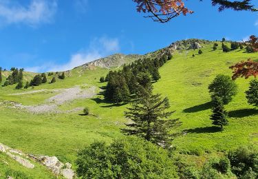
montagne d'Areng depuis la piste forestière après Férrères


Marche
Difficile
Ferrère,
Occitanie,
Hautes-Pyrénées,
France

11,7 km | 24 km-effort
7h 44min
Oui
Mountarrouy en boucle depuis la station de Nistos


Marche
Moyen
Sarrancolin,
Occitanie,
Hautes-Pyrénées,
France

10,8 km | 19,1 km-effort
5h 48min
Oui
nistos Nestea fait G4


Marche
Très facile
Sarrancolin,
Occitanie,
Hautes-Pyrénées,
France

7,4 km | 10,2 km-effort
4h 21min
Oui
Le Cournudère en boucle depuis Bordes de Saube


Marche
Moyen
Ferrère,
Occitanie,
Hautes-Pyrénées,
France

17,2 km | 34 km-effort
6h 35min
Oui
Lac de Bareilles


Marche
Moyen
Bareilles,
Occitanie,
Hautes-Pyrénées,
France

13,4 km | 24 km-effort
7h 15min
Oui
Cap Nestes


Marche
Moyen
Sarrancolin,
Occitanie,
Hautes-Pyrénées,
France

4 km | 7,7 km-effort
2h 10min
Oui

NISTOS Cimetière Anglo-Canadien et pic de DOULY


Marche
Difficile
Nistos,
Occitanie,
Hautes-Pyrénées,
France

8,8 km | 14,9 km-effort
3h 23min
Oui
soum de templa


Marche
Moyen
Ferrère,
Occitanie,
Hautes-Pyrénées,
France

16,7 km | 32 km-effort
5h 21min
Oui

cap Nesté depuis la Barousse


Marche
Moyen
Ferrère,
Occitanie,
Hautes-Pyrénées,
France

9,2 km | 19,3 km-effort
6h 46min
Oui


 SityTrail


