


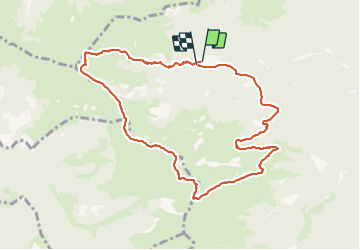

11,7 km | 24 km-effort


Utilisateur


Application GPS de randonnée GRATUITE
 SityTrail
IGN / Instituts géographiques
SityTrail World
Le monde est à vous
Randonnée Marche de 10,6 km à découvrir à Occitanie, Hautes-Pyrénées, Ferrère. Cette randonnée est proposée par dawed311.
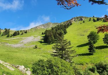
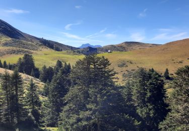
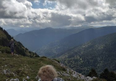
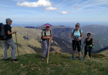
Belle rando et peu fréquentée vers un beau belvédère.
Le retour se fait sur une sente, en balcon, qui s'efface mais les asphodèles montrent le chemin. On se retrouve au pied de la jolie muraille de la montagne d'Areng avant de rejoindre la voiture
Marche
Marche
Marche
Marche
Marche
Marche

Marche
Marche
Marche