![](/images/other/stat-length.png)
![Randonnée Marche nordique Livron - Livron capsus Barzun plateau capbat - Photo](https://media.geolcdn.com/t/1900/400/9a56fbc8-0c1c-4031-b592-3ae60048f079.jpg&format=pjpeg&maxdim=2)
Livron capsus Barzun plateau capbat
LouisROGER
Utilisateur GUIDE
![Longueur](/images/other/stat-length.png)
Longueur
9,6 km
![Altitude max](https://static1.geolcdn.com/siteimages/upload/files/1508320355ic_sort_altitude_max_24dp.png)
Altitude max
431 m
![Dénivelé positif](https://static1.geolcdn.com/siteimages/upload/files/1508320355ic_sort_den_pos_24dp.png)
Dénivelé positif
167 m
![Km-Effort](/images/other/stat-length.png)
Km-Effort
11,8 km
![Altitude min](https://static1.geolcdn.com/siteimages/upload/files/1508320355ic_sort_altitude_min_24dp.png)
Altitude min
319 m
![Dénivelé négatif](https://static1.geolcdn.com/siteimages/upload/files/1508320355ic_sort_den_neg_24dp.png)
Dénivelé négatif
166 m
![Boucle](https://static1.geolcdn.com/siteimages/upload/files/16400158638029165_repeat_loop_refresh_sync_direction_icon.png)
Boucle
Oui
Date de création :
2020-05-16 13:01:18.321
Dernière modification :
2020-05-16 14:55:53.609
![Marche nordique](https://static1.geolcdn.com/sitytour/trail-icons/102.png)
1h53
Difficulté : Très facile
![Scannez ce code QR pour ouvrir la randonnée dans l'application SityTrail](https://capi.geolives.com/qq0zvz2zws4bq2lad0pu/sitytour/trails/2397908/qr.png?size=200)
Application GPS de randonnée GRATUITE
À propos
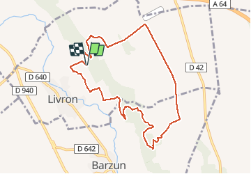
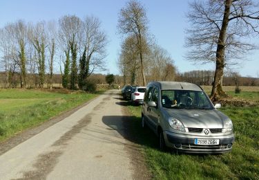
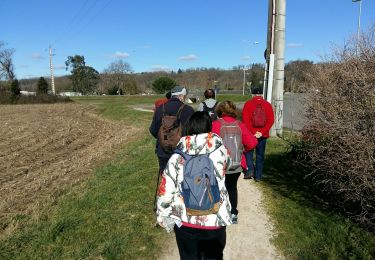
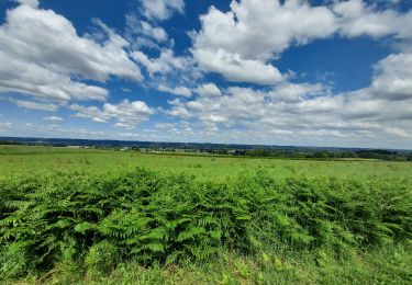
Randonnée Marche nordique de 9,6 km à découvrir à Nouvelle-Aquitaine, Pyrénées-Atlantiques, Livron. Cette randonnée est proposée par LouisROGER.
Description
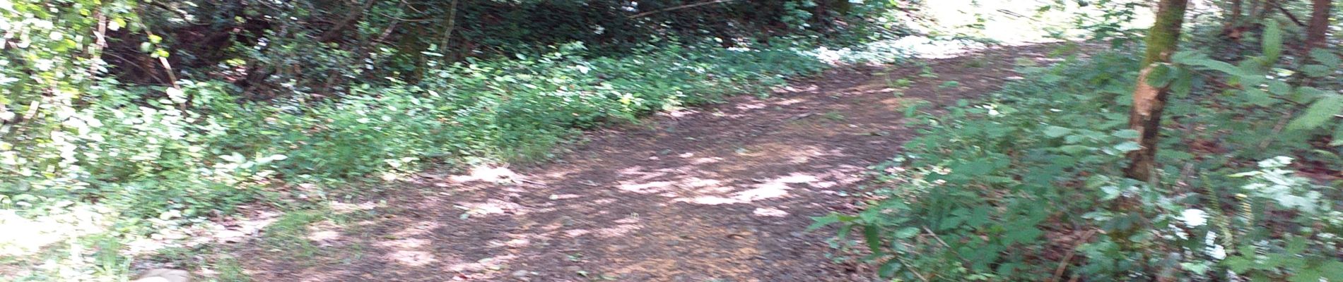
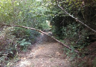
de la côte de Capbat vers l'est, montée au plateau par un bois de Barzun.
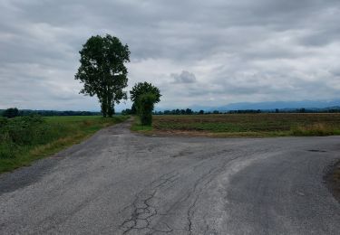
Retour par le plateau et la côte de Capbat en suivant les sentiers exCCOG.
Localisation
Pays :
France
Région :
Nouvelle-Aquitaine
Département/Province :
Pyrénées-Atlantiques
Commune :
Livron
Localité :
Unknown
Départ:(Dec)
Départ:(UTM)
732657 ; 4790605 (30T) N.
Commentaires
Randonnées à proximité
![Randonnée Marche Livron - Livron Rs vershourssimplifié - Photo](https://media.geolcdn.com/t/375/260/048bc8ad-839d-4bc4-a0d3-b7d260410813.jpg&format=jpg&maxdim=2)
![Marche Marche](https://static1.geolcdn.com/sitytour/trail-icons/101.png)
Livron Rs vershourssimplifié
Marche
Moyen
(1)
Livron,
Nouvelle-Aquitaine,
Pyrénées-Atlantiques,
France
![](/images/other/stat-length.png)
6,2 km | 6,7 km-effort
1h 31min
![](https://static1.geolcdn.com/siteimages/upload/files/16400158638029165_repeat_loop_refresh_sync_direction_icon.png)
Oui
![Randonnée Marche Luquet - Lac de Gabas - Luquet - Photo](https://media.geolcdn.com/t/375/260/ext.jpg?maxdim=2&url=https%3A%2F%2Fservices.sitytrail.com%2FGeolivesWS%2FDownloadMedia.ashx%3FTrailID%3D109816%26Media%3D4780_1.jpg)
![Marche Marche](https://static1.geolcdn.com/sitytour/trail-icons/101.png)
Lac de Gabas - Luquet
Marche
Moyen
(1)
Luquet,
Occitanie,
Hautes-Pyrénées,
France
![](/images/other/stat-length.png)
9,3 km | 11,1 km-effort
2h 0min
![](https://static1.geolcdn.com/siteimages/upload/files/16400158638029165_repeat_loop_refresh_sync_direction_icon.png)
Oui
![Randonnée Marche Barzun - BARZUN Bedat et Sarrailh RS fait - Photo](https://media.geolcdn.com/t/375/260/72e21bc4-c130-4e8c-8f46-0cc5a346e236.jpg&format=jpg&maxdim=2)
![Marche Marche](https://static1.geolcdn.com/sitytour/trail-icons/101.png)
BARZUN Bedat et Sarrailh RS fait
Marche
Facile
Barzun,
Nouvelle-Aquitaine,
Pyrénées-Atlantiques,
France
![](/images/other/stat-length.png)
5,1 km | 5,4 km-effort
1h 15min
![](https://static1.geolcdn.com/siteimages/upload/files/16400158638029165_repeat_loop_refresh_sync_direction_icon.png)
Oui
![Randonnée Marche Espoey - Rando santé Espoey du village au pied du bois - Photo](https://media.geolcdn.com/t/375/260/ext.jpg?maxdim=2&url=https%3A%2F%2Fstatic1.geolcdn.com%2Fsiteimages%2Fupload%2Ffiles%2F1553511878bg_sport_marche.png)
![Marche Marche](https://static1.geolcdn.com/sitytour/trail-icons/101.png)
Rando santé Espoey du village au pied du bois
Marche
Facile
(1)
Espoey,
Nouvelle-Aquitaine,
Pyrénées-Atlantiques,
France
![](/images/other/stat-length.png)
5 km | 5,7 km-effort
1h 11min
![](https://static1.geolcdn.com/siteimages/upload/files/16400158638029165_repeat_loop_refresh_sync_direction_icon.png)
Oui
![Randonnée Marche Livron - sur les pas deBC 2018 - Photo](https://media.geolcdn.com/t/375/260/ext.jpg?maxdim=2&url=https%3A%2F%2Fservices.sitytrail.com%2FGeolivesWS%2FDownloadMedia.ashx%3FTrailID%3D1030037%26Media%3Dfix__20180828104056.jpg)
![Marche Marche](https://static1.geolcdn.com/sitytour/trail-icons/101.png)
sur les pas deBC 2018
Marche
Très facile
Livron,
Nouvelle-Aquitaine,
Pyrénées-Atlantiques,
France
![](/images/other/stat-length.png)
12 km | 14,2 km-effort
3h 6min
![](https://static1.geolcdn.com/siteimages/upload/files/16400158638029165_repeat_loop_refresh_sync_direction_icon.png)
Oui
![Randonnée Marche Livron - rslivron - Photo](https://media.geolcdn.com/t/375/260/ext.jpg?maxdim=2&url=https%3A%2F%2Fstatic1.geolcdn.com%2Fsiteimages%2Fupload%2Ffiles%2F1553511878bg_sport_marche.png)
![Marche Marche](https://static1.geolcdn.com/sitytour/trail-icons/101.png)
rslivron
Marche
Très facile
(1)
Livron,
Nouvelle-Aquitaine,
Pyrénées-Atlantiques,
France
![](/images/other/stat-length.png)
5,6 km | 6,1 km-effort
1h 21min
![](https://static1.geolcdn.com/siteimages/upload/files/16400158638029165_repeat_loop_refresh_sync_direction_icon.png)
Oui
![Randonnée Marche Livron - LIVRON RS Artigamen et le bois de chataigners](https://media.geolcdn.com/t/375/260/4aa0343f-94c3-46f2-8df0-bc1d3924ac0a.jpg&format=jpg&maxdim=2)
![Marche Marche](https://static1.geolcdn.com/sitytour/trail-icons/101.png)
LIVRON RS Artigamen et le bois de chataigners "3867119"
Marche
Facile
Livron,
Nouvelle-Aquitaine,
Pyrénées-Atlantiques,
France
![](/images/other/stat-length.png)
5 km | 5,7 km-effort
1h 40min
![](https://static1.geolcdn.com/siteimages/upload/files/16400158638029165_repeat_loop_refresh_sync_direction_icon.png)
Oui
![Randonnée A pied Espoey - ESPOEY RS du village au pied du bois - Photo](https://media.geolcdn.com/t/375/260/5a028f0a-0ce7-4a42-8b1d-ac09418febe2.jpg&format=jpg&maxdim=2)
![A pied A pied](https://static1.geolcdn.com/sitytour/trail-icons/100.png)
ESPOEY RS du village au pied du bois
A pied
Facile
Espoey,
Nouvelle-Aquitaine,
Pyrénées-Atlantiques,
France
![](/images/other/stat-length.png)
5,5 km | 6,2 km-effort
1h 39min
![](https://static1.geolcdn.com/siteimages/upload/files/16400158638029165_repeat_loop_refresh_sync_direction_icon.png)
Oui
![Randonnée V.T.T. Lucgarier - Lucgarier RShoun de moussu reconnu - Photo](https://media.geolcdn.com/t/375/260/3af7f174-175d-4fa4-acc1-040b1ab78bdd.jpg&format=jpg&maxdim=2)
![V.T.T. V.T.T.](https://static1.geolcdn.com/sitytour/trail-icons/202.png)
Lucgarier RShoun de moussu reconnu
V.T.T.
Facile
Lucgarier,
Nouvelle-Aquitaine,
Pyrénées-Atlantiques,
France
![](/images/other/stat-length.png)
4,9 km | 6,1 km-effort
30min
![](https://static1.geolcdn.com/siteimages/upload/files/16400158638029165_repeat_loop_refresh_sync_direction_icon.png)
Oui