![](/images/other/stat-length.png)
![Randonnée A pied Béthisy-Saint-Pierre - le GR12 dans la Forêt de Compiègne - Photo](https://media.geolcdn.com/t/1900/400/ext.pjpeg?maxdim=2&url=https%3A%2F%2Fstatic1.geolcdn.com%2Fsiteimages%2Fupload%2Ffiles%2F1545311037marcheuse_200dpi.jpg)
le GR12 dans la Forêt de Compiègne
JeanLucA4
Utilisateur
![Longueur](/images/other/stat-length.png)
![Altitude max](https://static1.geolcdn.com/siteimages/upload/files/1508320355ic_sort_altitude_max_24dp.png)
![Dénivelé positif](https://static1.geolcdn.com/siteimages/upload/files/1508320355ic_sort_den_pos_24dp.png)
![Km-Effort](/images/other/stat-length.png)
![Altitude min](https://static1.geolcdn.com/siteimages/upload/files/1508320355ic_sort_altitude_min_24dp.png)
![Dénivelé négatif](https://static1.geolcdn.com/siteimages/upload/files/1508320355ic_sort_den_neg_24dp.png)
![Boucle](https://static1.geolcdn.com/siteimages/upload/files/16400158638029165_repeat_loop_refresh_sync_direction_icon.png)
![A pied](https://static1.geolcdn.com/sitytour/trail-icons/100.png)
--
Difficulté : Très difficile
![Scannez ce code QR pour ouvrir la randonnée dans l'application SityTrail](https://capi.geolives.com/qq0zvz2zws4bq2lad0pu/sitytour/trails/2374033/qr.png?size=200)
Application GPS de randonnée GRATUITE
À propos
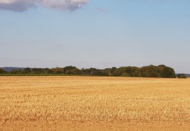
Randonnée A pied de 23 km à découvrir à Hauts-de-France, Oise, Béthisy-Saint-Pierre. Cette randonnée est proposée par JeanLucA4.
Description
voir aussi:
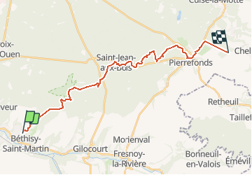
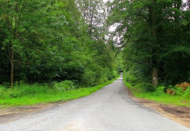
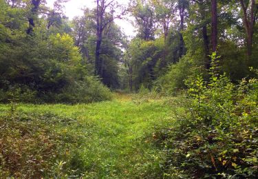
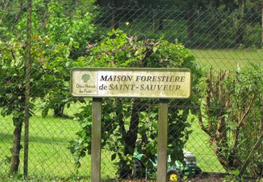
Le GR12 part du Nord de Béthisy-Saint-Martin, crois e le GR124A au carrefour d'Acaste, remonte la Tournante sur les Grands Monts puis continue au carrefour de Diane. Il rejoint le carrefour des Muses, passe Vaudrampont puis traverse Saint-Jean-aux-Bois. Il suit ensuite la Tournante sur la Héronnerie puis la Tournante sur le Voliard pour arriver à Pierrefonds. Il se dirige ensuite vers la Queue de Saint-Etienne pour continuer sur la Chaussée Brunehaut (fin à l'entrée de saint-Etienne).
Localisation
Commentaires
Randonnées à proximité
![Randonnée Marche Lacroix-Saint-Ouen - en Forêt de Compiègne_49_les Molineaux_le Chemin et la Route de Béthisy - Photo](https://media.geolcdn.com/t/375/260/41fd6252-f1e1-4d1a-a28e-78183312295b.jpg&format=jpg&maxdim=2)
![Marche Marche](https://static1.geolcdn.com/sitytour/trail-icons/101.png)
Marche
![](/images/other/stat-length.png)
![](https://static1.geolcdn.com/siteimages/upload/files/16400158638029165_repeat_loop_refresh_sync_direction_icon.png)
![Randonnée Marche Orrouy - en Forêt de Compiègne_41_autour des Petits Monts - Photo](https://media.geolcdn.com/t/375/260/33ce209f-356e-4c94-aaf2-21b4e887d2c9.jpg&format=jpg&maxdim=2)
![Marche Marche](https://static1.geolcdn.com/sitytour/trail-icons/101.png)
Marche
![](/images/other/stat-length.png)
![](https://static1.geolcdn.com/siteimages/upload/files/16400158638029165_repeat_loop_refresh_sync_direction_icon.png)
![Randonnée Marche Morienval - en forêt de Compiègne_37_les Tournantes des Petits Monts (sur et sous) - Photo](https://media.geolcdn.com/t/375/260/ext.jpg?maxdim=2&url=https%3A%2F%2Fservices.sitytrail.com%2FGeolivesWS%2FDownloadMedia.ashx%3FTrailID%3D924054%26Media%3D0f1f6a2b-d1e6-4243-9185-6a6591e598b4.JPG)
![Marche Marche](https://static1.geolcdn.com/sitytour/trail-icons/101.png)
Marche
![](/images/other/stat-length.png)
![](https://static1.geolcdn.com/siteimages/upload/files/16400158638029165_repeat_loop_refresh_sync_direction_icon.png)
![Randonnée V.T.C. Orrouy - Balade vélo entre pierrefond et compiegne - Photo](https://media.geolcdn.com/t/375/260/b93c6913-b0bc-4e73-acd4-b9a591a5fc34.jpg&format=jpg&maxdim=2)
![V.T.C. V.T.C.](https://static1.geolcdn.com/sitytour/trail-icons/203.png)
V.T.C.
![](/images/other/stat-length.png)
![](https://static1.geolcdn.com/siteimages/upload/files/16400158638029165_repeat_loop_refresh_sync_direction_icon.png)
![Randonnée Marche Saint-Jean-aux-Bois - en forêt de Compiègne_36_Tournantes sur les Grands Monts et les Grueries - Photo](https://media.geolcdn.com/t/375/260/ext.jpg?maxdim=2&url=https%3A%2F%2Fservices.sitytrail.com%2FGeolivesWS%2FDownloadMedia.ashx%3FTrailID%3D590179%26Media%3Dcdb783f6-c879-4797-9a86-1ea26bf633f9.JPG)
![Marche Marche](https://static1.geolcdn.com/sitytour/trail-icons/101.png)
Marche
![](/images/other/stat-length.png)
![](https://static1.geolcdn.com/siteimages/upload/files/16400158638029165_repeat_loop_refresh_sync_direction_icon.png)
![Randonnée Marche Lacroix-Saint-Ouen - en forêt de Compiègne_35_la Croix Saint-Sauveur_le Ru du Goderu - Photo](https://media.geolcdn.com/t/375/260/ext.jpg?maxdim=2&url=https%3A%2F%2Fservices.sitytrail.com%2FGeolivesWS%2FDownloadMedia.ashx%3FTrailID%3D807373%26Media%3De6c81f76-4260-4f34-94f8-0f524b6a7c8c.JPG)
![Marche Marche](https://static1.geolcdn.com/sitytour/trail-icons/101.png)
Marche
![](/images/other/stat-length.png)
![](https://static1.geolcdn.com/siteimages/upload/files/16400158638029165_repeat_loop_refresh_sync_direction_icon.png)
![Randonnée Marche Lacroix-Saint-Ouen - en forêt de Compiègne_15_Basse Queue_La Croix St-Sauveur_Les Molineaux - Photo](https://media.geolcdn.com/t/375/260/ext.jpg?maxdim=2&url=https%3A%2F%2Fservices.sitytrail.com%2FGeolivesWS%2FDownloadMedia.ashx%3FTrailID%3D967459%26Media%3D55d12505-451c-4938-a5aa-4d96faf1bebd.JPG)
![Marche Marche](https://static1.geolcdn.com/sitytour/trail-icons/101.png)
Marche
![](/images/other/stat-length.png)
![](https://static1.geolcdn.com/siteimages/upload/files/16400158638029165_repeat_loop_refresh_sync_direction_icon.png)
![Randonnée A pied Orrouy - Promenade des Chars Romains et Chars de Combat - Photo](https://media.geolcdn.com/t/375/260/b95b32a8-14f5-4d78-af84-afab6a4fc882.jpeg&format=jpg&maxdim=2)
![A pied A pied](https://static1.geolcdn.com/sitytour/trail-icons/100.png)
A pied
![](/images/other/stat-length.png)
![](https://static1.geolcdn.com/siteimages/upload/files/16400158638029165_repeat_loop_refresh_sync_direction_icon.png)
![Randonnée Marche Béthancourt-en-Valois - Béthancourt en valois - Photo](https://media.geolcdn.com/t/375/260/f53c1013-08a4-4833-8ca5-aef36e564bc1.jpg&format=jpg&maxdim=2)
![Marche Marche](https://static1.geolcdn.com/sitytour/trail-icons/101.png)
Marche
![](/images/other/stat-length.png)
![](https://static1.geolcdn.com/siteimages/upload/files/16400158638029165_repeat_loop_refresh_sync_direction_icon.png)