![](/images/other/stat-length.png)
![Randonnée A pied Gedinne - Ferme Jacob - La Fange de l'Abîme - Photo](https://media.geolcdn.com/t/1900/400/3a02597b-dbf9-4560-a8bb-f70d569df8ef.jpg&format=pjpeg&maxdim=2)
Ferme Jacob - La Fange de l'Abîme
MTBA
Utilisateur
![Longueur](/images/other/stat-length.png)
![Altitude max](https://static1.geolcdn.com/siteimages/upload/files/1508320355ic_sort_altitude_max_24dp.png)
![Dénivelé positif](https://static1.geolcdn.com/siteimages/upload/files/1508320355ic_sort_den_pos_24dp.png)
![Km-Effort](/images/other/stat-length.png)
![Altitude min](https://static1.geolcdn.com/siteimages/upload/files/1508320355ic_sort_altitude_min_24dp.png)
![Dénivelé négatif](https://static1.geolcdn.com/siteimages/upload/files/1508320355ic_sort_den_neg_24dp.png)
![Boucle](https://static1.geolcdn.com/siteimages/upload/files/16400158638029165_repeat_loop_refresh_sync_direction_icon.png)
![A pied](https://static1.geolcdn.com/sitytour/trail-icons/100.png)
2h00
Difficulté : Facile
![Scannez ce code QR pour ouvrir la randonnée dans l'application SityTrail](https://capi.geolives.com/qq0zvz2zws4bq2lad0pu/sitytour/trails/2373400/qr.png?size=200)
Application GPS de randonnée GRATUITE
À propos
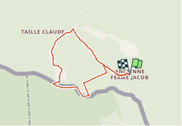
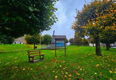
Randonnée A pied de 7 km à découvrir à Wallonie, Namur, Gedinne. Cette randonnée est proposée par MTBA.
Description
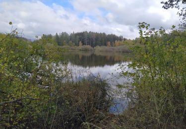
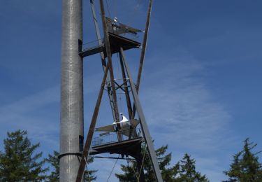
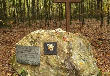
De Fange de l’Abîme is een natuurreservaat gesitueerd op het plateau Croix Scaille, vlakbij de Milleniumtoren.
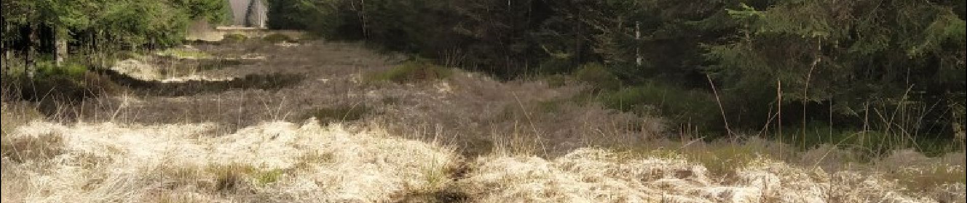
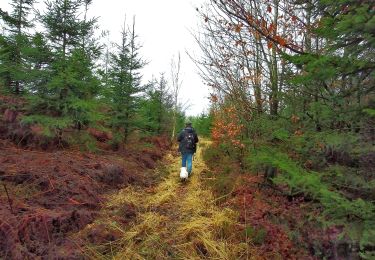
Deze wandeling leid je door sparrenbossen, met een weelderige onderbegroeiing van bosbessen, langs deels verharde banen. Ze gaat vervolgens over in kleine bospaden alvorens het veen te bereiken dat via een knuppelpad doorkruist wordt. Educatieve borden geven uitleg over dit bijzondere biotoop.
Hoewel je tijdens de wandeling bijna geen daling waarneemt, wacht je op het einde wel een lange klim via de geasfalteerde rustige baan alvorens je vertrekpunt te bereiken.
Tijdens het seizoen drankgelegenheid aan de Milleniumtoren.
Localisation
Commentaires
Randonnées à proximité
![Marche Marche](https://static1.geolcdn.com/sitytour/trail-icons/101.png)
Marche
![](/images/other/stat-length.png)
![](https://static1.geolcdn.com/siteimages/upload/files/16400158638029165_repeat_loop_refresh_sync_direction_icon.png)
![Randonnée Marche Gedinne - Gedinne - Circuit Natura 2000](https://media.geolcdn.com/t/375/260/ext.jpg?maxdim=2&url=https%3A%2F%2Fservices.sitytrail.com%2FGeolivesWS%2FDownloadMedia.ashx%3FTrailID%3D472278%26Media%3Dd7fd7a8f-ff34-456c-92bf-c54889e59e75.jpg)
![Marche Marche](https://static1.geolcdn.com/sitytour/trail-icons/101.png)
Marche
![](/images/other/stat-length.png)
![](https://static1.geolcdn.com/siteimages/upload/files/16400158638029165_repeat_loop_refresh_sync_direction_icon.png)
![Randonnée Marche Gedinne - RB-Na-08_Rienne - Photo](https://media.geolcdn.com/t/375/260/ext.jpg?maxdim=2&url=https%3A%2F%2Fservices.sitytrail.com%2FGeolivesWS%2FDownloadMedia.ashx%3FTrailID%3D179634%26Media%3D50c146e4-51ae-4441-b546-c84e45c04bf9.jpg)
![Marche Marche](https://static1.geolcdn.com/sitytour/trail-icons/101.png)
Marche
![](/images/other/stat-length.png)
![](https://static1.geolcdn.com/siteimages/upload/files/16400158638029165_repeat_loop_refresh_sync_direction_icon.png)
![Randonnée Marche Gedinne - La vallée de la Houille - Rienne - Photo](https://media.geolcdn.com/t/375/260/ext.jpg?maxdim=2&url=https%3A%2F%2Fstatic1.geolcdn.com%2Fsiteimages%2Fupload%2Ffiles%2F1553511878bg_sport_marche.png)
![Marche Marche](https://static1.geolcdn.com/sitytour/trail-icons/101.png)
Marche
![](/images/other/stat-length.png)
![](https://static1.geolcdn.com/siteimages/upload/files/16400158638029165_repeat_loop_refresh_sync_direction_icon.png)
![Randonnée Marche Gedinne - Balade à Willerzie - Gedinne - Photo](https://media.geolcdn.com/t/375/260/5ec22972-002a-40e1-b0ee-bd3232993f27.jpeg&format=jpg&maxdim=2)
![Marche Marche](https://static1.geolcdn.com/sitytour/trail-icons/101.png)
Marche
![](/images/other/stat-length.png)
![](https://static1.geolcdn.com/siteimages/upload/files/16400158638029165_repeat_loop_refresh_sync_direction_icon.png)
![Randonnée A pied Gedinne - L'Ange Gardien - Photo](https://media.geolcdn.com/t/375/260/ext.jpg?maxdim=2&url=https%3A%2F%2Fpivotmedia.tourismewallonie.be%2FOTH-A0-0062-3FPM%2FOTH-A0-0062-3FPM.jpg)
![A pied A pied](https://static1.geolcdn.com/sitytour/trail-icons/100.png)
![Randonnée Marche Gedinne - Balade à la Croix-Scaille - Les Fanges de l'Abîme - Photo](https://media.geolcdn.com/t/375/260/90477e17-0e05-4a6f-bcf1-b60967f06656.jpeg&format=jpg&maxdim=2)
![Marche Marche](https://static1.geolcdn.com/sitytour/trail-icons/101.png)
Marche
![](/images/other/stat-length.png)
![](https://static1.geolcdn.com/siteimages/upload/files/16400158638029165_repeat_loop_refresh_sync_direction_icon.png)
![Randonnée Marche Gedinne - Espace liberté 44 - Photo](https://media.geolcdn.com/t/375/260/bba44172-4661-46c9-9ee8-3e242016800f.jpg&format=jpg&maxdim=2)
![Marche Marche](https://static1.geolcdn.com/sitytour/trail-icons/101.png)
Marche
![](/images/other/stat-length.png)
![](https://static1.geolcdn.com/siteimages/upload/files/16400158638029165_repeat_loop_refresh_sync_direction_icon.png)
![Randonnée Marche Gedinne - Ange gardien - Photo](https://media.geolcdn.com/t/375/260/754ed601-b24d-44d7-8a04-d7dd06597edc.jpg&format=jpg&maxdim=2)
![Marche Marche](https://static1.geolcdn.com/sitytour/trail-icons/101.png)