![](/images/other/stat-length.png)
La Soufrière et retour par le Col de l'Échelle et la chute du galion
ETMU5496
Utilisateur
![Longueur](/images/other/stat-length.png)
![Altitude max](https://static1.geolcdn.com/siteimages/upload/files/1508320355ic_sort_altitude_max_24dp.png)
![Dénivelé positif](https://static1.geolcdn.com/siteimages/upload/files/1508320355ic_sort_den_pos_24dp.png)
![Km-Effort](/images/other/stat-length.png)
![Altitude min](https://static1.geolcdn.com/siteimages/upload/files/1508320355ic_sort_altitude_min_24dp.png)
![Dénivelé négatif](https://static1.geolcdn.com/siteimages/upload/files/1508320355ic_sort_den_neg_24dp.png)
![Boucle](https://static1.geolcdn.com/siteimages/upload/files/16400158638029165_repeat_loop_refresh_sync_direction_icon.png)
![A pied](https://static1.geolcdn.com/sitytour/trail-icons/100.png)
--
Difficulté : Difficile
![Scannez ce code QR pour ouvrir la randonnée dans l'application SityTrail](https://capi.geolives.com/qq0zvz2zws4bq2lad0pu/sitytour/trails/2373078/qr.png?size=200)
Application GPS de randonnée GRATUITE
À propos
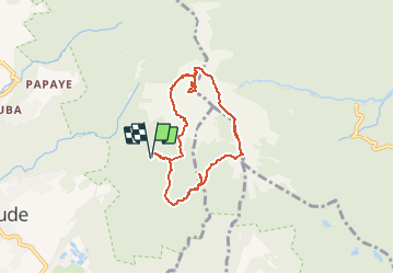
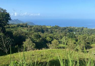
Randonnée A pied de 9,2 km à découvrir à Guadeloupe, Inconnu, Saint-Claude. Cette randonnée est proposée par ETMU5496.
Description
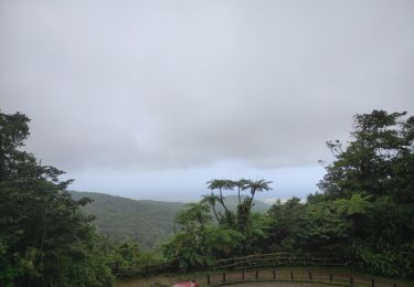
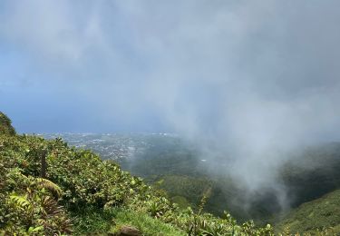
Un joli parcours au départ des bains jaunes pour une classique ascension de la soufrière et retour par le col de l'échelle.
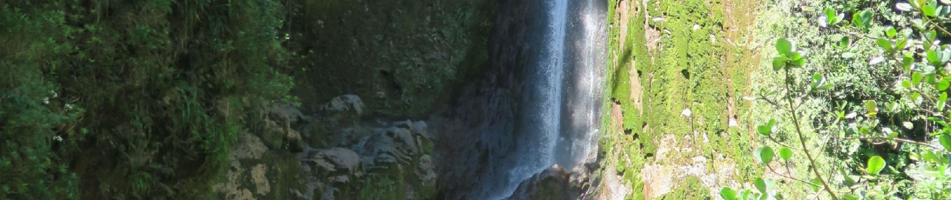
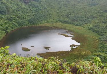
Eviter un retour direct et préférer vous diriger en direction de la citerne pour emprunter ensuite la trace de l'armistice et aller voir la chute du galion (une corde fixée sur la roche permet de se hisser au plus près car la pente est sévère).
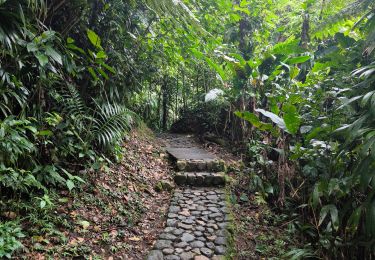
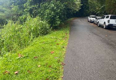
Retour ensuite par le sentier qui ramène au pas du Roy puis aux bains jaunes et le parking de départ sur la route.
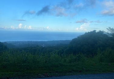
remarque : profiter du paysage au passage dans la forêt qui ramène au pas du Roy pour apercevoir l'archipel des Saintes.
Compter 5h en tout pour prendre le temps d'admirer la vue et l'activité de la Soufrière (fumeroles permanentes) ainsi que les sites de la citerne et de la belle chute du Galion.
Localisation
Commentaires
Randonnées à proximité
![Randonnée Autre activité Trois-Rivières - trace des poteaux monté armistice l'echelle soufrière carmichael matouba - Photo](https://media.geolcdn.com/t/375/260/ext.jpg?maxdim=2&url=https%3A%2F%2Fservices.sitytrail.com%2FGeolivesWS%2FDownloadMedia.ashx%3FTrailID%3D1004711%26Media%3D20180705171811.jpg)
![Autre activité Autre activité](https://static1.geolcdn.com/sitytour/trail-icons/900.png)
Autre activité
![](/images/other/stat-length.png)
![](https://static1.geolcdn.com/siteimages/upload/files/16400158638029165_repeat_loop_refresh_sync_direction_icon.png)
![Randonnée Marche Saint-Claude - Guadeloupe - Chute du Galion - La Citerne - Photo](https://media.geolcdn.com/t/375/260/eec73e29-92ac-4bc1-9083-7f50f5622fbd.jpg&format=jpg&maxdim=2)
![Marche Marche](https://static1.geolcdn.com/sitytour/trail-icons/101.png)
Marche
![](/images/other/stat-length.png)
![](https://static1.geolcdn.com/siteimages/upload/files/16400158638029165_repeat_loop_refresh_sync_direction_icon.png)
![Randonnée Marche Capesterre-Belle-Eau - chutes du carbets 1 et 2 🇬🇵 - Photo](https://media.geolcdn.com/t/375/260/3b2fd3aa-aa4e-4881-8bff-99583d58f440.jpg&format=jpg&maxdim=2)
![Marche Marche](https://static1.geolcdn.com/sitytour/trail-icons/101.png)
Marche
![](/images/other/stat-length.png)
![](https://static1.geolcdn.com/siteimages/upload/files/16400158638029165_repeat_loop_refresh_sync_direction_icon.png)
![Randonnée Marche Saint-Claude - Guadeloupe - La Soufrière - La Citerne - Photo](https://media.geolcdn.com/t/375/260/b0295af4-d31e-494f-95e4-ba418af820be.jpg&format=jpg&maxdim=2)
![Marche Marche](https://static1.geolcdn.com/sitytour/trail-icons/101.png)
Marche
![](/images/other/stat-length.png)
![](https://static1.geolcdn.com/siteimages/upload/files/16400158638029165_repeat_loop_refresh_sync_direction_icon.png)
![Randonnée Marche Saint-Claude - la souffriere - Photo](https://media.geolcdn.com/t/375/260/ext.jpg?maxdim=2&url=https%3A%2F%2Fstatic1.geolcdn.com%2Fsiteimages%2Fupload%2Ffiles%2F1553511878bg_sport_marche.png)
![Marche Marche](https://static1.geolcdn.com/sitytour/trail-icons/101.png)
Marche
![](/images/other/stat-length.png)
![](https://static1.geolcdn.com/siteimages/upload/files/16400158638029165_repeat_loop_refresh_sync_direction_icon.png)
![Randonnée Trail Saint-Claude - Beausoleil - Photo](https://media.geolcdn.com/t/375/260/ca090071-d4cf-4e69-b0ab-dd0d3a28db41.jpg&format=jpg&maxdim=2)
![Trail Trail](https://static1.geolcdn.com/sitytour/trail-icons/104.png)
Trail
![](/images/other/stat-length.png)
![](https://static1.geolcdn.com/siteimages/upload/files/16400158638029165_repeat_loop_refresh_sync_direction_icon.png)
![Randonnée Trail Saint-Claude - Beausoleil - Photo](https://media.geolcdn.com/t/375/260/7e7bf917-0954-46a9-bcc9-e0e65e77f667.jpg&format=jpg&maxdim=2)
![Trail Trail](https://static1.geolcdn.com/sitytour/trail-icons/104.png)
Trail
![](/images/other/stat-length.png)
![](https://static1.geolcdn.com/siteimages/upload/files/16400158638029165_repeat_loop_refresh_sync_direction_icon.png)
![Randonnée Trail Saint-Claude - Beau soleil - Photo](https://media.geolcdn.com/t/375/260/6ff951f0-0c00-4cbd-9ada-556e80c71bcd.jpg&format=jpg&maxdim=2)
![Trail Trail](https://static1.geolcdn.com/sitytour/trail-icons/104.png)
Trail
![](/images/other/stat-length.png)
![](https://static1.geolcdn.com/siteimages/upload/files/16400158638029165_repeat_loop_refresh_sync_direction_icon.png)
![Randonnée Marche Saint-Claude - Bains jaune - Photo](https://media.geolcdn.com/t/375/260/3aab55d0-0b19-475a-b35f-634187ce6c24.jpg&format=jpg&maxdim=2)
![Marche Marche](https://static1.geolcdn.com/sitytour/trail-icons/101.png)
Marche
![](/images/other/stat-length.png)
![](https://static1.geolcdn.com/siteimages/upload/files/16400158638029165_repeat_loop_refresh_sync_direction_icon.png)