![](/images/other/stat-length.png)
![Randonnée Marche Libin - Lesse Daverdise Lesse 15,8 km - Photo](https://media.geolcdn.com/t/1900/400/ext.pjpeg?maxdim=2&url=https%3A%2F%2Fstatic1.geolcdn.com%2Fsiteimages%2Fupload%2Ffiles%2F1553511878bg_sport_marche.png)
Lesse Daverdise Lesse 15,8 km
cravattep
Utilisateur
![Longueur](/images/other/stat-length.png)
Longueur
15,8 km
![Altitude max](https://static1.geolcdn.com/siteimages/upload/files/1508320355ic_sort_altitude_max_24dp.png)
Altitude max
429 m
![Dénivelé positif](https://static1.geolcdn.com/siteimages/upload/files/1508320355ic_sort_den_pos_24dp.png)
Dénivelé positif
391 m
![Km-Effort](/images/other/stat-length.png)
Km-Effort
21 km
![Altitude min](https://static1.geolcdn.com/siteimages/upload/files/1508320355ic_sort_altitude_min_24dp.png)
Altitude min
250 m
![Dénivelé négatif](https://static1.geolcdn.com/siteimages/upload/files/1508320355ic_sort_den_neg_24dp.png)
Dénivelé négatif
395 m
![Boucle](https://static1.geolcdn.com/siteimages/upload/files/16400158638029165_repeat_loop_refresh_sync_direction_icon.png)
Boucle
Oui
Date de création :
2020-03-28 10:36:42.278
Dernière modification :
2020-04-14 16:19:45.31
![Marche](https://static1.geolcdn.com/sitytour/trail-icons/101.png)
3h20
Difficulté : Moyen
![Scannez ce code QR pour ouvrir la randonnée dans l'application SityTrail](https://capi.geolives.com/qq0zvz2zws4bq2lad0pu/sitytour/trails/2371138/qr.png?size=200)
Application GPS de randonnée GRATUITE
À propos
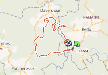
Randonnée Marche de 15,8 km à découvrir à Wallonie, Luxembourg, Libin. Cette randonnée est proposée par cravattep.
Description
Belle randonnée au départ du village de Lesse
On longe la Lesse puis ça grimpe ... ensuite cool dans la forêt de Daverdisse avant de redescendre vers la Lesse sans oublier le passage à la Roche des chevaux un peu avant la fin
Localisation
Pays :
Belgique
Région :
Wallonie
Département/Province :
Luxembourg
Commune :
Libin
Localité :
Redu
Départ:(Dec)
Départ:(UTM)
653724 ; 5539941 (31U) N.
Commentaires
Randonnées à proximité
![Randonnée Marche Paliseul - Balade au pays de la Haute-Lesse - Au fil de l'Our - Photo](https://media.geolcdn.com/t/375/260/ext.jpg?maxdim=2&url=https%3A%2F%2Fservices.sitytrail.com%2FGeolivesWS%2FDownloadMedia.ashx%3FTrailID%3D449048%26Media%3Db3ac4524-5d5c-4ded-ad9c-c2811f9c6857.JPG)
![Marche Marche](https://static1.geolcdn.com/sitytour/trail-icons/101.png)
Balade au pays de la Haute-Lesse - Au fil de l'Our
Marche
Facile
(6)
Paliseul,
Wallonie,
Luxembourg,
Belgique
![](/images/other/stat-length.png)
11,5 km | 14,5 km-effort
3h 9min
![](https://static1.geolcdn.com/siteimages/upload/files/16400158638029165_repeat_loop_refresh_sync_direction_icon.png)
Oui
![Randonnée Marche Paliseul - RB-Lu-10_Maissin - Photo](https://media.geolcdn.com/t/375/260/ext.jpg?maxdim=2&url=https%3A%2F%2Fservices.sitytrail.com%2FGeolivesWS%2FDownloadMedia.ashx%3FTrailID%3D315513%26Media%3D52f53adc-4763-4371-9efe-70f027b21c91.jpg)
![Marche Marche](https://static1.geolcdn.com/sitytour/trail-icons/101.png)
RB-Lu-10_Maissin
Marche
Difficile
(7)
Paliseul,
Wallonie,
Luxembourg,
Belgique
![](/images/other/stat-length.png)
25 km | 32 km-effort
6h 38min
![](https://static1.geolcdn.com/siteimages/upload/files/16400158638029165_repeat_loop_refresh_sync_direction_icon.png)
Oui
![Randonnée Marche Libin - Lesse - Promenade de la Lesse (LI06) - Photo](https://media.geolcdn.com/t/375/260/27528ace-a0b8-4107-8825-6100f3450bfd.jpg&format=jpg&maxdim=2)
![Marche Marche](https://static1.geolcdn.com/sitytour/trail-icons/101.png)
Lesse - Promenade de la Lesse (LI06)
Marche
Moyen
(6)
Libin,
Wallonie,
Luxembourg,
Belgique
![](/images/other/stat-length.png)
8,6 km | 11,3 km-effort
2h 26min
![](https://static1.geolcdn.com/siteimages/upload/files/16400158638029165_repeat_loop_refresh_sync_direction_icon.png)
Oui
![Randonnée Marche Daverdisse - Porcheresse Grinchi - Photo](https://media.geolcdn.com/t/375/260/60793136-a8a5-412f-98a4-b91886d74636.jpg&format=jpg&maxdim=2)
![Marche Marche](https://static1.geolcdn.com/sitytour/trail-icons/101.png)
Porcheresse Grinchi
Marche
Moyen
(1)
Daverdisse,
Wallonie,
Luxembourg,
Belgique
![](/images/other/stat-length.png)
7,1 km | 9,3 km-effort
2h 6min
![](https://static1.geolcdn.com/siteimages/upload/files/16400158638029165_repeat_loop_refresh_sync_direction_icon.png)
Oui
![Randonnée Marche Libin - Du village de Redu au hameau de Lesse - Photo](https://media.geolcdn.com/t/375/260/ext.jpg?maxdim=2&url=https%3A%2F%2Fservices.sitytrail.com%2FGeolivesWS%2FDownloadMedia.ashx%3FTrailID%3D449318%26Media%3D3daffb28-a541-4d0a-b434-13b6750e6d2d.JPG)
![Marche Marche](https://static1.geolcdn.com/sitytour/trail-icons/101.png)
Du village de Redu au hameau de Lesse
Marche
Facile
(3)
Libin,
Wallonie,
Luxembourg,
Belgique
![](/images/other/stat-length.png)
11,3 km | 14,9 km-effort
3h 13min
![](https://static1.geolcdn.com/siteimages/upload/files/16400158638029165_repeat_loop_refresh_sync_direction_icon.png)
Oui
![Randonnée Marche Libin - Lesse - Entre Lesse et Lomme - Photo](https://media.geolcdn.com/t/375/260/29de6fa8-4c44-40a4-a5ee-a6e3f0f650e2.jpg&format=jpg&maxdim=2)
![Marche Marche](https://static1.geolcdn.com/sitytour/trail-icons/101.png)
Lesse - Entre Lesse et Lomme
Marche
Très difficile
(2)
Libin,
Wallonie,
Luxembourg,
Belgique
![](/images/other/stat-length.png)
79 km | 102 km-effort
23h 15min
![](https://static1.geolcdn.com/siteimages/upload/files/16400158638029165_repeat_loop_refresh_sync_direction_icon.png)
Oui
![Randonnée Marche Libin - Redu - La Virée des Croix - Photo](https://media.geolcdn.com/t/375/260/ext.jpg?maxdim=2&url=https%3A%2F%2Fservices.sitytrail.com%2FGeolivesWS%2FDownloadMedia.ashx%3FTrailID%3D334581%26Media%3D577140e5-7a9b-4e16-8501-3973c972819c.JPG)
![Marche Marche](https://static1.geolcdn.com/sitytour/trail-icons/101.png)
Redu - La Virée des Croix
Marche
Moyen
(5)
Libin,
Wallonie,
Luxembourg,
Belgique
![](/images/other/stat-length.png)
6,1 km | 8,2 km-effort
1h 44min
![](https://static1.geolcdn.com/siteimages/upload/files/16400158638029165_repeat_loop_refresh_sync_direction_icon.png)
Oui
![Randonnée Marche Daverdisse - Porcheresse - Le Gros Bois (P1) - Photo](https://media.geolcdn.com/t/375/260/ext.jpg?maxdim=2&url=https%3A%2F%2Fservices.sitytrail.com%2FGeolivesWS%2FDownloadMedia.ashx%3FTrailID%3D334464%26Media%3D63060b0b-b07c-4065-a8bb-125fd5bf9bab.jpg)
![Marche Marche](https://static1.geolcdn.com/sitytour/trail-icons/101.png)
Porcheresse - Le Gros Bois (P1)
Marche
Moyen
(4)
Daverdisse,
Wallonie,
Luxembourg,
Belgique
![](/images/other/stat-length.png)
7 km | 9,4 km-effort
2h 2min
![](https://static1.geolcdn.com/siteimages/upload/files/16400158638029165_repeat_loop_refresh_sync_direction_icon.png)
Oui
![Randonnée Marche Paliseul - RB-Lu-10_Maissin_via-racc2 - Photo](https://media.geolcdn.com/t/375/260/ext.jpg?maxdim=2&url=https%3A%2F%2Fservices.sitytrail.com%2FGeolivesWS%2FDownloadMedia.ashx%3FTrailID%3D216782%26Media%3D52f53adc-4763-4371-9efe-70f027b21c91.jpg)
![Marche Marche](https://static1.geolcdn.com/sitytour/trail-icons/101.png)
RB-Lu-10_Maissin_via-racc2
Marche
Facile
(2)
Paliseul,
Wallonie,
Luxembourg,
Belgique
![](/images/other/stat-length.png)
22 km | 29 km-effort
4h 6min
![](https://static1.geolcdn.com/siteimages/upload/files/16400158638029165_repeat_loop_refresh_sync_direction_icon.png)
Oui