![](/images/other/stat-length.png)
![Randonnée Autre activité Orsières - VS - Dolent - Photo](https://media.geolcdn.com/t/1900/400/ext.pjpeg?maxdim=2&url=https%3A%2F%2Fstatic1.geolcdn.com%2Fsiteimages%2Fupload%2Ffiles%2F1545311037marcheuse_200dpi.jpg)
VS - Dolent
sterrettaz
Utilisateur
![Longueur](/images/other/stat-length.png)
Longueur
9,4 km
![Altitude max](https://static1.geolcdn.com/siteimages/upload/files/1508320355ic_sort_altitude_max_24dp.png)
Altitude max
3772 m
![Dénivelé positif](https://static1.geolcdn.com/siteimages/upload/files/1508320355ic_sort_den_pos_24dp.png)
Dénivelé positif
2118 m
![Km-Effort](/images/other/stat-length.png)
Km-Effort
31 km
![Altitude min](https://static1.geolcdn.com/siteimages/upload/files/1508320355ic_sort_altitude_min_24dp.png)
Altitude min
1637 m
![Dénivelé négatif](https://static1.geolcdn.com/siteimages/upload/files/1508320355ic_sort_den_neg_24dp.png)
Dénivelé négatif
35 m
![Boucle](https://static1.geolcdn.com/siteimages/upload/files/16400158638029165_repeat_loop_refresh_sync_direction_icon.png)
Boucle
Non
Date de création :
2014-12-11 00:00:00.0
Dernière modification :
2014-12-11 00:00:00.0
![Autre activité](https://static1.geolcdn.com/sitytour/trail-icons/900.png)
--
Difficulté : Inconnu
![Scannez ce code QR pour ouvrir la randonnée dans l'application SityTrail](https://capi.geolives.com/qq0zvz2zws4bq2lad0pu/sitytour/trails/23693/qr.png?size=200)
Application GPS de randonnée GRATUITE
À propos
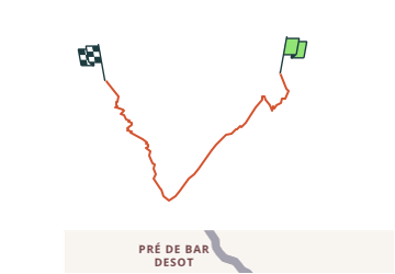
Randonnée Autre activité de 9,4 km à découvrir à Valais, Entremont, Orsières. Cette randonnée est proposée par sterrettaz.
Description
Avant la partie sommitale (crampons) il est possilbe de monter plus à l''ouest pour éviter certains passages un peu raides...
Localisation
Pays :
Suisse
Région :
Valais
Département/Province :
Entremont
Commune :
Orsières
Localité :
Unknown
Départ:(Dec)
Départ:(UTM)
352607 ; 5087395 (32T) N.
Commentaires
Randonnées à proximité
![Randonnée A pied Orsières - Trail Verbier St-Bernard - Traversée - Photo](https://media.geolcdn.com/t/375/260/dafbc912-1c22-4e42-aaf9-5568981fc800.jpeg&format=jpg&maxdim=2)
![A pied A pied](https://static1.geolcdn.com/sitytour/trail-icons/100.png)
Trail Verbier St-Bernard - Traversée
A pied
Très difficile
Orsières,
Valais,
Entremont,
Suisse
![](/images/other/stat-length.png)
37 km | 70 km-effort
15h 47min
![](https://static1.geolcdn.com/siteimages/upload/files/16400158638029165_repeat_loop_refresh_sync_direction_icon.png)
Non
![Randonnée A pied Orsières - Sentier des Bergers - Photo](https://media.geolcdn.com/t/375/260/a8cdee56-d9cf-46a0-9048-05577c82dfc2.jpeg&format=jpg&maxdim=2)
![A pied A pied](https://static1.geolcdn.com/sitytour/trail-icons/100.png)
Sentier des Bergers
A pied
Facile
Orsières,
Valais,
Entremont,
Suisse
![](/images/other/stat-length.png)
4,8 km | 9,2 km-effort
2h 5min
![](https://static1.geolcdn.com/siteimages/upload/files/16400158638029165_repeat_loop_refresh_sync_direction_icon.png)
Non
![Randonnée Marche Orsières - La Fouly Ferret - Photo](https://media.geolcdn.com/t/375/260/9ccbcdc3-96f7-4967-963b-9422de80e17a.jpg&format=jpg&maxdim=2)
![Marche Marche](https://static1.geolcdn.com/sitytour/trail-icons/101.png)
La Fouly Ferret
Marche
Moyen
Orsières,
Valais,
Entremont,
Suisse
![](/images/other/stat-length.png)
6,4 km | 9,7 km-effort
2h 58min
![](https://static1.geolcdn.com/siteimages/upload/files/16400158638029165_repeat_loop_refresh_sync_direction_icon.png)
Oui
![Randonnée A pied Courmayeur - Itinerario 23 Rifugio Dalmazzi - Photo](https://media.geolcdn.com/t/375/260/2530e1b3-3a61-40c9-a091-23aae0135330.jpeg&format=jpg&maxdim=2)
![A pied A pied](https://static1.geolcdn.com/sitytour/trail-icons/100.png)
Itinerario 23 Rifugio Dalmazzi
A pied
Facile
Courmayeur,
Vallée d'Aoste,
Inconnu,
Italie
![](/images/other/stat-length.png)
4,1 km | 6,6 km-effort
1h 29min
![](https://static1.geolcdn.com/siteimages/upload/files/16400158638029165_repeat_loop_refresh_sync_direction_icon.png)
Non
![Randonnée Marche Courmayeur - TMB J4 Ref.ELENA - COURMAYEUR - Photo](https://media.geolcdn.com/t/375/260/ext.jpg?maxdim=2&url=https%3A%2F%2Fservices.sitytrail.com%2FGeolivesWS%2FDownloadMedia.ashx%3FTrailID%3D594957%26Media%3Dfix__20160706110719.jpg)
![Marche Marche](https://static1.geolcdn.com/sitytour/trail-icons/101.png)
TMB J4 Ref.ELENA - COURMAYEUR
Marche
Moyen
Courmayeur,
Vallée d'Aoste,
Inconnu,
Italie
![](/images/other/stat-length.png)
13,5 km | 22 km-effort
4h 18min
![](https://static1.geolcdn.com/siteimages/upload/files/16400158638029165_repeat_loop_refresh_sync_direction_icon.png)
Non
![Randonnée Marche Orsières - La Fouly, Randonée hivernale, Sentier de l''Amône - Photo](https://media.geolcdn.com/t/375/260/ext.jpg?maxdim=2&url=https%3A%2F%2Fstatic1.geolcdn.com%2Fsiteimages%2Fupload%2Ffiles%2F1553511878bg_sport_marche.png)
![Marche Marche](https://static1.geolcdn.com/sitytour/trail-icons/101.png)
La Fouly, Randonée hivernale, Sentier de l''Amône
Marche
Très facile
(1)
Orsières,
Valais,
Entremont,
Suisse
![](/images/other/stat-length.png)
1,9 km | 2,7 km-effort
50min
![](https://static1.geolcdn.com/siteimages/upload/files/16400158638029165_repeat_loop_refresh_sync_direction_icon.png)
Oui
![Randonnée Marche Orsières - ferret La Foully - Photo](https://media.geolcdn.com/t/375/260/63d1d980-6a97-41e6-89ba-75cc5f32987c.jpg&format=jpg&maxdim=2)
![Marche Marche](https://static1.geolcdn.com/sitytour/trail-icons/101.png)
ferret La Foully
Marche
Moyen
Orsières,
Valais,
Entremont,
Suisse
![](/images/other/stat-length.png)
4,6 km | 6,1 km-effort
2h 20min
![](https://static1.geolcdn.com/siteimages/upload/files/16400158638029165_repeat_loop_refresh_sync_direction_icon.png)
Non
![Randonnée Marche Orsières - fully - Photo](https://media.geolcdn.com/t/375/260/2c6e4eef-8fbd-4687-9f38-cba51571dc4d.jpg&format=jpg&maxdim=2)
![Marche Marche](https://static1.geolcdn.com/sitytour/trail-icons/101.png)
![Randonnée Marche Courmayeur - TMB6 AN - Photo](https://media.geolcdn.com/t/375/260/c508a572-a524-441c-8f7e-e7526a957179.jpg&format=jpg&maxdim=2)
![Marche Marche](https://static1.geolcdn.com/sitytour/trail-icons/101.png)
TMB6 AN
Marche
Facile
Courmayeur,
Vallée d'Aoste,
Inconnu,
Italie
![](/images/other/stat-length.png)
12,6 km | 21 km-effort
4h 5min
![](https://static1.geolcdn.com/siteimages/upload/files/16400158638029165_repeat_loop_refresh_sync_direction_icon.png)
Non