![](/images/other/stat-length.png)
![Randonnée Marche Échiré - Coudray-Salbart (6km) - Photo](https://media.geolcdn.com/t/1900/400/ext.pjpeg?maxdim=2&url=https%3A%2F%2Fservices.sitytrail.com%2FGeolivesWS%2FDownloadMedia.ashx%3FTrailID%3D235638%26Media%3Dfix__20131203160628.jpg)
Coudray-Salbart (6km)
olaze
Utilisateur
![Longueur](/images/other/stat-length.png)
Longueur
5,8 km
![Altitude max](https://static1.geolcdn.com/siteimages/upload/files/1508320355ic_sort_altitude_max_24dp.png)
Altitude max
73 m
![Dénivelé positif](https://static1.geolcdn.com/siteimages/upload/files/1508320355ic_sort_den_pos_24dp.png)
Dénivelé positif
101 m
![Km-Effort](/images/other/stat-length.png)
Km-Effort
7,2 km
![Altitude min](https://static1.geolcdn.com/siteimages/upload/files/1508320355ic_sort_altitude_min_24dp.png)
Altitude min
30 m
![Dénivelé négatif](https://static1.geolcdn.com/siteimages/upload/files/1508320355ic_sort_den_neg_24dp.png)
Dénivelé négatif
104 m
![Boucle](https://static1.geolcdn.com/siteimages/upload/files/16400158638029165_repeat_loop_refresh_sync_direction_icon.png)
Boucle
Oui
Date de création :
2014-12-10 00:00:00.0
Dernière modification :
2014-12-10 00:00:00.0
![Marche](https://static1.geolcdn.com/sitytour/trail-icons/101.png)
2h04
Difficulté : Moyen
![Scannez ce code QR pour ouvrir la randonnée dans l'application SityTrail](https://capi.geolives.com/qq0zvz2zws4bq2lad0pu/sitytour/trails/235638/qr.png?size=200)
Application GPS de randonnée GRATUITE
À propos
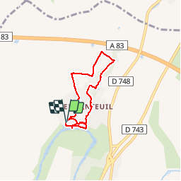
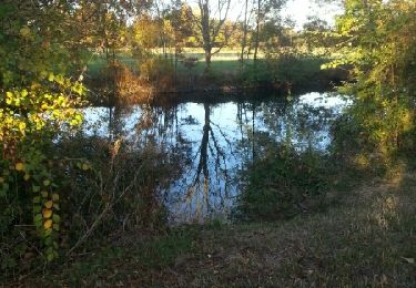
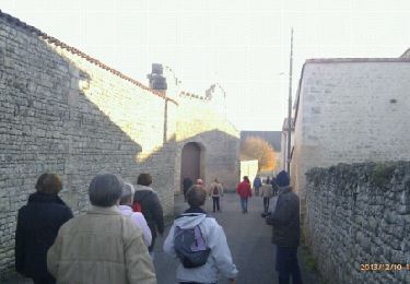
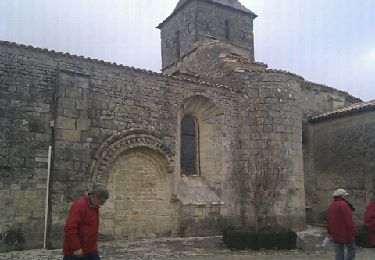
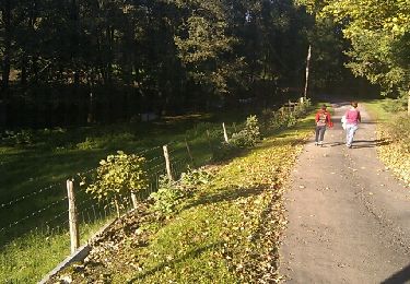
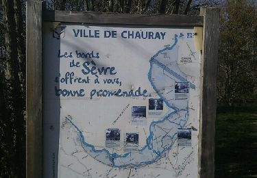
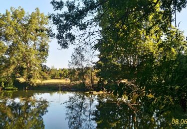
Randonnée Marche de 5,8 km à découvrir à Nouvelle-Aquitaine, Deux-Sèvres, Échiré. Cette randonnée est proposée par olaze.
Description
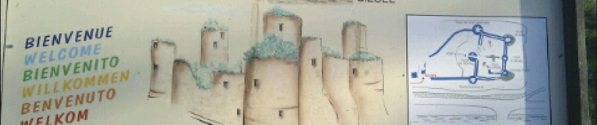
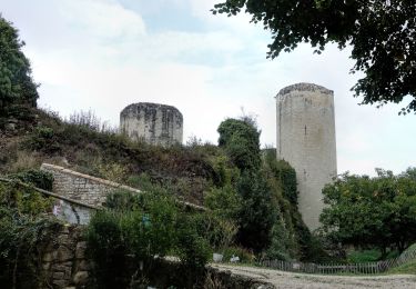
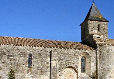
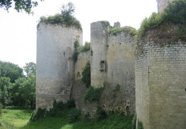
Randonnée autour du chateau Coudray-Salbart (Ternanteuil).
Bonnes pentes . (Ne pas faire par pluie, chemins parfois inondés).Club rando Bessines.
Localisation
Pays :
France
Région :
Nouvelle-Aquitaine
Département/Province :
Deux-Sèvres
Commune :
Échiré
Localité :
Unknown
Départ:(Dec)
Départ:(UTM)
697708 ; 5142508 (30T) N.
Commentaires
Randonnées à proximité
![Randonnée Marche Échiré - Echiré: balade des 3 châteaux - Photo](https://media.geolcdn.com/t/375/260/7daa007f-2d8f-4318-beb6-46c1636a9277.jpg&format=jpg&maxdim=2)
![Marche Marche](https://static1.geolcdn.com/sitytour/trail-icons/101.png)
Echiré: balade des 3 châteaux
Marche
Moyen
Échiré,
Nouvelle-Aquitaine,
Deux-Sèvres,
France
![](/images/other/stat-length.png)
6,5 km | 7,2 km-effort
2h 41min
![](https://static1.geolcdn.com/siteimages/upload/files/16400158638029165_repeat_loop_refresh_sync_direction_icon.png)
Oui
![Vélo électrique Vélo électrique](https://static1.geolcdn.com/sitytour/trail-icons/205.png)
Sciecq ( tour)
Vélo électrique
Très facile
Sciecq,
Nouvelle-Aquitaine,
Deux-Sèvres,
France
![](/images/other/stat-length.png)
11,1 km | 12 km-effort
58min
![](https://static1.geolcdn.com/siteimages/upload/files/16400158638029165_repeat_loop_refresh_sync_direction_icon.png)
Oui
![Randonnée Marche Échiré - 2016-10-31 Échiré Ternanteuil Échiré - Photo](https://media.geolcdn.com/t/375/260/ext.jpg?maxdim=2&url=https%3A%2F%2Fservices.sitytrail.com%2FGeolivesWS%2FDownloadMedia.ashx%3FTrailID%3D653957%26Media%3Dfix__20161031164422.jpg)
![Marche Marche](https://static1.geolcdn.com/sitytour/trail-icons/101.png)
2016-10-31 Échiré Ternanteuil Échiré
Marche
Facile
Échiré,
Nouvelle-Aquitaine,
Deux-Sèvres,
France
![](/images/other/stat-length.png)
11,9 km | 13,4 km-effort
2h 55min
![](https://static1.geolcdn.com/siteimages/upload/files/16400158638029165_repeat_loop_refresh_sync_direction_icon.png)
Oui
![Randonnée Marche Saint-Maxire - St Maxire - Photo](https://media.geolcdn.com/t/375/260/ext.jpg?maxdim=2&url=https%3A%2F%2Fservices.sitytrail.com%2FGeolivesWS%2FDownloadMedia.ashx%3FTrailID%3D236739%26Media%3Dfix__20131210160333.jpg)
![Marche Marche](https://static1.geolcdn.com/sitytour/trail-icons/101.png)
St Maxire
Marche
Facile
Saint-Maxire,
Nouvelle-Aquitaine,
Deux-Sèvres,
France
![](/images/other/stat-length.png)
8 km | 9,4 km-effort
2h 6min
![](https://static1.geolcdn.com/siteimages/upload/files/16400158638029165_repeat_loop_refresh_sync_direction_icon.png)
Oui
![Randonnée Marche Échiré - Mélusine au bord de la Sèvre - Echiré - Photo](https://media.geolcdn.com/t/375/260/ext.jpg?maxdim=2&url=https%3A%2F%2Fservices.sitytrail.com%2FGeolivesWS%2FDownloadMedia.ashx%3FTrailID%3D173023%26Media%3D14529_3.jpg)
![Marche Marche](https://static1.geolcdn.com/sitytour/trail-icons/101.png)
Mélusine au bord de la Sèvre - Echiré
Marche
Moyen
Échiré,
Nouvelle-Aquitaine,
Deux-Sèvres,
France
![](/images/other/stat-length.png)
11,6 km | 13,1 km-effort
2h 49min
![](https://static1.geolcdn.com/siteimages/upload/files/16400158638029165_repeat_loop_refresh_sync_direction_icon.png)
Oui
![Randonnée Marche Sciecq - Sciecq - Photo](https://media.geolcdn.com/t/375/260/ext.jpg?maxdim=2&url=https%3A%2F%2Fservices.sitytrail.com%2FGeolivesWS%2FDownloadMedia.ashx%3FTrailID%3D165946%26Media%3D20121211154956.jpeg)
![Marche Marche](https://static1.geolcdn.com/sitytour/trail-icons/101.png)
Sciecq
Marche
Moyen
Sciecq,
Nouvelle-Aquitaine,
Deux-Sèvres,
France
![](/images/other/stat-length.png)
6,9 km | 8,3 km-effort
1h 47min
![](https://static1.geolcdn.com/siteimages/upload/files/16400158638029165_repeat_loop_refresh_sync_direction_icon.png)
Oui
![Randonnée Marche Sainte-Ouenne - St Ouenne - Photo](https://media.geolcdn.com/t/375/260/ext.jpg?maxdim=2&url=https%3A%2F%2Fservices.sitytrail.com%2FGeolivesWS%2FDownloadMedia.ashx%3FTrailID%3D160513%26Media%3D20121030153909.jpeg)
![Marche Marche](https://static1.geolcdn.com/sitytour/trail-icons/101.png)
St Ouenne
Marche
Moyen
Sainte-Ouenne,
Nouvelle-Aquitaine,
Deux-Sèvres,
France
![](/images/other/stat-length.png)
10,2 km | 12,3 km-effort
2h 40min
![](https://static1.geolcdn.com/siteimages/upload/files/16400158638029165_repeat_loop_refresh_sync_direction_icon.png)
Oui
![Randonnée Marche Chauray - Chauray - Photo](https://media.geolcdn.com/t/375/260/ext.jpg?maxdim=2&url=https%3A%2F%2Fservices.sitytrail.com%2FGeolivesWS%2FDownloadMedia.ashx%3FTrailID%3D116617%26Media%3D20120313160339.jpeg)
![Marche Marche](https://static1.geolcdn.com/sitytour/trail-icons/101.png)
Chauray
Marche
Facile
Chauray,
Nouvelle-Aquitaine,
Deux-Sèvres,
France
![](/images/other/stat-length.png)
8,7 km | 9,6 km-effort
2h 7min
![](https://static1.geolcdn.com/siteimages/upload/files/16400158638029165_repeat_loop_refresh_sync_direction_icon.png)
Oui
![Randonnée Marche Sciecq - Sciecq (vallée de Périgny) - Photo](https://media.geolcdn.com/t/375/260/8971bb24-cc18-4a30-8e27-43fad8b5414c.jpg&format=jpg&maxdim=2)
![Marche Marche](https://static1.geolcdn.com/sitytour/trail-icons/101.png)
Sciecq (vallée de Périgny)
Marche
Moyen
Sciecq,
Nouvelle-Aquitaine,
Deux-Sèvres,
France
![](/images/other/stat-length.png)
8,5 km | 9,7 km-effort
2h 8min
![](https://static1.geolcdn.com/siteimages/upload/files/16400158638029165_repeat_loop_refresh_sync_direction_icon.png)
Oui