![](/images/other/stat-length.png)
![Randonnée Marche Geer - Promenade le long du Geer et réserve - Photo](https://media.geolcdn.com/t/1900/400/4fc37dda-e21b-43f8-a27a-3af14e8a0d8e.jpg&format=pjpeg&maxdim=2)
Promenade le long du Geer et réserve
cedricclaessens
Utilisateur
![Longueur](/images/other/stat-length.png)
Longueur
7,4 km
![Altitude max](https://static1.geolcdn.com/siteimages/upload/files/1508320355ic_sort_altitude_max_24dp.png)
Altitude max
131 m
![Dénivelé positif](https://static1.geolcdn.com/siteimages/upload/files/1508320355ic_sort_den_pos_24dp.png)
Dénivelé positif
43 m
![Km-Effort](/images/other/stat-length.png)
Km-Effort
7,9 km
![Altitude min](https://static1.geolcdn.com/siteimages/upload/files/1508320355ic_sort_altitude_min_24dp.png)
Altitude min
119 m
![Dénivelé négatif](https://static1.geolcdn.com/siteimages/upload/files/1508320355ic_sort_den_neg_24dp.png)
Dénivelé négatif
43 m
![Boucle](https://static1.geolcdn.com/siteimages/upload/files/16400158638029165_repeat_loop_refresh_sync_direction_icon.png)
Boucle
Oui
Date de création :
2020-03-07 10:48:32.0
Dernière modification :
2020-03-07 13:14:02.6
![Marche](https://static1.geolcdn.com/sitytour/trail-icons/101.png)
1h52
Difficulté : Facile
![Scannez ce code QR pour ouvrir la randonnée dans l'application SityTrail](https://capi.geolives.com/qq0zvz2zws4bq2lad0pu/sitytour/trails/2356166/qr.png?size=200)
Application GPS de randonnée GRATUITE
À propos
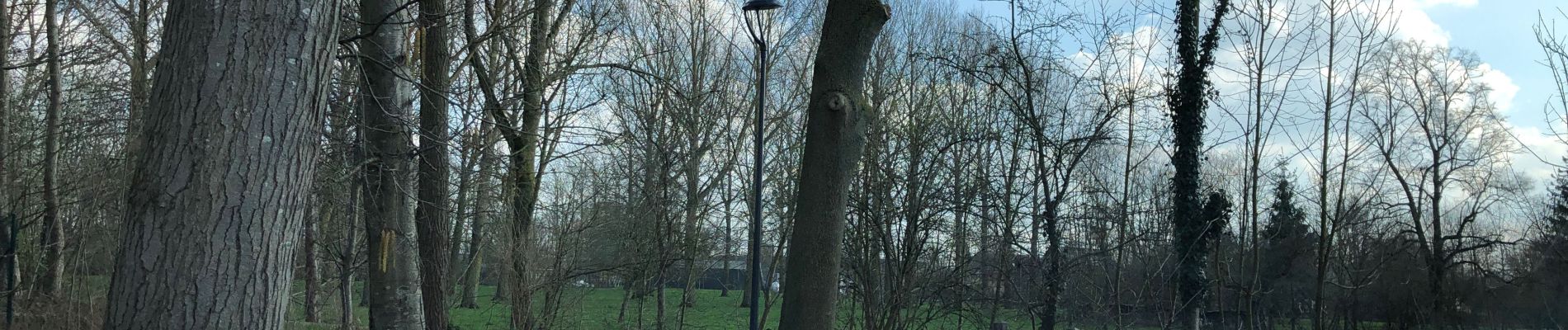
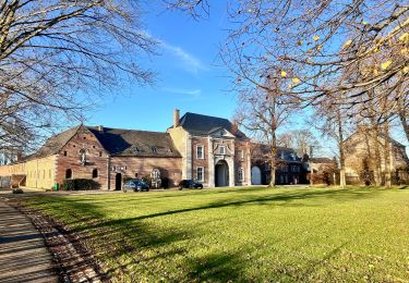
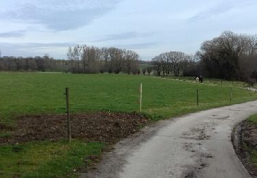
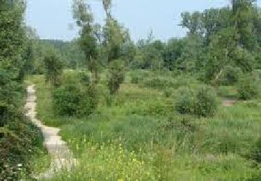
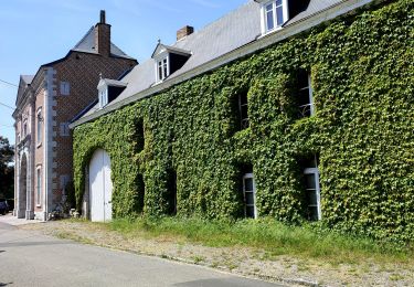
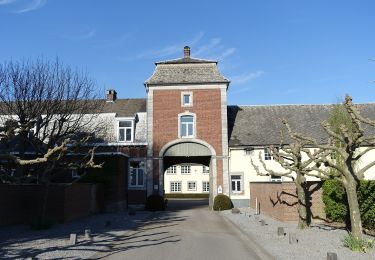
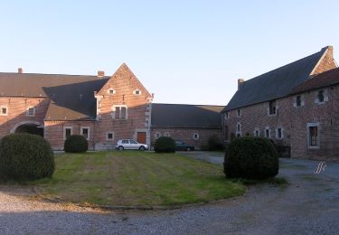
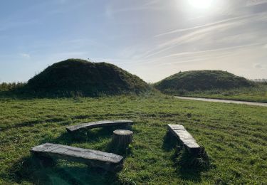
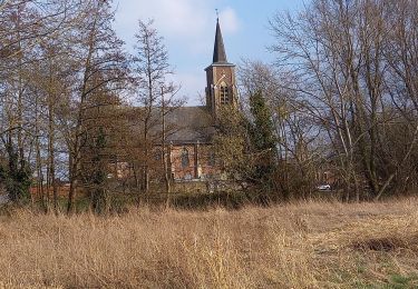
Randonnée Marche de 7,4 km à découvrir à Wallonie, Liège, Geer. Cette randonnée est proposée par cedricclaessens.
Description
Magnifique promenade le long de l’eau, chemin facilement carrossable qui débouche sur la réserve naturelle de Hollogne-Sur-Geer.
Localisation
Pays :
Belgique
Région :
Wallonie
Département/Province :
Liège
Commune :
Geer
Localité :
Geer
Départ:(Dec)
Départ:(UTM)
653701 ; 5615161 (31U) N.
Commentaires
Randonnées à proximité
![Randonnée Marche Hannut - La Balade des Chevées - Photo](https://media.geolcdn.com/t/375/260/c40a8656-229d-4d2b-8925-ffea50baaa2d.jpeg&format=jpg&maxdim=2)
![Marche Marche](https://static1.geolcdn.com/sitytour/trail-icons/101.png)
La Balade des Chevées
Marche
Facile
(1)
Hannut,
Wallonie,
Liège,
Belgique
![](/images/other/stat-length.png)
5,2 km | 5,7 km-effort
1h 17min
![](https://static1.geolcdn.com/siteimages/upload/files/16400158638029165_repeat_loop_refresh_sync_direction_icon.png)
Oui
![Randonnée Marche Braives - Boucle Moulin de Velupont - Photo](https://media.geolcdn.com/t/375/260/ext.jpg?maxdim=2&url=https%3A%2F%2Fservices.sitytrail.com%2FGeolivesWS%2FDownloadMedia.ashx%3FTrailID%3D705146%26Media%3Dfix__20170225113122.jpg)
![Marche Marche](https://static1.geolcdn.com/sitytour/trail-icons/101.png)
Boucle Moulin de Velupont
Marche
Très facile
(4)
Braives,
Wallonie,
Liège,
Belgique
![](/images/other/stat-length.png)
4,6 km | 5,2 km-effort
55min
![](https://static1.geolcdn.com/siteimages/upload/files/16400158638029165_repeat_loop_refresh_sync_direction_icon.png)
Oui
![Randonnée Marche Waremme - WACHNET WAREMME - Photo](https://media.geolcdn.com/t/375/260/9402a055-337f-4143-8a11-4cda7b0783be.png&format=jpg&maxdim=2)
![Marche Marche](https://static1.geolcdn.com/sitytour/trail-icons/101.png)
WACHNET WAREMME
Marche
Facile
(2)
Waremme,
Wallonie,
Liège,
Belgique
![](/images/other/stat-length.png)
2,5 km | 2,7 km-effort
36min
![](https://static1.geolcdn.com/siteimages/upload/files/16400158638029165_repeat_loop_refresh_sync_direction_icon.png)
Oui
![Randonnée Marche Hannut - La balade des chevées (5km) - Photo](https://media.geolcdn.com/t/375/260/4f5eaa7c-e24d-4247-898f-e668713f7776.jpg&format=jpg&maxdim=2)
![Marche Marche](https://static1.geolcdn.com/sitytour/trail-icons/101.png)
La balade des chevées (5km)
Marche
Facile
(1)
Hannut,
Wallonie,
Liège,
Belgique
![](/images/other/stat-length.png)
5,3 km | 5,7 km-effort
1h 18min
![](https://static1.geolcdn.com/siteimages/upload/files/16400158638029165_repeat_loop_refresh_sync_direction_icon.png)
Oui
![Randonnée A pied Geer - Promenade des Peupliers - Photo](https://media.geolcdn.com/t/375/260/f68fd01a-6493-4bfb-8eb0-00aa4284b467.jpeg&format=jpg&maxdim=2)
![A pied A pied](https://static1.geolcdn.com/sitytour/trail-icons/100.png)
Promenade des Peupliers
A pied
Facile
Geer,
Wallonie,
Liège,
Belgique
![](/images/other/stat-length.png)
8,9 km | 9,6 km-effort
2h 11min
![](https://static1.geolcdn.com/siteimages/upload/files/16400158638029165_repeat_loop_refresh_sync_direction_icon.png)
Oui
![Randonnée A pied Geer - Promenade du Geer - Photo](https://media.geolcdn.com/t/375/260/b73edfb0-f782-4f6f-af6c-98fa8486e229.jpeg&format=jpg&maxdim=2)
![A pied A pied](https://static1.geolcdn.com/sitytour/trail-icons/100.png)
Promenade du Geer
A pied
Facile
(2)
Geer,
Wallonie,
Liège,
Belgique
![](/images/other/stat-length.png)
9,5 km | 10,3 km-effort
2h 20min
![](https://static1.geolcdn.com/siteimages/upload/files/16400158638029165_repeat_loop_refresh_sync_direction_icon.png)
Non
![Randonnée Cyclotourisme Waremme - WAR LIGN V WAL FALLAIS AVEN L S S G AXHE WAR - Photo](https://media.geolcdn.com/t/375/260/ext.jpg?maxdim=2&url=https%3A%2F%2Fstatic1.geolcdn.com%2Fsiteimages%2Fupload%2Ffiles%2F1524743154velo.jpg)
![Cyclotourisme Cyclotourisme](https://static1.geolcdn.com/sitytour/trail-icons/204.png)
WAR LIGN V WAL FALLAIS AVEN L S S G AXHE WAR
Cyclotourisme
Très facile
(1)
Waremme,
Wallonie,
Liège,
Belgique
![](/images/other/stat-length.png)
39 km | 43 km-effort
Inconnu
![](https://static1.geolcdn.com/siteimages/upload/files/16400158638029165_repeat_loop_refresh_sync_direction_icon.png)
Oui
![Randonnée Marche Gingelom - Les tumulus gallo-romains de Gingelom - Photo](https://media.geolcdn.com/t/375/260/efb3c4a9-8d44-482e-a912-cdace479afa1.jpeg&format=jpg&maxdim=2)
![Marche Marche](https://static1.geolcdn.com/sitytour/trail-icons/101.png)
Les tumulus gallo-romains de Gingelom
Marche
Facile
Gingelom,
Flandre,
Limbourg,
Belgique
![](/images/other/stat-length.png)
4,2 km | 4,7 km-effort
1h 4min
![](https://static1.geolcdn.com/siteimages/upload/files/16400158638029165_repeat_loop_refresh_sync_direction_icon.png)
Oui
![Randonnée Marche Berloz - Corswarem - Photo](https://media.geolcdn.com/t/375/260/d6b93252-b6ff-4ae4-bd02-4ed611d3318b.jpg&format=jpg&maxdim=2)
![Marche Marche](https://static1.geolcdn.com/sitytour/trail-icons/101.png)
Excellent 👍👍