


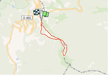

10,5 km | 17,7 km-effort

Utilisateur


Application GPS de randonnée GRATUITE
 SityTrail
IGN / Instituts géographiques
SityTrail World
Le monde est à vous
Randonnée Raquettes à neige de 4,7 km à découvrir à Bourgogne-Franche-Comté, Territoire-de-Belfort, Lepuix. Cette randonnée est proposée par helmut68.
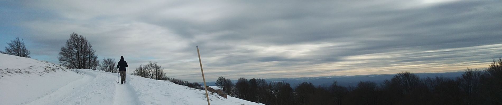
Sortie raquettes départ parking de la piste de ski " la Gentiane" . Balisage " violet ".
Très belles vues sur les Alpes Suisse & Française.
Alors à vos raquettes pour un moment d'évasion...


Marche

Marche

Marche

Marche

Marche

Marche

Marche
Marche

Marche