![](/images/other/stat-length.png)
![Randonnée Raquettes à neige Tende - Col de Tende - Photo](https://media.geolcdn.com/t/1900/400/0ff79dcc-533d-443b-b72d-0fd18d9aa751.jpeg&format=pjpeg&maxdim=2)
Col de Tende
bozo1970
Utilisateur
![Longueur](/images/other/stat-length.png)
Longueur
20 km
![Altitude max](https://static1.geolcdn.com/siteimages/upload/files/1508320355ic_sort_altitude_max_24dp.png)
Altitude max
1911 m
![Dénivelé positif](https://static1.geolcdn.com/siteimages/upload/files/1508320355ic_sort_den_pos_24dp.png)
Dénivelé positif
749 m
![Km-Effort](/images/other/stat-length.png)
Km-Effort
30 km
![Altitude min](https://static1.geolcdn.com/siteimages/upload/files/1508320355ic_sort_altitude_min_24dp.png)
Altitude min
1351 m
![Dénivelé négatif](https://static1.geolcdn.com/siteimages/upload/files/1508320355ic_sort_den_neg_24dp.png)
Dénivelé négatif
750 m
![Boucle](https://static1.geolcdn.com/siteimages/upload/files/16400158638029165_repeat_loop_refresh_sync_direction_icon.png)
Boucle
Oui
Date de création :
2020-02-20 08:29:52.0
Dernière modification :
2020-02-21 08:03:06.207
![Raquettes à neige](https://static1.geolcdn.com/sitytour/trail-icons/504.png)
5h50
Difficulté : Moyen
![Scannez ce code QR pour ouvrir la randonnée dans l'application SityTrail](https://capi.geolives.com/qq0zvz2zws4bq2lad0pu/sitytour/trails/2340944/qr.png?size=200)
Application GPS de randonnée GRATUITE
À propos
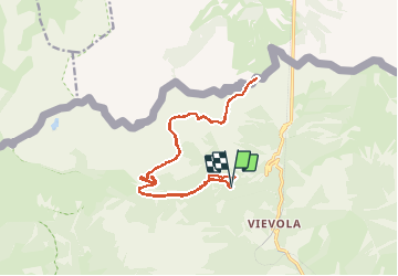
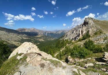
Randonnée Raquettes à neige de 20 km à découvrir à Provence-Alpes-Côte d'Azur, Alpes-Maritimes, Tende. Cette randonnée est proposée par bozo1970.
Description
Montée par le vallon de Caramagne
20km
5h50’ et 757m de D
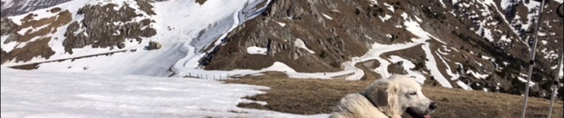
Agréable dans la neige !
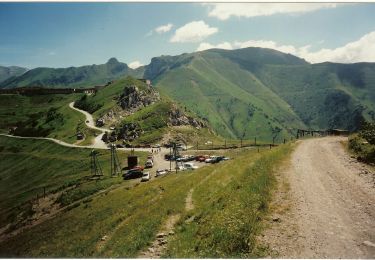
Un peu long...
Beaucoup de vent au col.
Localisation
Pays :
France
Région :
Provence-Alpes-Côte d'Azur
Département/Province :
Alpes-Maritimes
Commune :
Tende
Localité :
Unknown
Départ:(Dec)
Départ:(UTM)
384148 ; 4886747 (32T) N.
Commentaires
Randonnées à proximité
![Randonnée A pied Tende - Circuit de Fontanalbe - Photo](https://media.geolcdn.com/t/375/260/fbada9bc-eac2-4c15-a16e-af4bb85123b6.jpeg&format=jpg&maxdim=2)
![A pied A pied](https://static1.geolcdn.com/sitytour/trail-icons/100.png)
Circuit de Fontanalbe
A pied
Moyen
Tende,
Provence-Alpes-Côte d'Azur,
Alpes-Maritimes,
France
![](/images/other/stat-length.png)
14,6 km | 24 km-effort
5h 28min
![](https://static1.geolcdn.com/siteimages/upload/files/16400158638029165_repeat_loop_refresh_sync_direction_icon.png)
Oui
![Randonnée A pied Tende - Circuit des Forts - Photo](https://media.geolcdn.com/t/375/260/b53859bf-7f55-45fd-b80c-9810660ac6a4.jpeg&format=jpg&maxdim=2)
![A pied A pied](https://static1.geolcdn.com/sitytour/trail-icons/100.png)
Circuit des Forts
A pied
Facile
Tende,
Provence-Alpes-Côte d'Azur,
Alpes-Maritimes,
France
![](/images/other/stat-length.png)
10,7 km | 16,9 km-effort
3h 50min
![](https://static1.geolcdn.com/siteimages/upload/files/16400158638029165_repeat_loop_refresh_sync_direction_icon.png)
Oui
![Randonnée A pied Limone Piemonte - FR-L50 - Photo](https://media.geolcdn.com/t/375/260/6d3ea39a-115a-45b8-b72b-affc956c7cc8.jpeg&format=jpg&maxdim=2)
![A pied A pied](https://static1.geolcdn.com/sitytour/trail-icons/100.png)
![Randonnée Marche Tende - Tende - Casterino Fontanalba Lacs Jumeaux - 16.8km 760m 6h35 (0h40) - 2016 06 20 - Photo](https://media.geolcdn.com/t/375/260/ext.jpg?maxdim=2&url=https%3A%2F%2Fservices.sitytrail.com%2FGeolivesWS%2FDownloadMedia.ashx%3FTrailID%3D597810%26Media%3Dfix__20160620152052.jpg)
![Marche Marche](https://static1.geolcdn.com/sitytour/trail-icons/101.png)
Tende - Casterino Fontanalba Lacs Jumeaux - 16.8km 760m 6h35 (0h40) - 2016 06 20
Marche
Difficile
Tende,
Provence-Alpes-Côte d'Azur,
Alpes-Maritimes,
France
![](/images/other/stat-length.png)
16,8 km | 27 km-effort
6h 35min
![](https://static1.geolcdn.com/siteimages/upload/files/16400158638029165_repeat_loop_refresh_sync_direction_icon.png)
Oui
![Randonnée Marche Tende - Tende - Vallon de Casterino Refuge de Valmasque et les 3 lacs - 17.7km 750m 6h00 (45mn) - 2016 06 28 - Photo](https://media.geolcdn.com/t/375/260/ext.jpg?maxdim=2&url=https%3A%2F%2Fservices.sitytrail.com%2FGeolivesWS%2FDownloadMedia.ashx%3FTrailID%3D597803%26Media%3Dfix__20160628122144.jpg)
![Marche Marche](https://static1.geolcdn.com/sitytour/trail-icons/101.png)
Tende - Vallon de Casterino Refuge de Valmasque et les 3 lacs - 17.7km 750m 6...
Marche
Difficile
Tende,
Provence-Alpes-Côte d'Azur,
Alpes-Maritimes,
France
![](/images/other/stat-length.png)
17,7 km | 28 km-effort
6h 0min
![](https://static1.geolcdn.com/siteimages/upload/files/16400158638029165_repeat_loop_refresh_sync_direction_icon.png)
Oui
![Randonnée Marche Tende - tende boucle - Photo](https://media.geolcdn.com/t/375/260/62c5f523-2f83-4b76-96b8-df3883db8512.jpg&format=jpg&maxdim=2)
![Marche Marche](https://static1.geolcdn.com/sitytour/trail-icons/101.png)
tende boucle
Marche
Facile
Tende,
Provence-Alpes-Côte d'Azur,
Alpes-Maritimes,
France
![](/images/other/stat-length.png)
10,2 km | 12,9 km-effort
1h 16min
![](https://static1.geolcdn.com/siteimages/upload/files/16400158638029165_repeat_loop_refresh_sync_direction_icon.png)
Non
![Randonnée Marche Tende - caterino - Photo](https://media.geolcdn.com/t/375/260/8c39ac3e-d957-46f4-8e03-243fe9974591.jpg&format=jpg&maxdim=2)
![Marche Marche](https://static1.geolcdn.com/sitytour/trail-icons/101.png)
caterino
Marche
Difficile
Tende,
Provence-Alpes-Côte d'Azur,
Alpes-Maritimes,
France
![](/images/other/stat-length.png)
15,7 km | 26 km-effort
4h 47min
![](https://static1.geolcdn.com/siteimages/upload/files/16400158638029165_repeat_loop_refresh_sync_direction_icon.png)
Oui
![Randonnée Marche Tende - Boucle à Fontanalba - Photo](https://media.geolcdn.com/t/375/260/5a02cdc0-abff-43e4-9137-5fe1682e5e68.jpg&format=jpg&maxdim=2)
![Marche Marche](https://static1.geolcdn.com/sitytour/trail-icons/101.png)
Boucle à Fontanalba
Marche
Moyen
Tende,
Provence-Alpes-Côte d'Azur,
Alpes-Maritimes,
France
![](/images/other/stat-length.png)
12,8 km | 24 km-effort
4h 57min
![](https://static1.geolcdn.com/siteimages/upload/files/16400158638029165_repeat_loop_refresh_sync_direction_icon.png)
Non
![Randonnée Marche Tende - castel tournou - Photo](https://media.geolcdn.com/t/375/260/39bc4b5c-37a4-4af2-93f2-0eaa9196e8d4.jpg&format=jpg&maxdim=2)
![Marche Marche](https://static1.geolcdn.com/sitytour/trail-icons/101.png)
castel tournou
Marche
Moyen
Tende,
Provence-Alpes-Côte d'Azur,
Alpes-Maritimes,
France
![](/images/other/stat-length.png)
7 km | 13,5 km-effort
4h 20min
![](https://static1.geolcdn.com/siteimages/upload/files/16400158638029165_repeat_loop_refresh_sync_direction_icon.png)
Oui