![](/images/other/stat-length.png)
![Randonnée Marche Le Touquet-Paris-Plage - Le Touquet : Canadiens vers Golf - Photo](https://media.geolcdn.com/t/1900/400/ext.pjpeg?maxdim=2&url=https%3A%2F%2Fmedia.geolcdn.com%2Ff%2Ff1f10a1d-9747-4cfa-aaf6-d86579132c9e.jpg)
Le Touquet : Canadiens vers Golf
Lau Maes
Utilisateur
![Longueur](/images/other/stat-length.png)
Longueur
5,7 km
![Altitude max](https://static1.geolcdn.com/siteimages/upload/files/1508320355ic_sort_altitude_max_24dp.png)
Altitude max
28 m
![Dénivelé positif](https://static1.geolcdn.com/siteimages/upload/files/1508320355ic_sort_den_pos_24dp.png)
Dénivelé positif
48 m
![Km-Effort](/images/other/stat-length.png)
Km-Effort
6,3 km
![Altitude min](https://static1.geolcdn.com/siteimages/upload/files/1508320355ic_sort_altitude_min_24dp.png)
Altitude min
9 m
![Dénivelé négatif](https://static1.geolcdn.com/siteimages/upload/files/1508320355ic_sort_den_neg_24dp.png)
Dénivelé négatif
48 m
![Boucle](https://static1.geolcdn.com/siteimages/upload/files/16400158638029165_repeat_loop_refresh_sync_direction_icon.png)
Boucle
Oui
Date de création :
2020-02-18 09:04:00.0
Dernière modification :
2020-02-18 10:34:47.464
![Marche](https://static1.geolcdn.com/sitytour/trail-icons/101.png)
1h30
Difficulté : Difficile
![Scannez ce code QR pour ouvrir la randonnée dans l'application SityTrail](https://capi.geolives.com/qq0zvz2zws4bq2lad0pu/sitytour/trails/2338251/qr.png?size=200)
Application GPS de randonnée GRATUITE
À propos
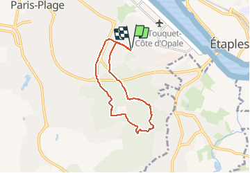
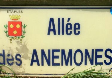
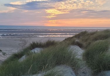
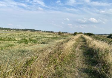
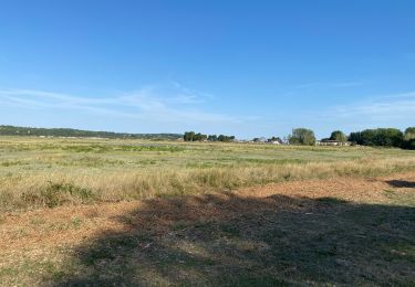
Randonnée Marche de 5,7 km à découvrir à Hauts-de-France, Pas-de-Calais, Le Touquet-Paris-Plage. Cette randonnée est proposée par Lau Maes.
Description
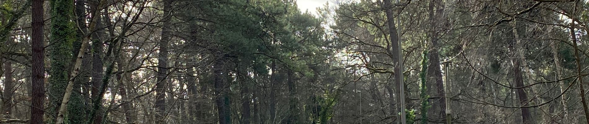
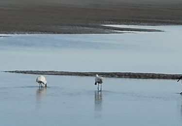
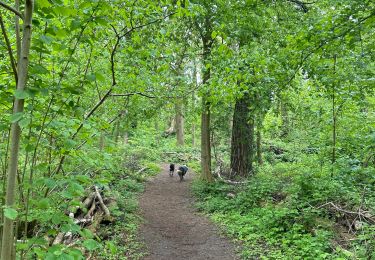
En traversant les bois au gré des sentiers fréquentés par les promeneurs, les joggeurs, les vététistes, les cavaliers. Prévoir une App d’orientation pour ne pas se perdre :-)
Localisation
Pays :
France
Région :
Hauts-de-France
Département/Province :
Pas-de-Calais
Commune :
Le Touquet-Paris-Plage
Localité :
Unknown
Départ:(Dec)
Départ:(UTM)
401770 ; 5596622 (31U) N.
Commentaires
Randonnées à proximité
![Randonnée Vélo Étaples - Les Garnoulles - Etaples - Photo](https://media.geolcdn.com/t/375/260/ext.jpg?maxdim=2&url=https%3A%2F%2Fservices.sitytrail.com%2FGeolivesWS%2FDownloadMedia.ashx%3FTrailID%3D110038%26Media%3D5140_6.jpg)
![Vélo Vélo](https://static1.geolcdn.com/sitytour/trail-icons/200.png)
Les Garnoulles - Etaples
Vélo
Moyen
(2)
Étaples,
Hauts-de-France,
Pas-de-Calais,
France
![](/images/other/stat-length.png)
34 km | 38 km-effort
2h 45min
![](https://static1.geolcdn.com/siteimages/upload/files/16400158638029165_repeat_loop_refresh_sync_direction_icon.png)
Oui
![Randonnée Marche Étaples - Le sentier du Rombly - Etaples - Photo](https://media.geolcdn.com/t/375/260/ext.jpg?maxdim=2&url=https%3A%2F%2Fservices.sitytrail.com%2FGeolivesWS%2FDownloadMedia.ashx%3FTrailID%3D110030%26Media%3D5135_5.jpg)
![Marche Marche](https://static1.geolcdn.com/sitytour/trail-icons/101.png)
Le sentier du Rombly - Etaples
Marche
Difficile
(3)
Étaples,
Hauts-de-France,
Pas-de-Calais,
France
![](/images/other/stat-length.png)
14,1 km | 17,3 km-effort
3h 30min
![](https://static1.geolcdn.com/siteimages/upload/files/16400158638029165_repeat_loop_refresh_sync_direction_icon.png)
Oui
![Randonnée A pied Étaples - Sentier de Rombly - Photo](https://media.geolcdn.com/t/375/260/ext.jpg?maxdim=2&url=https%3A%2F%2Fmedia.geolcdn.com%2Ff%2F91fe37b4-244e-4fc8-8ef4-3e25b2d6c241.jpeg)
![A pied A pied](https://static1.geolcdn.com/sitytour/trail-icons/100.png)
Sentier de Rombly
A pied
Moyen
Étaples,
Hauts-de-France,
Pas-de-Calais,
France
![](/images/other/stat-length.png)
17,2 km | 21 km-effort
4h 48min
![](https://static1.geolcdn.com/siteimages/upload/files/16400158638029165_repeat_loop_refresh_sync_direction_icon.png)
Oui
![Randonnée Marche Étaples - Étaples - La forestière - Photo](https://media.geolcdn.com/t/375/260/ext.jpg?maxdim=2&url=https%3A%2F%2Fmedia.geolcdn.com%2Ff%2Fea83baf0-4684-4df5-9be2-2a2c1d93a866.jpg)
![Marche Marche](https://static1.geolcdn.com/sitytour/trail-icons/101.png)
Étaples - La forestière
Marche
Facile
Étaples,
Hauts-de-France,
Pas-de-Calais,
France
![](/images/other/stat-length.png)
4,4 km | 5,5 km-effort
1h 26min
![](https://static1.geolcdn.com/siteimages/upload/files/16400158638029165_repeat_loop_refresh_sync_direction_icon.png)
Oui
![Randonnée Vélo de route Le Touquet-Paris-Plage - Le Touquet Vélo - Photo](https://media.geolcdn.com/t/375/260/ext.jpg?maxdim=2&url=https%3A%2F%2Fmedia.geolcdn.com%2Ff%2Fd0d444ac-fb80-4612-9631-6d43cd426718.jpg)
![Vélo de route Vélo de route](https://static1.geolcdn.com/sitytour/trail-icons/201.png)
Le Touquet Vélo
Vélo de route
Le Touquet-Paris-Plage,
Hauts-de-France,
Pas-de-Calais,
France
![](/images/other/stat-length.png)
23 km | 25 km-effort
2h 24min
![](https://static1.geolcdn.com/siteimages/upload/files/16400158638029165_repeat_loop_refresh_sync_direction_icon.png)
Oui
![Randonnée Marche Le Touquet-Paris-Plage - Le Touquet Paris Plage - Photo](https://media.geolcdn.com/t/375/260/ext.jpg?maxdim=2&url=https%3A%2F%2Fmedia.geolcdn.com%2Ff%2F58cf07f6-f257-4be4-a8f7-0f5714037a5d.jpg)
![Marche Marche](https://static1.geolcdn.com/sitytour/trail-icons/101.png)
Le Touquet Paris Plage
Marche
Le Touquet-Paris-Plage,
Hauts-de-France,
Pas-de-Calais,
France
![](/images/other/stat-length.png)
9 km | 9,8 km-effort
2h 36min
![](https://static1.geolcdn.com/siteimages/upload/files/16400158638029165_repeat_loop_refresh_sync_direction_icon.png)
Non
![Randonnée Marche nordique Le Touquet-Paris-Plage - Marche nordique : Boucle 12 km Le Touquet - Merlimont - Photo](https://media.geolcdn.com/t/375/260/ext.jpg?maxdim=2&url=https%3A%2F%2Fmedia.geolcdn.com%2Ff%2F3f68287f-5493-43e5-98e0-b8e122cf61f9.jpg)
![Marche nordique Marche nordique](https://static1.geolcdn.com/sitytour/trail-icons/102.png)
Marche nordique : Boucle 12 km Le Touquet - Merlimont
Marche nordique
Très facile
Le Touquet-Paris-Plage,
Hauts-de-France,
Pas-de-Calais,
France
![](/images/other/stat-length.png)
12,3 km | 12,5 km-effort
1h 59min
![](https://static1.geolcdn.com/siteimages/upload/files/16400158638029165_repeat_loop_refresh_sync_direction_icon.png)
Oui
![Randonnée Marche Le Touquet-Paris-Plage - Sur la route du musée - Photo](https://media.geolcdn.com/t/375/260/ext.jpg?maxdim=2&url=https%3A%2F%2Fmedia.geolcdn.com%2Ff%2F62c5aadb-0410-4785-8e61-ddcf957a5ea7.jpg)
![Marche Marche](https://static1.geolcdn.com/sitytour/trail-icons/101.png)
Sur la route du musée
Marche
Le Touquet-Paris-Plage,
Hauts-de-France,
Pas-de-Calais,
France
![](/images/other/stat-length.png)
8,4 km | 9 km-effort
1h 55min
![](https://static1.geolcdn.com/siteimages/upload/files/16400158638029165_repeat_loop_refresh_sync_direction_icon.png)
Oui
![Randonnée Marche Le Touquet-Paris-Plage - Balade dans la baie de Canche - Photo](https://media.geolcdn.com/t/375/260/ext.jpg?maxdim=2&url=https%3A%2F%2Fmedia.geolcdn.com%2Ff%2F3dc28a84-57d0-46cf-b02e-bd5974f0e2ec.jpg)
![Marche Marche](https://static1.geolcdn.com/sitytour/trail-icons/101.png)
Balade dans la baie de Canche
Marche
Très facile
Le Touquet-Paris-Plage,
Hauts-de-France,
Pas-de-Calais,
France
![](/images/other/stat-length.png)
7,3 km | 7,8 km-effort
1h 24min
![](https://static1.geolcdn.com/siteimages/upload/files/16400158638029165_repeat_loop_refresh_sync_direction_icon.png)
Non