Randonnée Marche Orthez - P16 Orthez-Guinarthe - Photo

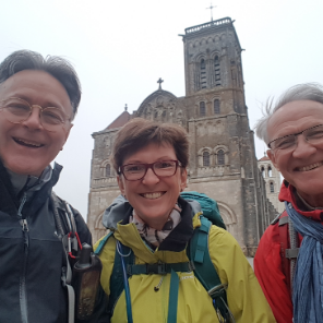
On ne s'arrête pas parce qu'on vieillit, ... on vieillit parce qu'on s'arrête !

© OpenStreetMap contributors
Longueur
Longueur
25 km
Altitude max
Altitude max
218 m
Dénivelé positif
Dénivelé positif
600 m
Km-Effort
Km-Effort  
33 km
Altitude min
Altitude min
50 m
Dénivelé négatif
Dénivelé négatif
604 m
Boucle
Boucle
Non
Date de création :
2020-02-11 12:38:21.655
Dernière modification :
2020-02-11 12:44:12.54

(0 Avis)

Marche
Marche
7h04
Difficulté : Très difficile

Scannez ce code QR pour ouvrir la randonnée dans l'application SityTrail

Application GPS de randonnée GRATUITE

Logo SityTrail SityTrail

IGN / Instituts géographiques

Télécharger SityTrail sur l'App Store Télécharger SityTrail sur Google Play

Logo SityTrail SityTrail World

Le monde est à vous

Télécharger SityTrail sur l'App Store Télécharger SityTrail sur Google Play Télécharger SityTrail sur Huawei AppGallery

À propos

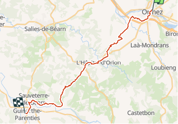
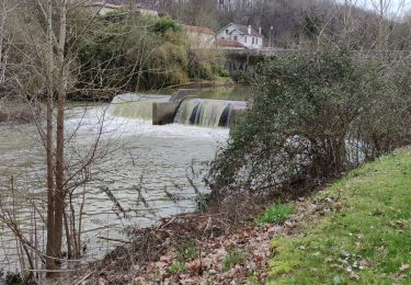
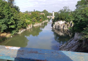
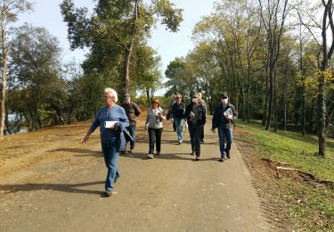
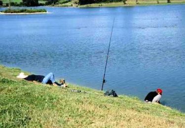
Randonnée Marche de 25 km à découvrir à Nouvelle-Aquitaine, Pyrénées-Atlantiques, Orthez. Cette randonnée est proposée par HEKABI.

Profil altimétrique

Points d'intérêt

Point d'intérêt Guinarthe-Parenties - Accueil pèlerin (MMDD T69/TOPO P13/Lepère P287) - Photo
ABICHE
GUINARTHE-PARENTIES 

Localisation

Pays :
France
Région :
Nouvelle-Aquitaine
Département/Province :
Pyrénées-Atlantiques
Commune :
Orthez
Localité :
Unknown
Départ:(UTM)
679990 ; 4817509 (30T) N.

Randonnées à proximité

Randonnée Marche Orthez - ORTHEZ  GRvP 29 02 2024 - Photo
Marche
GUIDE
marmotte65

Marche

Difficile
Orthez, Nouvelle-Aquitaine, Pyrénées-Atlantiques, France
14,4 km | 17,2 km-effort
5h 39min
Non
Randonnée A pied Orthez - PARI 2024 Orthez / Sault de Navailles
A pied
GUIDE
marmotte65

A pied

Facile
Orthez, Nouvelle-Aquitaine, Pyrénées-Atlantiques, France
14,4 km | 17,2 km-effort
3h 54min
Non
Randonnée Marche Orthez - ORTHEZ Medieval (CCLO) G4 labélisation fait  - Photo
Marche
GUIDE
marmotte65

Marche

Facile
Orthez, Nouvelle-Aquitaine, Pyrénées-Atlantiques, France
6 km | 7,6 km-effort
1h 53min
Oui
Randonnée Marche Orthez - ORTHEZ Laqueyre M1 et M2  le 14/12/2022
Marche
GUIDE
marmotte65

Marche

Difficile
Orthez, Nouvelle-Aquitaine, Pyrénées-Atlantiques, France
9,9 km | 12,2 km-effort
4h 46min
Oui
Randonnée Marche Orthez - ORTHEZ Lac de Biron - Photo
Marche
GUIDE
marmotte65

Marche

Très facile
Orthez, Nouvelle-Aquitaine, Pyrénées-Atlantiques, France
3,5 km | 3,8 km-effort
1h 16min
Non
Randonnée Course à pied Orthez - Géocaching Laqueyre - Photo
Course à pied
tracegps

Course à pied

Difficile
Orthez, Nouvelle-Aquitaine, Pyrénées-Atlantiques, France
10,8 km | 13,6 km-effort
1h 30min
Oui
Randonnée V.T.T. Orthez - Géocaching Laqueyre - Photo
V.T.T.
tracegps

V.T.T.

Moyen
Orthez, Nouvelle-Aquitaine, Pyrénées-Atlantiques, France
10,8 km | 13,6 km-effort
1h 0min
Oui
Randonnée Marche Orthez - Géocaching Laqueyre - Photo
Marche
tracegps

Marche

Moyen
Orthez, Nouvelle-Aquitaine, Pyrénées-Atlantiques, France
10,8 km | 13,6 km-effort
3h 0min
Oui
Randonnée Marche Orthez - Orthez - Laqueyre - Photo
Marche
tracegps

Marche

Moyen
Orthez, Nouvelle-Aquitaine, Pyrénées-Atlantiques, France
9,5 km | 11,6 km-effort
3h 0min
Oui


Fermer
Mes abonnements