![](/images/other/stat-length.png)
Grézac Pierre plate
mdauzat
Utilisateur
![Longueur](/images/other/stat-length.png)
![Altitude max](https://static1.geolcdn.com/siteimages/upload/files/1508320355ic_sort_altitude_max_24dp.png)
![Dénivelé positif](https://static1.geolcdn.com/siteimages/upload/files/1508320355ic_sort_den_pos_24dp.png)
![Km-Effort](/images/other/stat-length.png)
![Altitude min](https://static1.geolcdn.com/siteimages/upload/files/1508320355ic_sort_altitude_min_24dp.png)
![Dénivelé négatif](https://static1.geolcdn.com/siteimages/upload/files/1508320355ic_sort_den_neg_24dp.png)
![Boucle](https://static1.geolcdn.com/siteimages/upload/files/16400158638029165_repeat_loop_refresh_sync_direction_icon.png)
![Marche](https://static1.geolcdn.com/sitytour/trail-icons/101.png)
2h44
Difficulté : Moyen
![Scannez ce code QR pour ouvrir la randonnée dans l'application SityTrail](https://capi.geolives.com/qq0zvz2zws4bq2lad0pu/sitytour/trails/2325097/qr.png?size=200)
Application GPS de randonnée GRATUITE
À propos
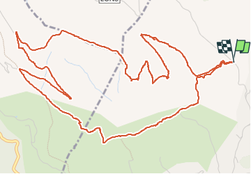
Randonnée Marche de 8,8 km à découvrir à Occitanie, Hérault, Lodève. Cette randonnée est proposée par mdauzat.
Description
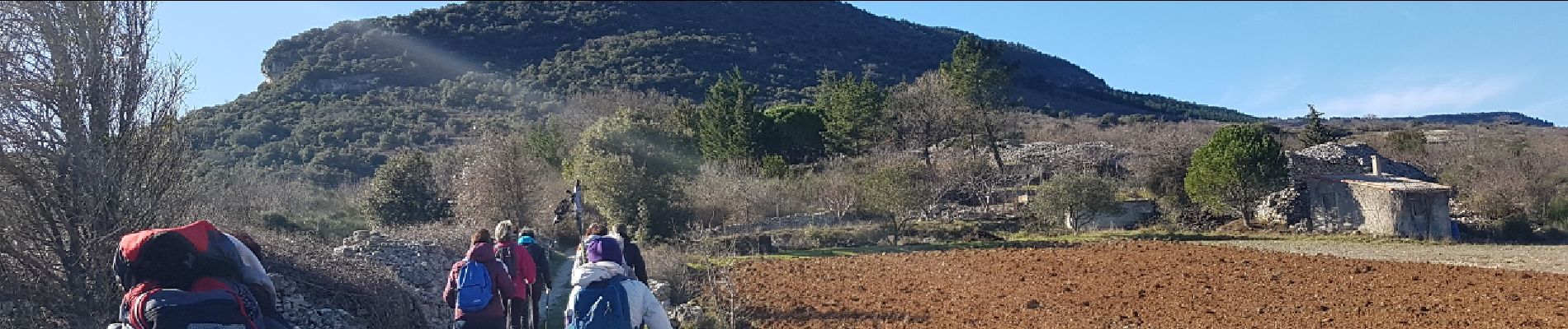
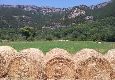
A partir de la route de Grézac (après Les Roucans, direction les Moulières), la piste monte sur le flanc est du Grézac et s'élève au dessus de la vallée de Lauroux, offrant déjà de très belles vues sur Poujols, Lauroux, et les environs. La piste passe ensuite en sous-bois (à noter un petit aven sur le bord du chemin) et gagne le plateau. C'est alors que l'on découvre la célèbre "Pierre Plate", promontoire rocheux qui surplombe l'Oppidum et permet d'admirer, sans conteste, la plus belle vue possible sur Lodève, et bien sûr, le Lac du Salagou, le Mont Liausson, le Pic Vissous, plus loin le Mont Sinclair... Après ce spectacle éblouissant, le trajet se poursuit sur le plateau du Grézac, longeant la très belle forêt, puis redescend sur le versant sud-ouest avant de se diriger à nouveau vers l'est. Il traverse "Grézac-le-bas", avec ses clapas monumentaux, ses très belles capitelles, et ses rochers aux allures mystérieuses, et passe en dessous de l'Oppidum pour revenir au point de départ en sous-bois. Une boucle magnifique, par un temps aussi splendide qu'inespéré en février !
Localisation
Commentaires
Randonnées à proximité
![Randonnée Marche Saint-Étienne-de-Gourgas - St Etienne de Gourgas - col de Melanque - Puech haut - Photo](https://media.geolcdn.com/t/375/260/ext.jpg?maxdim=2&url=https%3A%2F%2Fservices.sitytrail.com%2FGeolivesWS%2FDownloadMedia.ashx%3FTrailID%3D334032%26Media%3Decee9542-ae6c-4b78-860f-f4fbe993ce14.jpg)
![Marche Marche](https://static1.geolcdn.com/sitytour/trail-icons/101.png)
Marche
![](/images/other/stat-length.png)
![](https://static1.geolcdn.com/siteimages/upload/files/16400158638029165_repeat_loop_refresh_sync_direction_icon.png)
![Randonnée Marche nordique Olmet-et-Villecun - Villecun Lavalette - Photo](https://media.geolcdn.com/t/375/260/ff5dbcc8-7f6e-486e-b563-291aeb3db524.jpg&format=jpg&maxdim=2)
![Marche nordique Marche nordique](https://static1.geolcdn.com/sitytour/trail-icons/102.png)
Marche nordique
![](/images/other/stat-length.png)
![](https://static1.geolcdn.com/siteimages/upload/files/16400158638029165_repeat_loop_refresh_sync_direction_icon.png)
![Randonnée Marche nordique Lodève - Chemin des Tines - La Défriche - Belbezet - Montifort - Photo](https://media.geolcdn.com/t/375/260/5db620f0-9bce-46db-b4f7-036de46feabc.jpg&format=jpg&maxdim=2)
![Marche nordique Marche nordique](https://static1.geolcdn.com/sitytour/trail-icons/102.png)
Marche nordique
![](/images/other/stat-length.png)
![](https://static1.geolcdn.com/siteimages/upload/files/16400158638029165_repeat_loop_refresh_sync_direction_icon.png)
![Randonnée Marche Lodève - Saint-Martin - L'Ambeyran - Photo](https://media.geolcdn.com/t/375/260/ef8a520f-2d1e-48a3-a95d-ed76e0089665.jpg&format=jpg&maxdim=2)
![Marche Marche](https://static1.geolcdn.com/sitytour/trail-icons/101.png)
Marche
![](/images/other/stat-length.png)
![](https://static1.geolcdn.com/siteimages/upload/files/16400158638029165_repeat_loop_refresh_sync_direction_icon.png)
![Randonnée Marche Soumont - Balcons de Soumont - Photo](https://media.geolcdn.com/t/375/260/d9f45190-3768-4750-9561-de3d1f0991af.jpg&format=jpg&maxdim=2)
![Marche Marche](https://static1.geolcdn.com/sitytour/trail-icons/101.png)
Marche
![](/images/other/stat-length.png)
![](https://static1.geolcdn.com/siteimages/upload/files/16400158638029165_repeat_loop_refresh_sync_direction_icon.png)
![Randonnée Marche Lauroux - les corniches de lauroux - Photo](https://media.geolcdn.com/t/375/260/ext.jpg?maxdim=2&url=https%3A%2F%2Fservices.sitytrail.com%2FGeolivesWS%2FDownloadMedia.ashx%3FTrailID%3D333456%26Media%3D20140811173610.jpg)
![Marche Marche](https://static1.geolcdn.com/sitytour/trail-icons/101.png)
Marche
![](/images/other/stat-length.png)
![](https://static1.geolcdn.com/siteimages/upload/files/16400158638029165_repeat_loop_refresh_sync_direction_icon.png)
![Randonnée Marche Lodève - Le plateau de Grezac au depart de Lodève - Photo](https://media.geolcdn.com/t/375/260/ext.jpg?maxdim=2&url=https%3A%2F%2Fservices.sitytrail.com%2FGeolivesWS%2FDownloadMedia.ashx%3FTrailID%3D272866%26Media%3Dfix__20140430102722.jpg)
![Marche Marche](https://static1.geolcdn.com/sitytour/trail-icons/101.png)
Marche
![](/images/other/stat-length.png)
![](https://static1.geolcdn.com/siteimages/upload/files/16400158638029165_repeat_loop_refresh_sync_direction_icon.png)
![Randonnée Marche Saint-Étienne-de-Gourgas - Le cirque du Bout-du-Monde - Photo](https://media.geolcdn.com/t/375/260/ext.jpg?maxdim=2&url=https%3A%2F%2Fservices.sitytrail.com%2FGeolivesWS%2FDownloadMedia.ashx%3FTrailID%3D206744%26Media%3Dfix__20130721140204.jpg)
![Marche Marche](https://static1.geolcdn.com/sitytour/trail-icons/101.png)
Marche
![](/images/other/stat-length.png)
![](https://static1.geolcdn.com/siteimages/upload/files/16400158638029165_repeat_loop_refresh_sync_direction_icon.png)
![Randonnée Marche Soumont - Soumont et ses Dolmens - Photo](https://media.geolcdn.com/t/375/260/ext.jpg?maxdim=2&url=https%3A%2F%2Fservices.sitytrail.com%2FGeolivesWS%2FDownloadMedia.ashx%3FTrailID%3D198665%26Media%3D20130616160313.jpg)
![Marche Marche](https://static1.geolcdn.com/sitytour/trail-icons/101.png)
Marche
![](/images/other/stat-length.png)
![](https://static1.geolcdn.com/siteimages/upload/files/16400158638029165_repeat_loop_refresh_sync_direction_icon.png)