


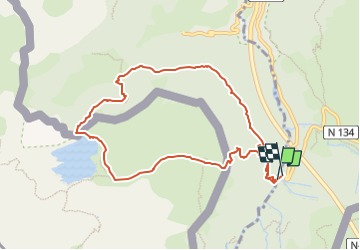

10,4 km | 19,6 km-effort


Utilisateur GUIDE


Application GPS de randonnée GRATUITE
 SityTrail
IGN / Instituts géographiques
SityTrail World
Le monde est à vous
Randonnée A pied de 9,9 km à découvrir à Nouvelle-Aquitaine, Pyrénées-Atlantiques, Borce. Cette randonnée est proposée par marmotte65.
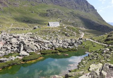
Extraordinaire balade avec quand même un passage délicat sur le retour le passage de l’échelle de fer, sinon le lac est magnifique surtout par un jour sans vent ou la montagne se reflète dans l’eau c'est tout simplement magique.

A pied
A pied

A pied

Marche
Marche

Marche

Marche

Marche
Marche