![](/images/other/stat-length.png)
![Randonnée Marche Lentegí - les arbres petrifies - Photo](https://media.geolcdn.com/t/1900/400/0b9d6321-13d8-4551-a0f4-c4e1d276d87a.jpg&format=pjpeg&maxdim=2)
les arbres petrifies
jpipacific
Utilisateur
![Longueur](/images/other/stat-length.png)
Longueur
9,5 km
![Altitude max](https://static1.geolcdn.com/siteimages/upload/files/1508320355ic_sort_altitude_max_24dp.png)
Altitude max
1079 m
![Dénivelé positif](https://static1.geolcdn.com/siteimages/upload/files/1508320355ic_sort_den_pos_24dp.png)
Dénivelé positif
409 m
![Km-Effort](/images/other/stat-length.png)
Km-Effort
15 km
![Altitude min](https://static1.geolcdn.com/siteimages/upload/files/1508320355ic_sort_altitude_min_24dp.png)
Altitude min
772 m
![Dénivelé négatif](https://static1.geolcdn.com/siteimages/upload/files/1508320355ic_sort_den_neg_24dp.png)
Dénivelé négatif
411 m
![Boucle](https://static1.geolcdn.com/siteimages/upload/files/16400158638029165_repeat_loop_refresh_sync_direction_icon.png)
Boucle
Oui
Date de création :
2020-01-27 10:26:31.572
Dernière modification :
2020-01-27 16:43:26.099
![Marche](https://static1.geolcdn.com/sitytour/trail-icons/101.png)
3h46
Difficulté : Difficile
![Scannez ce code QR pour ouvrir la randonnée dans l'application SityTrail](https://capi.geolives.com/qq0zvz2zws4bq2lad0pu/sitytour/trails/2317024/qr.png?size=200)
Application GPS de randonnée GRATUITE
À propos
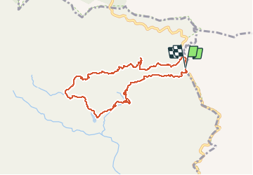
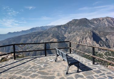
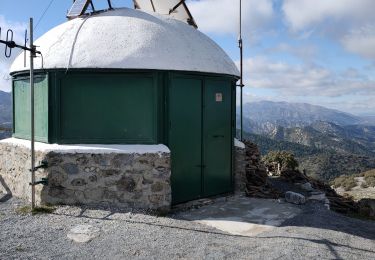
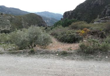
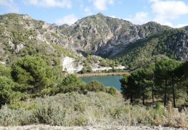
Randonnée Marche de 9,5 km à découvrir à Andalousie, Grenade, Lentegí. Cette randonnée est proposée par jpipacific.
Description
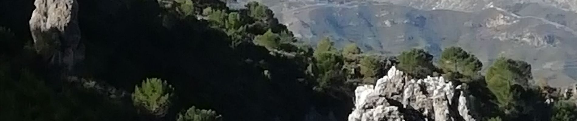
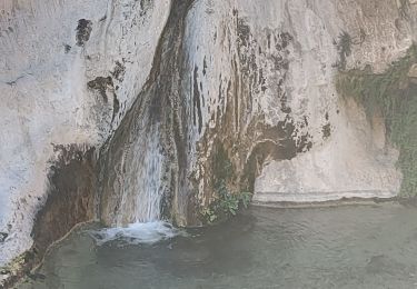
Magnifique randonnée jusqu'à la cascade des arbres pétrifiés.
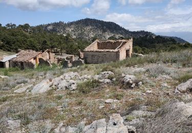
Après c'est un peu long, les paysages sont moins époustouflants et la pente n'est pas douce.
Localisation
Pays :
Espagne
Région :
Andalousie
Département/Province :
Grenade
Commune :
Lentegí
Localité :
Unknown
Départ:(Dec)
Départ:(UTM)
435496 ; 4079750 (30S) N.
Commentaires
Randonnées à proximité
![Randonnée Marche Lentegí - Poza de las animas - Photo](https://media.geolcdn.com/t/375/260/138d79bf-c8e6-4959-ad11-fb1767b7d5eb.jpg&format=jpg&maxdim=2)
![Marche Marche](https://static1.geolcdn.com/sitytour/trail-icons/101.png)
Poza de las animas
Marche
Moyen
(1)
Lentegí,
Andalousie,
Grenade,
Espagne
![](/images/other/stat-length.png)
5,4 km | 9,5 km-effort
2h 42min
![](https://static1.geolcdn.com/siteimages/upload/files/16400158638029165_repeat_loop_refresh_sync_direction_icon.png)
Oui
![Randonnée Marche Albuñuelas - Casas forestales de la huida - Photo](https://media.geolcdn.com/t/375/260/b799c49f-c161-43d0-a137-70666738a819.jpg&format=jpg&maxdim=2)
![Marche Marche](https://static1.geolcdn.com/sitytour/trail-icons/101.png)
Casas forestales de la huida
Marche
Moyen
Albuñuelas,
Andalousie,
Grenade,
Espagne
![](/images/other/stat-length.png)
7,7 km | 10,3 km-effort
2h 20min
![](https://static1.geolcdn.com/siteimages/upload/files/16400158638029165_repeat_loop_refresh_sync_direction_icon.png)
Oui
![Randonnée Marche Lentegí - Lentegi Las Bizarras - Photo](https://media.geolcdn.com/t/375/260/6e3b7bc9-1a0d-4a1d-bbbf-2f25e6bc75de.jpg&format=jpg&maxdim=2)
![Marche Marche](https://static1.geolcdn.com/sitytour/trail-icons/101.png)
Lentegi Las Bizarras
Marche
Moyen
Lentegí,
Andalousie,
Grenade,
Espagne
![](/images/other/stat-length.png)
8,5 km | 13,9 km-effort
3h 51min
![](https://static1.geolcdn.com/siteimages/upload/files/16400158638029165_repeat_loop_refresh_sync_direction_icon.png)
Oui
![Randonnée Marche Albuñuelas - pico Lopera - Photo](https://media.geolcdn.com/t/375/260/35cc272b-f47d-4f9b-80d4-f6141b4e6d16.jpg&format=jpg&maxdim=2)
![Marche Marche](https://static1.geolcdn.com/sitytour/trail-icons/101.png)
pico Lopera
Marche
Facile
Albuñuelas,
Andalousie,
Grenade,
Espagne
![](/images/other/stat-length.png)
7,2 km | 11 km-effort
2h 0min
![](https://static1.geolcdn.com/siteimages/upload/files/16400158638029165_repeat_loop_refresh_sync_direction_icon.png)
Oui
![Randonnée Moto-cross Lentegí - Lentegi Vélez de Benaudalla - Photo](https://media.geolcdn.com/t/375/260/82f69f2a-fa53-4f07-aef5-63c3aeaa5dc3.jpg&format=jpg&maxdim=2)
![Moto-cross Moto-cross](https://static1.geolcdn.com/sitytour/trail-icons/406.png)
Lentegi Vélez de Benaudalla
Moto-cross
Très facile
Lentegí,
Andalousie,
Grenade,
Espagne
![](/images/other/stat-length.png)
74 km | 104 km-effort
2h 31min
![](https://static1.geolcdn.com/siteimages/upload/files/16400158638029165_repeat_loop_refresh_sync_direction_icon.png)
Non
![Randonnée Marche Lentegí - Lentegi 2019 - Photo](https://media.geolcdn.com/t/375/260/a924e236-f249-4f5e-ad92-4ffdbc7fba71.jpg&format=jpg&maxdim=2)
![Marche Marche](https://static1.geolcdn.com/sitytour/trail-icons/101.png)
Lentegi 2019
Marche
Très facile
Lentegí,
Andalousie,
Grenade,
Espagne
![](/images/other/stat-length.png)
5 km | 7,4 km-effort
1h 33min
![](https://static1.geolcdn.com/siteimages/upload/files/16400158638029165_repeat_loop_refresh_sync_direction_icon.png)
Oui
![Marche Marche](https://static1.geolcdn.com/sitytour/trail-icons/101.png)
1er novembre 2017 Roi Verde
Marche
Très facile
Otívar,
Andalousie,
Grenade,
Espagne
![](/images/other/stat-length.png)
55 km | 77 km-effort
1h 58min
![](https://static1.geolcdn.com/siteimages/upload/files/16400158638029165_repeat_loop_refresh_sync_direction_icon.png)
Non
![Randonnée Marche Otívar - rio verde depuis parking GPX - Photo](https://media.geolcdn.com/t/375/260/ext.jpg?maxdim=2&url=https%3A%2F%2Fstatic1.geolcdn.com%2Fsiteimages%2Fupload%2Ffiles%2F1553511878bg_sport_marche.png)
![Marche Marche](https://static1.geolcdn.com/sitytour/trail-icons/101.png)
rio verde depuis parking GPX
Marche
Très facile
Otívar,
Andalousie,
Grenade,
Espagne
![](/images/other/stat-length.png)
8,7 km | 15,1 km-effort
3h 17min
![](https://static1.geolcdn.com/siteimages/upload/files/16400158638029165_repeat_loop_refresh_sync_direction_icon.png)
Oui
![Randonnée Marche Lentegí - Rio Verde alta GPX - Photo](https://media.geolcdn.com/t/375/260/ext.jpg?maxdim=2&url=https%3A%2F%2Fstatic1.geolcdn.com%2Fsiteimages%2Fupload%2Ffiles%2F1553511878bg_sport_marche.png)
![Marche Marche](https://static1.geolcdn.com/sitytour/trail-icons/101.png)
Rio Verde alta GPX
Marche
Très facile
Lentegí,
Andalousie,
Grenade,
Espagne
![](/images/other/stat-length.png)
7,2 km | 10,5 km-effort
2h 19min
![](https://static1.geolcdn.com/siteimages/upload/files/16400158638029165_repeat_loop_refresh_sync_direction_icon.png)
Non