Randonnée Marche Jusix - Jusix - Photo
 Briarwood
Briarwood

Utilisateur

© OpenStreetMap contributors
Longueur
Longueur
7,9 km
Altitude max
Altitude max
20 m
Dénivelé positif
Dénivelé positif
23 m
Km-Effort
Km-Effort  
8,2 km
Altitude min
Altitude min
12 m
Dénivelé négatif
Dénivelé négatif
22 m
Boucle
Boucle
Oui
Date de création :
2020-01-09 13:32:48.0
Dernière modification :
2020-01-09 17:24:02.32

(0 Avis)

Marche
Marche
2h18
Difficulté : Très facile

Scannez ce code QR pour ouvrir la randonnée dans l'application SityTrail

Application GPS de randonnée GRATUITE

Logo SityTrail SityTrail

IGN / Instituts géographiques

Télécharger SityTrail sur l'App Store Télécharger SityTrail sur Google Play

Logo SityTrail SityTrail World

Le monde est à vous

Télécharger SityTrail sur l'App Store Télécharger SityTrail sur Google Play Télécharger SityTrail sur Huawei AppGallery

À propos

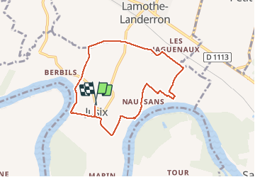
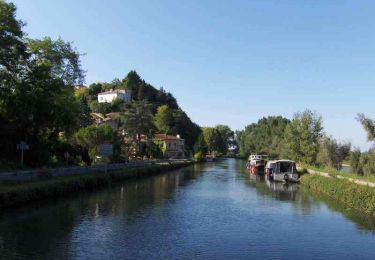
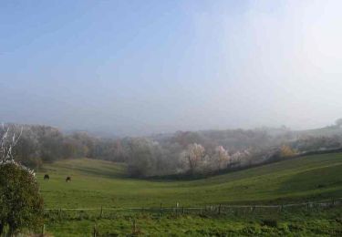
Randonnée Marche de 7,9 km à découvrir à Nouvelle-Aquitaine, Lot-et-Garonne, Jusix. Cette randonnée est proposée par Briarwood.

Description

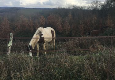
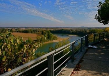
Randonnée très facile, les bords de Garonne ont été en grande partie évité à cause de traces très profonde de tracteur et de boue suite aux inondations, dommage ....

Profil altimétrique

Photos

Localisation

Pays :
France
Région :
Nouvelle-Aquitaine
Département/Province :
Lot-et-Garonne
Commune :
Jusix
Localité :
Unknown
Départ:(Dec)
Départ:(UTM)
265531 ; 4936234 (31T) N.

Randonnées à proximité

Randonnée Marche Sainte-Bazeille - couthures  - Photo
Marche
sandrineh

Marche

Très facile
Sainte-Bazeille, Nouvelle-Aquitaine, Lot-et-Garonne, France
6,3 km | 6,9 km-effort
2h 58min
Oui
Randonnée Marche Sainte-Bazeille - couthures  - Photo
Marche
sandrineh

Marche

Très facile
Sainte-Bazeille, Nouvelle-Aquitaine, Lot-et-Garonne, France
6,3 km | 6,9 km-effort
2h 58min
Oui
Randonnée Marche Meilhan-sur-Garonne - Meillhan sur Garonne - Photo
Marche
Briarwood

Marche

Facile
Meilhan-sur-Garonne, Nouvelle-Aquitaine, Lot-et-Garonne, France
4,6 km | 5,7 km-effort
1h 31min
Oui
Randonnée Marche Mongauzy - Mongauzy - Boucle du Médier - Photo
Marche
Briarwood

Marche

Moyen
Mongauzy, Nouvelle-Aquitaine, Gironde, France
7,3 km | 9,3 km-effort
1h 52min
Oui
Randonnée Marche Sainte-Bazeille - Sainte-Bazeille, Paysage et Archéologie - Pays Val de Garonne - Gascogne - Photo
Marche
tracegps

Marche

Facile
Sainte-Bazeille, Nouvelle-Aquitaine, Lot-et-Garonne, France
3,4 km | 3,9 km-effort
1h 15min
Oui
Randonnée V.T.T. Meilhan-sur-Garonne - Meilhan, entre Canal et Garonne - Pays Val de Garonne - Gascogne - Photo
V.T.T.
tracegps

V.T.T.

Facile
Meilhan-sur-Garonne, Nouvelle-Aquitaine, Lot-et-Garonne, France
5,8 km | 7 km-effort
45min
Oui
Randonnée Marche Meilhan-sur-Garonne - Meilhan, entre Canal et Garonne - Pays Val de Garonne - Gascogne - Photo
Marche
tracegps

Marche

Facile
Meilhan-sur-Garonne, Nouvelle-Aquitaine, Lot-et-Garonne, France
5,8 km | 7 km-effort
2h 0min
Oui
Randonnée Marche Jusix - Jusix, presqu'île de Garonne - Pays Val de Garonne - Gascogne - Photo
Marche
tracegps

Marche

Moyen
Jusix, Nouvelle-Aquitaine, Lot-et-Garonne, France
7,7 km | 8 km-effort
2h 30min
Oui
Randonnée V.T.T. Couthures-sur-Garonne - Couthures, la promenade des Gens de Garonne - Pays Val de Garonne - Gascogne - Photo
V.T.T.
tracegps

V.T.T.

Facile
Couthures-sur-Garonne, Nouvelle-Aquitaine, Lot-et-Garonne, France
4,7 km | 5,2 km-effort
34min
Oui


Fermer
Mes abonnements