Randonnée Voiture Sainte-Marie - AEROPORT SAINT DENIS - RELAIS DES CIMES - Photo

AEROPORT SAINT DENIS - RELAIS DES CIMES

 MTS
MTS

Utilisateur

© OpenStreetMap contributors
Longueur
Longueur
44 km
Altitude max
Altitude max
951 m
Dénivelé positif
Dénivelé positif
1474 m
Km-Effort
Km-Effort  
61 km
Altitude min
Altitude min
5 m
Dénivelé négatif
Dénivelé négatif
556 m
Boucle
Boucle
Non
Date de création :
2020-01-09 14:25:54.786
Dernière modification :
2020-01-09 14:26:27.183

(0 Avis)

Voiture
Voiture
--
Difficulté : Très facile

Scannez ce code QR pour ouvrir la randonnée dans l'application SityTrail

Application GPS de randonnée GRATUITE

Logo SityTrail SityTrail

IGN / Instituts géographiques

Télécharger SityTrail sur l'App Store Télécharger SityTrail sur Google Play

Logo SityTrail SityTrail World

Le monde est à vous

Télécharger SityTrail sur l'App Store Télécharger SityTrail sur Google Play Télécharger SityTrail sur Huawei AppGallery

À propos

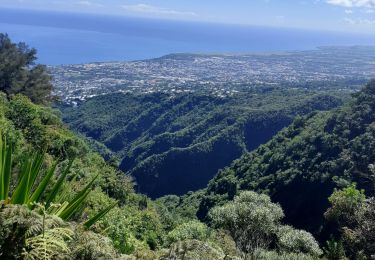
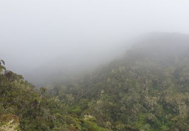
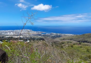
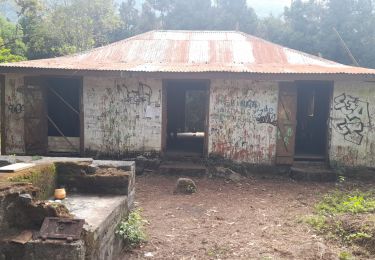
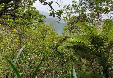
Randonnée Voiture de 44 km à découvrir à La Réunion, Inconnu, Sainte-Marie. Cette randonnée est proposée par MTS.

Profil altimétrique

Localisation

Pays :
France
Région :
La Réunion
Département/Province :
Inconnu
Commune :
Sainte-Marie
Localité :
Unknown
Départ:(UTM)
345115 ; 7689044 (40K) S.

Randonnées à proximité

Randonnée V.T.T. Saint-Denis - La Réunion - Saint-Denis à Sainte-Suzanne - Photo
V.T.T.
olive2b

V.T.T.

Facile
(1)
Saint-Denis, La Réunion, Inconnu, France
17,8 km | 20 km-effort
1h 22min
Non
Randonnée A pied Saint-Denis - Ilet quinquina Riviere des pluies - Photo
A pied
jean60200

A pied

Moyen
Saint-Denis, La Réunion, Inconnu, France
12,6 km | 25 km-effort
5h 42min
Oui
Randonnée Marche Saint-Denis - Cascade Chaudron  - Photo
Marche
sylviedaniel

Marche

Facile
Saint-Denis, La Réunion, Inconnu, France
21 km | 34 km-effort
1h 45min
Non
Randonnée V.T.T. Saint-Denis - La Réunion - St Denis -  Ste Suzanne - Photo
V.T.T.
olive2b

V.T.T.

Facile
Saint-Denis, La Réunion, Inconnu, France
17,1 km | 19,4 km-effort
1h 29min
Non
Randonnée Trail Saint-Denis - pic adam/providence - Photo
Trail
payet

Trail

Moyen
Saint-Denis, La Réunion, Inconnu, France
23 km | 40 km-effort
5h 1min
Non
Randonnée Marche Saint-Denis - Piton BDN -Mamode Camp par le gîte de Roche Ecrite - Photo
Marche
lgmalherbe

Marche

Difficile
Saint-Denis, La Réunion, Inconnu, France
16,3 km | 31 km-effort
6h 55min
Non
Randonnée Trail Saint-Denis - pic Adam/ dos d âne / kalla/ possession  - Photo
Trail
payet

Trail

Difficile
Saint-Denis, La Réunion, Inconnu, France
32 km | 54 km-effort
6h 57min
Non
Randonnée Trail Saint-Denis - moufia pic adam  ilet Guillaume  - Photo
Trail
payet

Trail

Difficile
Saint-Denis, La Réunion, Inconnu, France
36 km | 69 km-effort
7h 58min
Non
Randonnée Marche Saint-Denis - Tour du Pic Adam - Photo
Marche
lgmalherbe

Marche

Moyen
Saint-Denis, La Réunion, Inconnu, France
7 km | 13,9 km-effort
4h 0min
Oui


Fermer
Mes abonnements