![](/images/other/stat-length.png)
LUC SUR ORBIEU - la Roche trouée
Licianus2
Utilisateur
![Longueur](/images/other/stat-length.png)
![Altitude max](https://static1.geolcdn.com/siteimages/upload/files/1508320355ic_sort_altitude_max_24dp.png)
![Dénivelé positif](https://static1.geolcdn.com/siteimages/upload/files/1508320355ic_sort_den_pos_24dp.png)
![Km-Effort](/images/other/stat-length.png)
![Altitude min](https://static1.geolcdn.com/siteimages/upload/files/1508320355ic_sort_altitude_min_24dp.png)
![Dénivelé négatif](https://static1.geolcdn.com/siteimages/upload/files/1508320355ic_sort_den_neg_24dp.png)
![Boucle](https://static1.geolcdn.com/siteimages/upload/files/16400158638029165_repeat_loop_refresh_sync_direction_icon.png)
![Marche](https://static1.geolcdn.com/sitytour/trail-icons/101.png)
1h33
Difficulté : Très facile
![Scannez ce code QR pour ouvrir la randonnée dans l'application SityTrail](https://capi.geolives.com/qq0zvz2zws4bq2lad0pu/sitytour/trails/2299376/qr.png?size=200)
Application GPS de randonnée GRATUITE
À propos
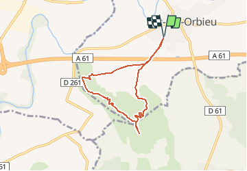
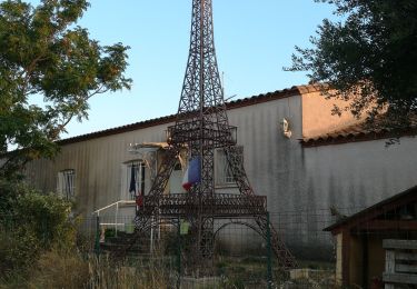
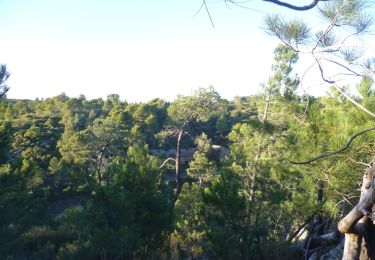
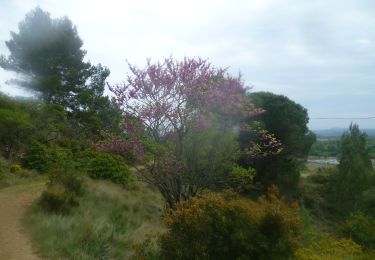
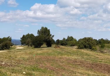
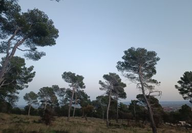
Randonnée Marche de 6,8 km à découvrir à Occitanie, Aude, Luc-sur-Orbieu. Cette randonnée est proposée par Licianus2.
Description
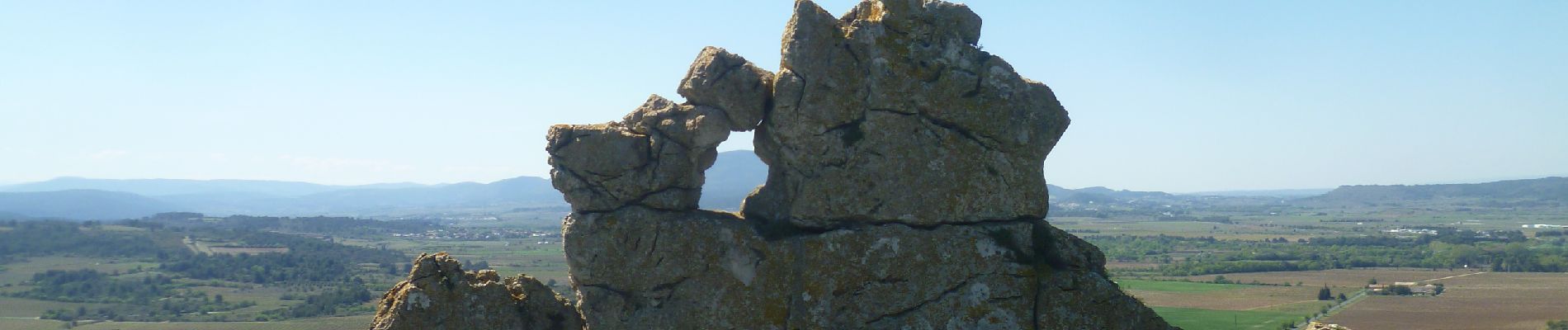
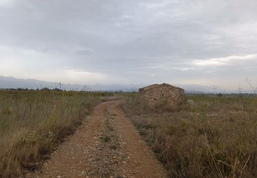
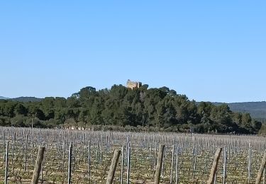
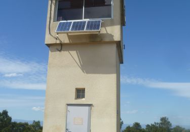
Petite boucle constituée principalement de pistes et d'une bonne partie de chemins ruraux goudronnée. Le petit passage par "la roche trouée" reste cependant agréable et pensez à dépasser la croix du balisage pour monter jusqu’à une borne géodésique à 180 m, offrant une belle panoramique.
Localisation
Commentaires
Randonnées à proximité
![Randonnée Marche Lézignan-Corbières - La Roche Trouée (2) - Photo](https://media.geolcdn.com/t/375/260/26c1d966-bce5-454f-8bb9-55217d5081e5.jpg&format=jpg&maxdim=2)
![Marche Marche](https://static1.geolcdn.com/sitytour/trail-icons/101.png)
Marche
![](/images/other/stat-length.png)
![](https://static1.geolcdn.com/siteimages/upload/files/16400158638029165_repeat_loop_refresh_sync_direction_icon.png)
![Randonnée Marche Lézignan-Corbières - Lézignan Corbières-Argens Minervois-Olonzac - Photo](https://media.geolcdn.com/t/375/260/6f6845e7-9549-4c29-a070-e1ffdd655148.jpg&format=jpg&maxdim=2)
![Marche Marche](https://static1.geolcdn.com/sitytour/trail-icons/101.png)
Marche
![](/images/other/stat-length.png)
![](https://static1.geolcdn.com/siteimages/upload/files/16400158638029165_repeat_loop_refresh_sync_direction_icon.png)
![Randonnée Marche Lézignan-Corbières - Lézignan Corbières - Fontarèche- Relais des Corbières - Photo](https://media.geolcdn.com/t/375/260/5886abe1-3fe5-40bd-b548-3f7c4ae5c568.jpg&format=jpg&maxdim=2)
![Marche Marche](https://static1.geolcdn.com/sitytour/trail-icons/101.png)
Marche
![](/images/other/stat-length.png)
![](https://static1.geolcdn.com/siteimages/upload/files/16400158638029165_repeat_loop_refresh_sync_direction_icon.png)
![Randonnée Marche Boutenac - BOUTENAC - Circuit des combes par la chapelle St Siméon - Photo](https://media.geolcdn.com/t/375/260/6d952a44-6ab0-4a19-85d3-879d77425b43.jpg&format=jpg&maxdim=2)
![Marche Marche](https://static1.geolcdn.com/sitytour/trail-icons/101.png)
Marche
![](/images/other/stat-length.png)
![](https://static1.geolcdn.com/siteimages/upload/files/16400158638029165_repeat_loop_refresh_sync_direction_icon.png)
![Marche Marche](https://static1.geolcdn.com/sitytour/trail-icons/101.png)
Marche
![](/images/other/stat-length.png)
![](https://static1.geolcdn.com/siteimages/upload/files/16400158638029165_repeat_loop_refresh_sync_direction_icon.png)
![Marche Marche](https://static1.geolcdn.com/sitytour/trail-icons/101.png)
Marche
![](/images/other/stat-length.png)
![](https://static1.geolcdn.com/siteimages/upload/files/16400158638029165_repeat_loop_refresh_sync_direction_icon.png)
![Randonnée Marche Lézignan-Corbières - LEZIGNAN La pinède par les éoliennes - Photo](https://media.geolcdn.com/t/375/260/0c2d43da-86db-4ced-b9c3-8217ccc6dfd7.jpg&format=jpg&maxdim=2)
![Marche Marche](https://static1.geolcdn.com/sitytour/trail-icons/101.png)
Marche
![](/images/other/stat-length.png)
![](https://static1.geolcdn.com/siteimages/upload/files/16400158638029165_repeat_loop_refresh_sync_direction_icon.png)
![Randonnée Marche Lézignan-Corbières - La Pinède Lézignan Corbières - Photo](https://media.geolcdn.com/t/375/260/b6ff1560-ed9b-46b9-a1db-33279c5f55ff.jpg&format=jpg&maxdim=2)
![Marche Marche](https://static1.geolcdn.com/sitytour/trail-icons/101.png)
Marche
![](/images/other/stat-length.png)
![](https://static1.geolcdn.com/siteimages/upload/files/16400158638029165_repeat_loop_refresh_sync_direction_icon.png)
![Randonnée Marche Lézignan-Corbières - Lezignan - Photo](https://media.geolcdn.com/t/375/260/13b0da84-8142-49b5-8131-e76e6ff6171b.jpg&format=jpg&maxdim=2)
![Marche Marche](https://static1.geolcdn.com/sitytour/trail-icons/101.png)
Marche
![](/images/other/stat-length.png)
![](https://static1.geolcdn.com/siteimages/upload/files/16400158638029165_repeat_loop_refresh_sync_direction_icon.png)