![](/images/other/stat-length.png)
![Randonnée Marche Hamont-Achel - Peerkepad EXTRA rondwandeling 4b - 20km. - Photo](https://media.geolcdn.com/t/1900/400/ext.pjpeg?maxdim=2&url=https%3A%2F%2Fstatic1.geolcdn.com%2Fsiteimages%2Fupload%2Ffiles%2F1553511878bg_sport_marche.png)
Peerkepad EXTRA rondwandeling 4b - 20km.
flip96
Utilisateur
![Longueur](/images/other/stat-length.png)
Longueur
19,5 km
![Altitude max](https://static1.geolcdn.com/siteimages/upload/files/1508320355ic_sort_altitude_max_24dp.png)
Altitude max
44 m
![Dénivelé positif](https://static1.geolcdn.com/siteimages/upload/files/1508320355ic_sort_den_pos_24dp.png)
Dénivelé positif
111 m
![Km-Effort](/images/other/stat-length.png)
Km-Effort
21 km
![Altitude min](https://static1.geolcdn.com/siteimages/upload/files/1508320355ic_sort_altitude_min_24dp.png)
Altitude min
24 m
![Dénivelé négatif](https://static1.geolcdn.com/siteimages/upload/files/1508320355ic_sort_den_neg_24dp.png)
Dénivelé négatif
112 m
![Boucle](https://static1.geolcdn.com/siteimages/upload/files/16400158638029165_repeat_loop_refresh_sync_direction_icon.png)
Boucle
Oui
Date de création :
2020-01-06 11:02:46.898
Dernière modification :
2020-01-06 15:05:05.82
![Marche](https://static1.geolcdn.com/sitytour/trail-icons/101.png)
3h55
Difficulté : Difficile
![Scannez ce code QR pour ouvrir la randonnée dans l'application SityTrail](https://capi.geolives.com/qq0zvz2zws4bq2lad0pu/sitytour/trails/2298405/qr.png?size=200)
Application GPS de randonnée GRATUITE
À propos
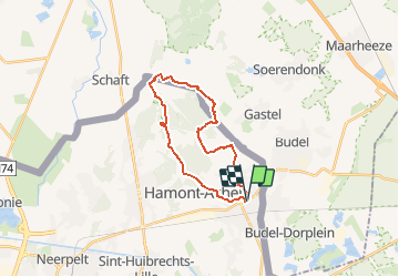
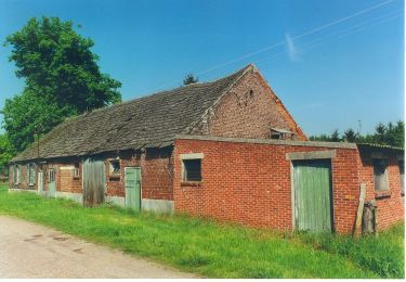
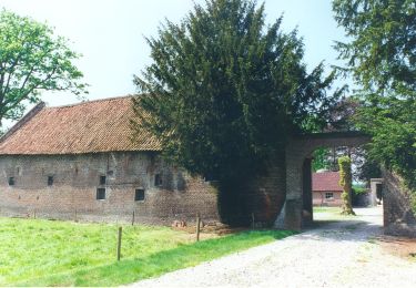
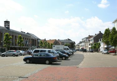
Randonnée Marche de 19,5 km à découvrir à Flandre, Limbourg, Hamont-Achel. Cette randonnée est proposée par flip96.
Description
Vierde EXTRA/4b rondwandeling Peerkepad. Tussen Hamont-Achel en Achelse Kluis.
20km. Ca. 110 meter stijging/afdaling.
Route is NIET gemarkeerd.
Localisation
Pays :
Belgique
Région :
Flandre
Département/Province :
Limbourg
Commune :
Hamont-Achel
Localité :
Hamont
Départ:(Dec)
Départ:(UTM)
677737 ; 5680902 (31U) N.
Commentaires
Randonnées à proximité
![Randonnée A pied Hamont-Achel - De Warmbeekvallei Groene rechthoek - Photo](https://media.geolcdn.com/t/375/260/90c9376c-13f4-44b4-8f1f-1df706cc30b8.jpeg&format=jpg&maxdim=2)
![A pied A pied](https://static1.geolcdn.com/sitytour/trail-icons/100.png)
De Warmbeekvallei Groene rechthoek
A pied
Facile
Hamont-Achel,
Flandre,
Limbourg,
Belgique
![](/images/other/stat-length.png)
3,2 km | 3,6 km-effort
49min
![](https://static1.geolcdn.com/siteimages/upload/files/16400158638029165_repeat_loop_refresh_sync_direction_icon.png)
Oui
![Randonnée A pied Hamont-Achel - De Warmbeekvallei Blauwe ruit - Photo](https://media.geolcdn.com/t/375/260/1d6592a3-283e-4c3a-8dc9-aae80003c3fc.jpeg&format=jpg&maxdim=2)
![A pied A pied](https://static1.geolcdn.com/sitytour/trail-icons/100.png)
De Warmbeekvallei Blauwe ruit
A pied
Facile
Hamont-Achel,
Flandre,
Limbourg,
Belgique
![](/images/other/stat-length.png)
4,4 km | 4,8 km-effort
1h 5min
![](https://static1.geolcdn.com/siteimages/upload/files/16400158638029165_repeat_loop_refresh_sync_direction_icon.png)
Oui
![Randonnée A pied Hamont-Achel - Rochefort - Photo](https://media.geolcdn.com/t/375/260/f2785453-ece4-4bfc-8c43-14e870fda637.jpeg&format=jpg&maxdim=2)
![A pied A pied](https://static1.geolcdn.com/sitytour/trail-icons/100.png)
Rochefort
A pied
Facile
(1)
Hamont-Achel,
Flandre,
Limbourg,
Belgique
![](/images/other/stat-length.png)
8,6 km | 9,5 km-effort
2h 8min
![](https://static1.geolcdn.com/siteimages/upload/files/16400158638029165_repeat_loop_refresh_sync_direction_icon.png)
Oui
![Randonnée A pied Hamont-Achel - Westmalle - Photo](https://media.geolcdn.com/t/375/260/1d6592a3-283e-4c3a-8dc9-aae80003c3fc.jpeg&format=jpg&maxdim=2)
![A pied A pied](https://static1.geolcdn.com/sitytour/trail-icons/100.png)
Westmalle
A pied
Facile
Hamont-Achel,
Flandre,
Limbourg,
Belgique
![](/images/other/stat-length.png)
9,9 km | 10,6 km-effort
2h 24min
![](https://static1.geolcdn.com/siteimages/upload/files/16400158638029165_repeat_loop_refresh_sync_direction_icon.png)
Oui
![Randonnée A pied Hamont-Achel - Westvleteren - Photo](https://media.geolcdn.com/t/375/260/5e59b7fa-c649-44b3-b4e3-165f2820bf15.jpeg&format=jpg&maxdim=2)
![A pied A pied](https://static1.geolcdn.com/sitytour/trail-icons/100.png)
Westvleteren
A pied
Facile
Hamont-Achel,
Flandre,
Limbourg,
Belgique
![](/images/other/stat-length.png)
8,3 km | 8,9 km-effort
2h 1min
![](https://static1.geolcdn.com/siteimages/upload/files/16400158638029165_repeat_loop_refresh_sync_direction_icon.png)
Oui
![Randonnée A pied Hamont-Achel - De Warmbeekvallei Oranje bol - Photo](https://media.geolcdn.com/t/375/260/1d6592a3-283e-4c3a-8dc9-aae80003c3fc.jpeg&format=jpg&maxdim=2)
![A pied A pied](https://static1.geolcdn.com/sitytour/trail-icons/100.png)
De Warmbeekvallei Oranje bol
A pied
Facile
Hamont-Achel,
Flandre,
Limbourg,
Belgique
![](/images/other/stat-length.png)
5,9 km | 6,5 km-effort
1h 28min
![](https://static1.geolcdn.com/siteimages/upload/files/16400158638029165_repeat_loop_refresh_sync_direction_icon.png)
Oui
![Randonnée A pied Hamont-Achel - De Warmbeekvallei Blauwe ruit - Photo](https://media.geolcdn.com/t/375/260/aa90fbd5-e85f-4922-aa4d-0441c36d3597.jpeg&format=jpg&maxdim=2)
![A pied A pied](https://static1.geolcdn.com/sitytour/trail-icons/100.png)
De Warmbeekvallei Blauwe ruit
A pied
Facile
Hamont-Achel,
Flandre,
Limbourg,
Belgique
![](/images/other/stat-length.png)
4,4 km | 4,8 km-effort
1h 5min
![](https://static1.geolcdn.com/siteimages/upload/files/16400158638029165_repeat_loop_refresh_sync_direction_icon.png)
Oui
![Randonnée A pied Hamont-Achel - Chimay - Photo](https://media.geolcdn.com/t/375/260/a6be2ac2-dc95-40cd-8120-691d3d404de0.jpeg&format=jpg&maxdim=2)
![A pied A pied](https://static1.geolcdn.com/sitytour/trail-icons/100.png)
Chimay
A pied
Facile
Hamont-Achel,
Flandre,
Limbourg,
Belgique
![](/images/other/stat-length.png)
11,6 km | 12,3 km-effort
2h 48min
![](https://static1.geolcdn.com/siteimages/upload/files/16400158638029165_repeat_loop_refresh_sync_direction_icon.png)
Oui
![Randonnée A pied Hamont-Achel - Zundert - Photo](https://media.geolcdn.com/t/375/260/0c1f9d6f-601d-420e-92f3-cb1cc9a88f88.jpeg&format=jpg&maxdim=2)
![A pied A pied](https://static1.geolcdn.com/sitytour/trail-icons/100.png)
Zundert
A pied
Facile
Hamont-Achel,
Flandre,
Limbourg,
Belgique
![](/images/other/stat-length.png)
13,3 km | 14,1 km-effort
3h 12min
![](https://static1.geolcdn.com/siteimages/upload/files/16400158638029165_repeat_loop_refresh_sync_direction_icon.png)
Oui