


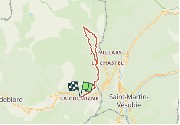

7,8 km | 16,3 km-effort

Utilisateur


Application GPS de randonnée GRATUITE
 SityTrail
IGN / Instituts géographiques
SityTrail World
Le monde est à vous
Randonnée Marche de 10,9 km à découvrir à Provence-Alpes-Côte d'Azur, Alpes-Maritimes, Valdeblore. Cette randonnée est proposée par GrouGary.
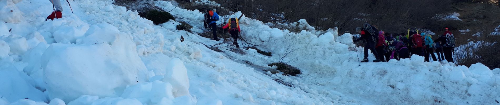
Passages délicats : pente très raide et glacée et une coulée avalancheuse dans l'ubac (retour). Sinon génial sur l'Adret et vacheries (aller).


Marche

Marche

A pied

A pied

Marche

Ski de randonnée

Ski de randonnée

Ski de randonnée

Marche