![](/images/other/stat-length.png)
![Randonnée Marche Huy - Balade de Ben Ahin - Photo](https://media.geolcdn.com/t/1900/400/c2ba02dc-21aa-4a15-817f-270226f6f0ab.jpg&format=pjpeg&maxdim=2)
Balade de Ben Ahin
Thierry0032
Utilisateur
![Longueur](/images/other/stat-length.png)
Longueur
12,2 km
![Altitude max](https://static1.geolcdn.com/siteimages/upload/files/1508320355ic_sort_altitude_max_24dp.png)
Altitude max
235 m
![Dénivelé positif](https://static1.geolcdn.com/siteimages/upload/files/1508320355ic_sort_den_pos_24dp.png)
Dénivelé positif
312 m
![Km-Effort](/images/other/stat-length.png)
Km-Effort
16,4 km
![Altitude min](https://static1.geolcdn.com/siteimages/upload/files/1508320355ic_sort_altitude_min_24dp.png)
Altitude min
86 m
![Dénivelé négatif](https://static1.geolcdn.com/siteimages/upload/files/1508320355ic_sort_den_neg_24dp.png)
Dénivelé négatif
316 m
![Boucle](https://static1.geolcdn.com/siteimages/upload/files/16400158638029165_repeat_loop_refresh_sync_direction_icon.png)
Boucle
Oui
Date de création :
2020-01-04 11:45:47.543
Dernière modification :
2020-01-04 18:51:46.22
![Marche](https://static1.geolcdn.com/sitytour/trail-icons/101.png)
3h53
Difficulté : Moyen
![Scannez ce code QR pour ouvrir la randonnée dans l'application SityTrail](https://capi.geolives.com/qq0zvz2zws4bq2lad0pu/sitytour/trails/2297071/qr.png?size=200)
Application GPS de randonnée GRATUITE
À propos
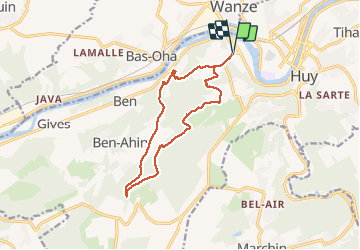
Randonnée Marche de 12,2 km à découvrir à Wallonie, Liège, Huy. Cette randonnée est proposée par Thierry0032.
Description
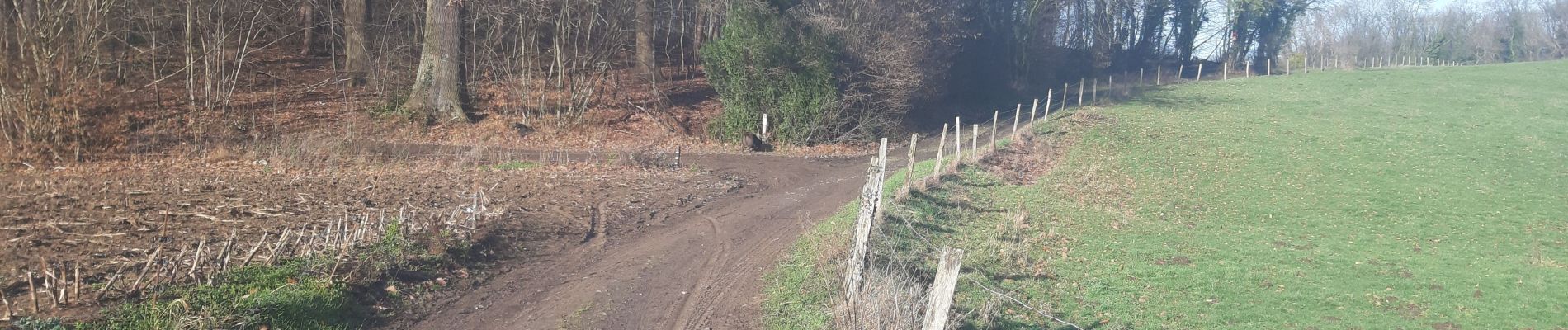
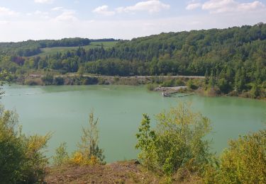
Balade le long de rivière et dans des chemins champêtres.
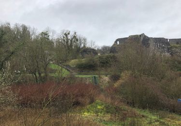
Une jolie tour de guet en pierre du pays en fin de promenade...possiblement sur une propriété privée, mais rien ne l'indique hormis une barrière que le chemin contourne juste avant de rejoindre la route.
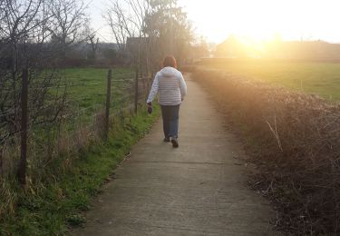
Localisation
Pays :
Belgique
Région :
Wallonie
Département/Province :
Liège
Commune :
Huy
Localité :
Ben-Ahin
Départ:(Dec)
Départ:(UTM)
657113 ; 5599087 (31U) N.
Commentaires
Randonnées à proximité
![Randonnée Marche Huy - Huy Ben-Ahin. Natura 2000 des sites qui valent le détour ! Lg9 - Photo](https://media.geolcdn.com/t/375/260/ext.jpg?maxdim=2&url=https%3A%2F%2Fservices.sitytrail.com%2FGeolivesWS%2FDownloadMedia.ashx%3FTrailID%3D182987%26Media%3Da8459ff4-9180-431b-88aa-1e326f78de1f.JPG)
![Marche Marche](https://static1.geolcdn.com/sitytour/trail-icons/101.png)
Huy Ben-Ahin. Natura 2000 des sites qui valent le détour ! Lg9
Marche
Moyen
(15)
Huy,
Wallonie,
Liège,
Belgique
![](/images/other/stat-length.png)
7,9 km | 10,7 km-effort
2h 18min
![](https://static1.geolcdn.com/siteimages/upload/files/16400158638029165_repeat_loop_refresh_sync_direction_icon.png)
Non
![Marche Marche](https://static1.geolcdn.com/sitytour/trail-icons/101.png)
CHATEAU DE MOHA
Marche
Moyen
(2)
Wanze,
Wallonie,
Liège,
Belgique
![](/images/other/stat-length.png)
7,3 km | 9,1 km-effort
1h 58min
![](https://static1.geolcdn.com/siteimages/upload/files/16400158638029165_repeat_loop_refresh_sync_direction_icon.png)
Oui
![Randonnée Marche Huy - TIHANGE (Temple Tibétain). - Photo](https://media.geolcdn.com/t/375/260/ext.jpg?maxdim=2&url=https%3A%2F%2Fservices.sitytrail.com%2FGeolivesWS%2FDownloadMedia.ashx%3FTrailID%3D458488%26Media%3Dfix__20150813122829.jpg)
![Marche Marche](https://static1.geolcdn.com/sitytour/trail-icons/101.png)
TIHANGE (Temple Tibétain).
Marche
Très facile
(2)
Huy,
Wallonie,
Liège,
Belgique
![](/images/other/stat-length.png)
11,5 km | 13,9 km-effort
3h 1min
![](https://static1.geolcdn.com/siteimages/upload/files/16400158638029165_repeat_loop_refresh_sync_direction_icon.png)
Oui
![Randonnée Marche Wanze - antheit - Photo](https://media.geolcdn.com/t/375/260/63403872-a8da-4090-b10f-81e240d58ff7.jpg&format=jpg&maxdim=2)
![Marche Marche](https://static1.geolcdn.com/sitytour/trail-icons/101.png)
![Randonnée Marche Wanze - les long pieds anthey - Photo](https://media.geolcdn.com/t/375/260/04ed0be7-9f2b-4519-ab41-baa0902f0e32.jpg&format=jpg&maxdim=2)
![Marche Marche](https://static1.geolcdn.com/sitytour/trail-icons/101.png)
les long pieds anthey
Marche
Moyen
(1)
Wanze,
Wallonie,
Liège,
Belgique
![](/images/other/stat-length.png)
12,9 km | 16 km-effort
2h 34min
![](https://static1.geolcdn.com/siteimages/upload/files/16400158638029165_repeat_loop_refresh_sync_direction_icon.png)
Oui
![Randonnée Marche Huy - Ben Ahin La Solière - Photo](https://media.geolcdn.com/t/375/260/ext.jpg?maxdim=2&url=https%3A%2F%2Fservices.sitytrail.com%2FGeolivesWS%2FDownloadMedia.ashx%3FTrailID%3D42709%26Media%3Dl)
![Marche Marche](https://static1.geolcdn.com/sitytour/trail-icons/101.png)
Ben Ahin La Solière
Marche
Très facile
(1)
Huy,
Wallonie,
Liège,
Belgique
![](/images/other/stat-length.png)
14,3 km | 19 km-effort
4h 54min
![](https://static1.geolcdn.com/siteimages/upload/files/16400158638029165_repeat_loop_refresh_sync_direction_icon.png)
Oui
![Randonnée Marche Wanze - Balade de Moha à Huccorgne - Photo](https://media.geolcdn.com/t/375/260/79c0e9b7-562a-4cd6-b98a-d6b2066aed18.jpg&format=jpg&maxdim=2)
![Marche Marche](https://static1.geolcdn.com/sitytour/trail-icons/101.png)
Balade de Moha à Huccorgne
Marche
Difficile
Wanze,
Wallonie,
Liège,
Belgique
![](/images/other/stat-length.png)
9,7 km | 12,2 km-effort
2h 45min
![](https://static1.geolcdn.com/siteimages/upload/files/16400158638029165_repeat_loop_refresh_sync_direction_icon.png)
Oui
![Randonnée Marche Wanze - Promenade de la pierre à Moha - Photo](https://media.geolcdn.com/t/375/260/3e1d5a0a-9771-4a56-9792-6d76817a97b6.jpg&format=jpg&maxdim=2)
![Marche Marche](https://static1.geolcdn.com/sitytour/trail-icons/101.png)
Promenade de la pierre à Moha
Marche
Moyen
(4)
Wanze,
Wallonie,
Liège,
Belgique
![](/images/other/stat-length.png)
7,5 km | 9,2 km-effort
2h 10min
![](https://static1.geolcdn.com/siteimages/upload/files/16400158638029165_repeat_loop_refresh_sync_direction_icon.png)
Oui
![Randonnée Marche Huy - Le Vallon de la Solières - Photo](https://media.geolcdn.com/t/375/260/65d2a8d6-d502-4481-b1eb-8bc80a021f76.jpg&format=jpg&maxdim=2)
![Marche Marche](https://static1.geolcdn.com/sitytour/trail-icons/101.png)
Le Vallon de la Solières
Marche
Difficile
(3)
Huy,
Wallonie,
Liège,
Belgique
![](/images/other/stat-length.png)
10,2 km | 13,4 km-effort
4h 5min
![](https://static1.geolcdn.com/siteimages/upload/files/16400158638029165_repeat_loop_refresh_sync_direction_icon.png)
Oui