![](/images/other/stat-length.png)
![Randonnée Vélo électrique Destelbergen - Naar Donkmeer - Photo](https://media.geolcdn.com/t/1900/400/6c32145f-a382-4995-9028-a936e2b2fe25.jpg&format=pjpeg&maxdim=2)
Naar Donkmeer
bometdehamer
Utilisateur
![Longueur](/images/other/stat-length.png)
Longueur
43 km
![Altitude max](https://static1.geolcdn.com/siteimages/upload/files/1508320355ic_sort_altitude_max_24dp.png)
Altitude max
15 m
![Dénivelé positif](https://static1.geolcdn.com/siteimages/upload/files/1508320355ic_sort_den_pos_24dp.png)
Dénivelé positif
224 m
![Km-Effort](/images/other/stat-length.png)
Km-Effort
46 km
![Altitude min](https://static1.geolcdn.com/siteimages/upload/files/1508320355ic_sort_altitude_min_24dp.png)
Altitude min
-3 m
![Dénivelé négatif](https://static1.geolcdn.com/siteimages/upload/files/1508320355ic_sort_den_neg_24dp.png)
Dénivelé négatif
226 m
![Boucle](https://static1.geolcdn.com/siteimages/upload/files/16400158638029165_repeat_loop_refresh_sync_direction_icon.png)
Boucle
Non
Date de création :
2019-12-28 12:03:12.0
Dernière modification :
2019-12-28 23:55:02.406
![Vélo électrique](https://static1.geolcdn.com/sitytour/trail-icons/205.png)
2h54
Difficulté : Facile
![Scannez ce code QR pour ouvrir la randonnée dans l'application SityTrail](https://capi.geolives.com/qq0zvz2zws4bq2lad0pu/sitytour/trails/2292134/qr.png?size=200)
Application GPS de randonnée GRATUITE
À propos
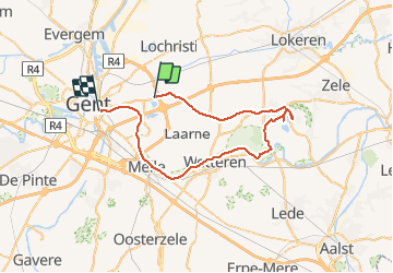
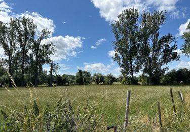
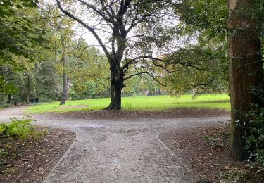
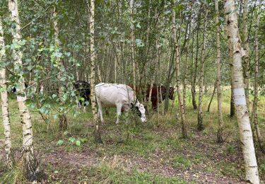
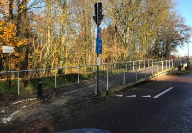
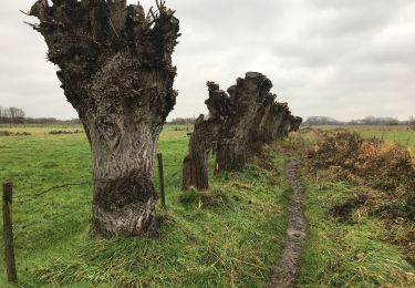
Randonnée Vélo électrique de 43 km à découvrir à Flandre, Flandre orientale, Destelbergen. Cette randonnée est proposée par bometdehamer.
Description
Mooi fietstochtje, vertrokken vanuit Gent, maar had SityTrail vergeten activeren. Pas gedaan in Destelbergen... En: ik race niet, ik kijk rond.
Localisation
Pays :
Belgique
Région :
Flandre
Département/Province :
Flandre orientale
Commune :
Destelbergen
Localité :
Destelbergen
Départ:(Dec)
Départ:(UTM)
556817 ; 5656556 (31U) N.
Commentaires
Randonnées à proximité
![Randonnée Vélo électrique Gand - Kastelentocht Sterretrappers 2 versie 3/7/2022 - Photo](https://media.geolcdn.com/t/375/260/2c827f43-8f51-42e6-8438-08eb0c46cfeb.jpg&format=jpg&maxdim=2)
![Vélo électrique Vélo électrique](https://static1.geolcdn.com/sitytour/trail-icons/205.png)
Kastelentocht Sterretrappers 2 versie 3/7/2022
Vélo électrique
Moyen
(1)
Gand,
Flandre,
Flandre orientale,
Belgique
![](/images/other/stat-length.png)
58 km | 62 km-effort
5h 52min
![](https://static1.geolcdn.com/siteimages/upload/files/16400158638029165_repeat_loop_refresh_sync_direction_icon.png)
Oui
![Randonnée Vélo électrique Gand - Vlaamse Ardennen - Photo](https://media.geolcdn.com/t/375/260/063caacd-efaf-402c-867e-f82400864df3.jpg&format=jpg&maxdim=2)
![Vélo électrique Vélo électrique](https://static1.geolcdn.com/sitytour/trail-icons/205.png)
Vlaamse Ardennen
Vélo électrique
Difficile
Gand,
Flandre,
Flandre orientale,
Belgique
![](/images/other/stat-length.png)
92 km | 102 km-effort
5h 42min
![](https://static1.geolcdn.com/siteimages/upload/files/16400158638029165_repeat_loop_refresh_sync_direction_icon.png)
Oui
![Randonnée Marche Gand - Lourdes d’Oostacker 12,7 km - Photo](https://media.geolcdn.com/t/375/260/20fffe1a-8249-4631-9b83-5dd74a95fee8.jpg&format=jpg&maxdim=2)
![Marche Marche](https://static1.geolcdn.com/sitytour/trail-icons/101.png)
Lourdes d’Oostacker 12,7 km
Marche
Facile
Gand,
Flandre,
Flandre orientale,
Belgique
![](/images/other/stat-length.png)
12,8 km | 13,8 km-effort
3h 37min
![](https://static1.geolcdn.com/siteimages/upload/files/16400158638029165_repeat_loop_refresh_sync_direction_icon.png)
Oui
![Randonnée Marche Gand - Gent Noord 10,3 km - Photo](https://media.geolcdn.com/t/375/260/47603e63-b72c-4e63-9dbe-31b92d1ec704.jpg&format=jpg&maxdim=2)
![Marche Marche](https://static1.geolcdn.com/sitytour/trail-icons/101.png)
Gent Noord 10,3 km
Marche
Facile
Gand,
Flandre,
Flandre orientale,
Belgique
![](/images/other/stat-length.png)
10,3 km | 11,2 km-effort
3h 53min
![](https://static1.geolcdn.com/siteimages/upload/files/16400158638029165_repeat_loop_refresh_sync_direction_icon.png)
Oui
![Randonnée Marche Gand - Gent gentbrugge 17,1 km - Photo](https://media.geolcdn.com/t/375/260/6cfc1f4d-41af-4b3d-9ed6-198688e4eb23.jpg&format=jpg&maxdim=2)
![Marche Marche](https://static1.geolcdn.com/sitytour/trail-icons/101.png)
Gent gentbrugge 17,1 km
Marche
Facile
Gand,
Flandre,
Flandre orientale,
Belgique
![](/images/other/stat-length.png)
17,1 km | 18,5 km-effort
5h 21min
![](https://static1.geolcdn.com/siteimages/upload/files/16400158638029165_repeat_loop_refresh_sync_direction_icon.png)
Oui
![Randonnée V.T.C. Gand - Naar Godefroot... - Photo](https://media.geolcdn.com/t/375/260/39ae019d-c97a-4eac-95c9-89088942f563.jpg&format=jpg&maxdim=2)
![V.T.C. V.T.C.](https://static1.geolcdn.com/sitytour/trail-icons/203.png)
Naar Godefroot...
V.T.C.
Gand,
Flandre,
Flandre orientale,
Belgique
![](/images/other/stat-length.png)
47 km | 51 km-effort
2h 48min
![](https://static1.geolcdn.com/siteimages/upload/files/16400158638029165_repeat_loop_refresh_sync_direction_icon.png)
Oui
![Randonnée Marche Gand - Langs Schelde en E17 - Photo](https://media.geolcdn.com/t/375/260/8be4dc8f-6f29-46ec-b107-156fe1b53b4f.jpg&format=jpg&maxdim=2)
![Marche Marche](https://static1.geolcdn.com/sitytour/trail-icons/101.png)
Langs Schelde en E17
Marche
Très facile
(1)
Gand,
Flandre,
Flandre orientale,
Belgique
![](/images/other/stat-length.png)
7,9 km | 8,5 km-effort
1h 58min
![](https://static1.geolcdn.com/siteimages/upload/files/16400158638029165_repeat_loop_refresh_sync_direction_icon.png)
Oui
![Randonnée Marche Gand - bgg - gent dampoort - bourgoyen - drongen - Photo](https://media.geolcdn.com/t/375/260/ext.jpg?maxdim=2&url=https%3A%2F%2Fstatic1.geolcdn.com%2Fsiteimages%2Fupload%2Ffiles%2F1553511878bg_sport_marche.png)
![Marche Marche](https://static1.geolcdn.com/sitytour/trail-icons/101.png)
bgg - gent dampoort - bourgoyen - drongen
Marche
Très difficile
Gand,
Flandre,
Flandre orientale,
Belgique
![](/images/other/stat-length.png)
28 km | 31 km-effort
6h 59min
![](https://static1.geolcdn.com/siteimages/upload/files/16400158638029165_repeat_loop_refresh_sync_direction_icon.png)
Oui
![Randonnée Marche Gand - ggb - En boucle Dampoort / Gand / Bourgoyen / Blaarmeersen - Photo](https://media.geolcdn.com/t/375/260/ext.jpg?maxdim=2&url=https%3A%2F%2Fstatic1.geolcdn.com%2Fsiteimages%2Fupload%2Ffiles%2F1553511878bg_sport_marche.png)
![Marche Marche](https://static1.geolcdn.com/sitytour/trail-icons/101.png)
ggb - En boucle Dampoort / Gand / Bourgoyen / Blaarmeersen
Marche
Très difficile
Gand,
Flandre,
Flandre orientale,
Belgique
![](/images/other/stat-length.png)
23 km | 25 km-effort
5h 39min
![](https://static1.geolcdn.com/siteimages/upload/files/16400158638029165_repeat_loop_refresh_sync_direction_icon.png)
Oui