Randonnée Marche Hauenstein-Ifenthal - 6 Hauenstein Balsthal - Photo
 hallauer
hallauer

Utilisateur

© OpenStreetMap contributors
Longueur
Longueur
21 km
Altitude max
Altitude max
1060 m
Dénivelé positif
Dénivelé positif
899 m
Km-Effort
Km-Effort  
34 km
Altitude min
Altitude min
487 m
Dénivelé négatif
Dénivelé négatif
1085 m
Boucle
Boucle
Non
Date de création :
2014-12-11 00:00:00.0
Dernière modification :
2014-12-11 00:00:00.0

(0 Avis)

Marche
Marche
6h56
Difficulté : Inconnu

Scannez ce code QR pour ouvrir la randonnée dans l'application SityTrail

Application GPS de randonnée GRATUITE

Logo SityTrail SityTrail

IGN / Instituts géographiques

Télécharger SityTrail sur l'App Store Télécharger SityTrail sur Google Play

Logo SityTrail SityTrail World

Le monde est à vous

Télécharger SityTrail sur l'App Store Télécharger SityTrail sur Google Play Télécharger SityTrail sur Huawei AppGallery

À propos

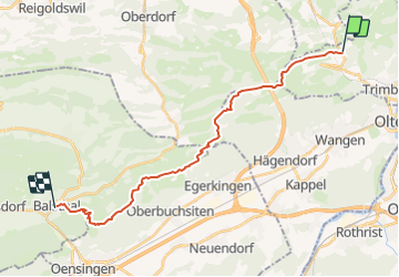
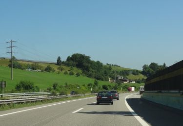
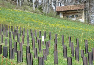
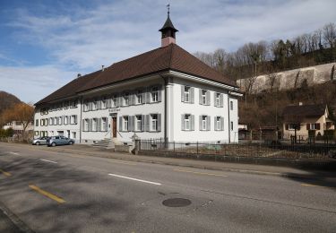
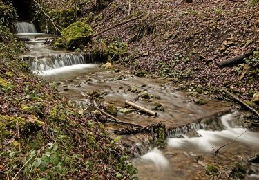
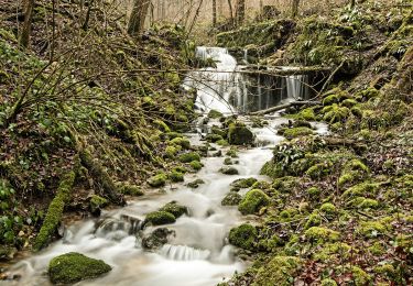
Randonnée Marche de 21 km à découvrir à Soleure, Bezirk Gösgen, Hauenstein-Ifenthal. Cette randonnée est proposée par hallauer.

Profil altimétrique

Points d'intérêt

Point d'intérêt Eptingen - Belchenfluh - Photo
hallauer
EPTINGEN 
Point d'intérêt Balsthal -  - Photo
hallauer
BALSTHAL 
Point d'intérêt Oensingen - Roggenfluh - Photo
hallauer
OENSINGEN 
Point d'intérêt Hauenstein-Ifenthal -  - Photo
hallauer
HAUENSTEIN-IFENTHAL 

Localisation

Pays :
Suisse
Région :
Soleure
Département/Province :
Bezirk Gösgen
Commune :
Hauenstein-Ifenthal
Localité :
Unknown
Départ:(Dec)
Départ:(UTM)
414855 ; 5247869 (32T) N.

Randonnées à proximité

Randonnée A pied Olten - Walderlebnispfad Bannwald - Photo
A pied
PRO

A pied

Facile
Olten, Soleure, Bezirk Olten, Suisse
3 km | 4,7 km-effort
1h 3min
Oui
Randonnée A pied Läufelfingen - Läufelfingen - Ober Diegten - Photo
A pied
PRO

A pied

Facile
Läufelfingen, Bâle-Campagne, Bezirk Sissach, Suisse
5,5 km | 8,6 km-effort
1h 57min
Non
Randonnée A pied Hauenstein-Ifenthal - Challhöchi - Ober Belchen - Photo
A pied
PRO

A pied

Facile
Hauenstein-Ifenthal, Soleure, Bezirk Gösgen, Suisse
3,1 km | 4,8 km-effort
1h 5min
Non
Randonnée A pied Känerkinden - Känerkinden - Gisiberg - Photo
A pied
PRO

A pied

Facile
Känerkinden, Bâle-Campagne, Bezirk Sissach, Suisse
4,5 km | 5,8 km-effort
1h 19min
Non
Randonnée A pied Hauenstein-Ifenthal - Hauenstein - Challhöchi - Photo
A pied
PRO

A pied

Facile
Hauenstein-Ifenthal, Soleure, Bezirk Gösgen, Suisse
3,1 km | 5 km-effort
1h 7min
Non
Randonnée A pied Hauenstein-Ifenthal - Ifenthal- Trimbach - Photo
A pied
PRO

A pied

Facile
Hauenstein-Ifenthal, Soleure, Bezirk Gösgen, Suisse
3 km | 3,9 km-effort
52min
Non
Randonnée A pied Wangen bei Olten - Olten - Rumpelweid - Photo
A pied
PRO

A pied

Facile
Wangen bei Olten, Soleure, Bezirk Olten, Suisse
3,7 km | 4,7 km-effort
1h 4min
Non
Randonnée A pied Wangen bei Olten - Wangen bei Olten - Rumpelhöchi - Photo
A pied
PRO

A pied

Facile
Wangen bei Olten, Soleure, Bezirk Olten, Suisse
3,1 km | 6,1 km-effort
1h 22min
Non
Randonnée A pied Olten - Wangen bei Olten - Olten - Photo
A pied
PRO

A pied

Facile
Olten, Soleure, Bezirk Olten, Suisse
3,5 km | 4 km-effort
54min
Non


Fermer
Mes abonnements