


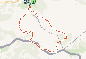

18,8 km | 27 km-effort


Utilisateur GUIDE


Application GPS de randonnée GRATUITE
 SityTrail
IGN / Instituts géographiques
SityTrail World
Le monde est à vous
Randonnée A pied de 10,3 km à découvrir à Nouvelle-Aquitaine, Pyrénées-Atlantiques, Urrugne. Cette randonnée est proposée par marmotte65.
Reco faite le 4/12/2019 avec J-c et M-j
Sortie autoroute Urrugne. Au rond point à l'entrée du village prendre la
direction d'Ibardin et aller vers Olhette continuer vers Ascain. a la sortie de Olhette
hôtel restaurant prendre le deuxième à D chemin de Xuruen-Borda
jusqu'au bout et se garer au parking sur la droite.
le PN pourra se prendre sur la frontière en dessous de la Rhune (s'il ni a pas de vent).
Ne as manquer le GR 10 pour la descente vers Olhette, et si tout se pase bien nous aurons passer une superbe journée.

Marche

Marche

Marche

Marche

Marche

V.T.T.
Marche
Marche
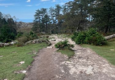
Marche