![](/images/other/stat-length.png)
![Randonnée Marche Molières-Cavaillac - Molières-Cavaillac à Bez-et-Esparon - Photo](https://media.geolcdn.com/t/1900/400/ext.pjpeg?maxdim=2&url=https%3A%2F%2Fservices.sitytrail.com%2FGeolivesWS%2FDownloadMedia.ashx%3FTrailID%3D227203%26Media%3Dfix__20131014115118.jpg)
Molières-Cavaillac à Bez-et-Esparon
randotines
Utilisateur GUIDE
![Longueur](/images/other/stat-length.png)
![Altitude max](https://static1.geolcdn.com/siteimages/upload/files/1508320355ic_sort_altitude_max_24dp.png)
![Dénivelé positif](https://static1.geolcdn.com/siteimages/upload/files/1508320355ic_sort_den_pos_24dp.png)
![Km-Effort](/images/other/stat-length.png)
![Altitude min](https://static1.geolcdn.com/siteimages/upload/files/1508320355ic_sort_altitude_min_24dp.png)
![Dénivelé négatif](https://static1.geolcdn.com/siteimages/upload/files/1508320355ic_sort_den_neg_24dp.png)
![Boucle](https://static1.geolcdn.com/siteimages/upload/files/16400158638029165_repeat_loop_refresh_sync_direction_icon.png)
![Marche](https://static1.geolcdn.com/sitytour/trail-icons/101.png)
6h05
Difficulté : Difficile
![Scannez ce code QR pour ouvrir la randonnée dans l'application SityTrail](https://capi.geolives.com/qq0zvz2zws4bq2lad0pu/sitytour/trails/227203/qr.png?size=200)
Application GPS de randonnée GRATUITE
À propos
Randonnée Marche de 19,2 km à découvrir à Occitanie, Gard, Molières-Cavaillac. Cette randonnée est proposée par randotines.
Description
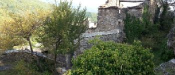
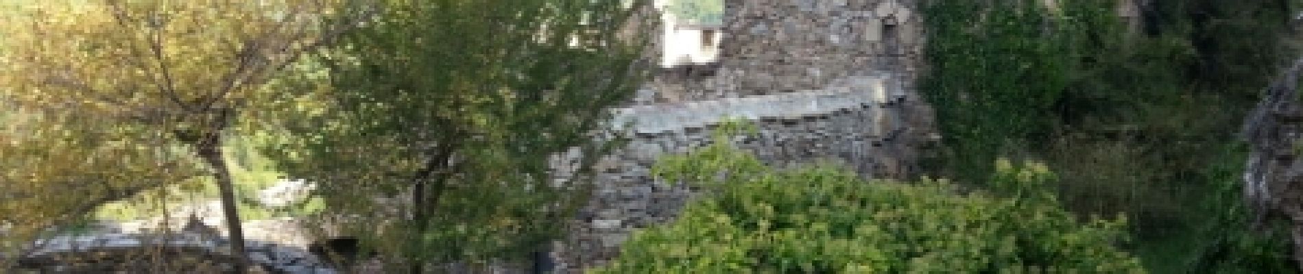
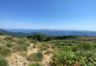
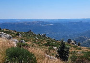
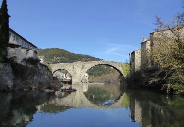
Très belle randonnée au départ de Mollières-Cavaillac qui se dirige vers le sommet d'Esparon.
Visite du petit cimetière et du village avant de descendre à Bez-et-Esparon puis remontée vers le Bosc.
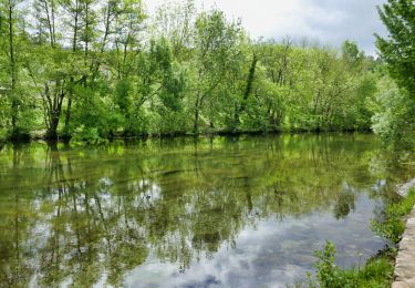
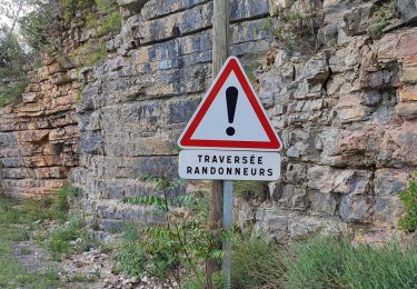
Ensuite belle traversée d'une chataigneraie pour revenir à Esparon par le GR de pays " Tour du viganais". Attention au point 31 T 544194 4870607, bifurquez à droite pour prendre un raccourci la D272a juste avant Breau-et-Salagosse vers la Poujade.
Retour au parking par le PR.
Bonne balade.
Localisation
Commentaires
Randonnées à proximité
![Marche Marche](https://static1.geolcdn.com/sitytour/trail-icons/101.png)
Marche
![](/images/other/stat-length.png)
![](https://static1.geolcdn.com/siteimages/upload/files/16400158638029165_repeat_loop_refresh_sync_direction_icon.png)
![Randonnée Marche Aumessas - Lac les Pisés départ Travers - Photo](https://media.geolcdn.com/t/375/260/679d267a-6a58-4423-871e-bc39638c17f2.jpg&format=jpg&maxdim=2)
![Marche Marche](https://static1.geolcdn.com/sitytour/trail-icons/101.png)
Marche
![](/images/other/stat-length.png)
![](https://static1.geolcdn.com/siteimages/upload/files/16400158638029165_repeat_loop_refresh_sync_direction_icon.png)
![Randonnée Marche Aumessas - Lac de Pises au départ Le Travers - Photo](https://media.geolcdn.com/t/375/260/2cc8f3c5-30d6-4002-a3b7-bac26a191665.jpg&format=jpg&maxdim=2)
![Marche Marche](https://static1.geolcdn.com/sitytour/trail-icons/101.png)
Marche
![](/images/other/stat-length.png)
![](https://static1.geolcdn.com/siteimages/upload/files/16400158638029165_repeat_loop_refresh_sync_direction_icon.png)
![Randonnée Marche Molières-Cavaillac - esparon_col Mouzoules - Photo](https://media.geolcdn.com/t/375/260/ext.jpg?maxdim=2&url=https%3A%2F%2Fstatic1.geolcdn.com%2Fsiteimages%2Fupload%2Ffiles%2F1553511878bg_sport_marche.png)
![Marche Marche](https://static1.geolcdn.com/sitytour/trail-icons/101.png)
Marche
![](/images/other/stat-length.png)
![](https://static1.geolcdn.com/siteimages/upload/files/16400158638029165_repeat_loop_refresh_sync_direction_icon.png)
![Randonnée Marche Arre - Vallée de l'Arre - Photo](https://media.geolcdn.com/t/375/260/0cd1e3db-2c3a-4247-99e2-3dd412bf8085.jpg&format=jpg&maxdim=2)
![Marche Marche](https://static1.geolcdn.com/sitytour/trail-icons/101.png)
![Randonnée Marche Bréau-Mars - Bréau le tour - Photo](https://media.geolcdn.com/t/375/260/04181ca0-7890-4fba-8e38-4c365efc7b61.jpg&format=jpg&maxdim=2)
![Marche Marche](https://static1.geolcdn.com/sitytour/trail-icons/101.png)
![Randonnée Marche Le Vigan - Le Vigan Nacelles GR7 - Photo](https://media.geolcdn.com/t/375/260/944fa77a-9052-4a0b-8e78-aaa140d1aa33.jpg&format=jpg&maxdim=2)
![Marche Marche](https://static1.geolcdn.com/sitytour/trail-icons/101.png)
Marche
![](/images/other/stat-length.png)
![](https://static1.geolcdn.com/siteimages/upload/files/16400158638029165_repeat_loop_refresh_sync_direction_icon.png)
![Randonnée Marche Le Vigan - le Vigan-la vallée de l'Arre - Photo](https://media.geolcdn.com/t/375/260/ext.jpg?maxdim=2&url=https%3A%2F%2Fservices.sitytrail.com%2FGeolivesWS%2FDownloadMedia.ashx%3FTrailID%3D362454%26Media%3Df059e141-c158-4c18-9b0d-6b8c8a751e74.JPG)
![Marche Marche](https://static1.geolcdn.com/sitytour/trail-icons/101.png)
Marche
![](/images/other/stat-length.png)
![](https://static1.geolcdn.com/siteimages/upload/files/16400158638029165_repeat_loop_refresh_sync_direction_icon.png)
![Randonnée Marche Le Vigan - Circuit de l'Arre 22.3.24 - Photo](https://media.geolcdn.com/t/375/260/80a9bb4e-928c-4afa-9ddd-7bba78e3bd2f.jpg&format=jpg&maxdim=2)
![Marche Marche](https://static1.geolcdn.com/sitytour/trail-icons/101.png)
Marche
![](/images/other/stat-length.png)
![](https://static1.geolcdn.com/siteimages/upload/files/16400158638029165_repeat_loop_refresh_sync_direction_icon.png)