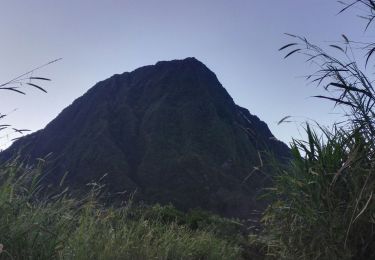
Randonnée A pied Salazie - De Grand Îlet à Hell Bourg - Photo

De Grand Îlet à Hell Bourg

 ETMU5496
ETMU5496

Utilisateur

© OpenStreetMap contributors
Longueur
Longueur
19,8 km
Altitude max
Altitude max
1352 m
Dénivelé positif
Dénivelé positif
1251 m
Km-Effort
Km-Effort  
37 km
Altitude min
Altitude min
690 m
Dénivelé négatif
Dénivelé négatif
1440 m
Boucle
Boucle
Non
Date de création :
2019-11-19 08:50:45.672
Dernière modification :
2019-12-28 17:00:44.119

(0 Avis)

A pied
A pied
--
Difficulté : Difficile

Scannez ce code QR pour ouvrir la randonnée dans l'application SityTrail

Application GPS de randonnée GRATUITE

Logo SityTrail SityTrail

IGN / Instituts géographiques

Télécharger SityTrail sur l'App Store Télécharger SityTrail sur Google Play

Logo SityTrail SityTrail World

Le monde est à vous

Télécharger SityTrail sur l'App Store Télécharger SityTrail sur Google Play Télécharger SityTrail sur Huawei AppGallery

À propos

Randonnée A pied de 19,8 km à découvrir à La Réunion, Inconnu, Salazie. Cette randonnée est proposée par ETMU5496.

Description

Un tracé exigeant au coeur de la Réunion

Profil altimétrique

Points d'intérêt

Point d'intérêt Salazie - Grand Îlet - Photo
ETMU5496
SALAZIE 
Point d'intérêt Salazie - GR R1 à gauche - Photo
ETMU5496
Point d'intérêt Salazie - Tout droit - Photo
ETMU5496
SALAZIE 
Point d'intérêt Salazie - Tout droit - Photo
ETMU5496
SALAZIE 
Point d'intérêt Salazie - Abri à droite - Photo
ETMU5496
Point d'intérêt Salazie - Piton d'Anchaing - Photo
ETMU5496
Point d'intérêt Salazie - Pont métallique - Photo
ETMU5496
Point d'intérêt Salazie - À gauche - Photo
ETMU5496
SALAZIE 
Point d'intérêt Salazie - Sentier à gauche - Photo
ETMU5496
Point d'intérêt Salazie - Hell Bourg - Photo
ETMU5496
SALAZIE 

Localisation

Pays :
France
Région :
La Réunion
Département/Province :
Inconnu
Commune :
Salazie
Localité :
Unknown
Départ:(UTM)
341492 ; 7673735 (40K) S.

Randonnées à proximité

Randonnée Marche Salazie - Piton d'Anchain - Photo
Marche
sylviedaniel

Marche

Difficile
Salazie, La Réunion, Inconnu, France
9,1 km | 19,3 km-effort
2h 48min
Oui
Randonnée Marche Salazie - hellbourg trou de fer aller retour - Photo
Marche
RoMo

Marche

Difficile
Salazie, La Réunion, Inconnu, France
22 km | 37 km-effort
7h 14min
Non
Randonnée Marche La Possession - Marla par la Nouvelle du col des boeufs - Photo
Marche
sylviedaniel

Marche

Moyen
La Possession, La Réunion, Inconnu, France
14,6 km | 23 km-effort
5h 0min
Non
Randonnée Marche Salazie - Trpu de fer belouve depuis hellbourg - Photo
Marche
simonm0204

Marche

(1)
Salazie, La Réunion, Inconnu, France
17,4 km | 29 km-effort
7h 26min
Oui
Randonnée Marche La Possession - La Réunion - Mafate - Photo
Marche
olive2b

Marche

Moyen
La Possession, La Réunion, Inconnu, France
5,9 km | 9,5 km-effort
2h 41min
Non
Randonnée Marche La Possession - La Réunion - Boucle Mafate par le Col des boeufs - Photo
Marche
olive2b

Marche

Moyen
La Possession, La Réunion, Inconnu, France
16,9 km | 30 km-effort
2h 41min
Oui
Randonnée Marche Salazie - GR® R1 Le Tour du piton des Neiges - De Hell-Bourg à la Caverne Dufour  - Photo
Marche
tracegps

Marche

Difficile
Salazie, La Réunion, Inconnu, France
12,1 km | 28 km-effort
6h 30min
Non
Randonnée Marche La Possession - mafate les hauts j 1 horaire - Photo
Marche
picvert09

Marche

Difficile
(1)
La Possession, La Réunion, Inconnu, France
5,1 km | 8,3 km-effort
3h 26min
Non
Randonnée sport Saint-Denis - (J2)-Gîte de la Roche Écrite - Dos d’Ane (fait) - Photo
sport
GeorgesV.

sport

Très facile
Saint-Denis, La Réunion, Inconnu, France
18,4 km | 29 km-effort
Inconnu
Non


Fermer
Mes abonnements