![](/images/other/stat-length.png)
![Randonnée Marche Mathay - ecot 11km par village Ecot - Photo](https://media.geolcdn.com/t/1900/400/ext.pjpeg?maxdim=2&url=https%3A%2F%2Fstatic1.geolcdn.com%2Fsiteimages%2Fupload%2Ffiles%2F1553511878bg_sport_marche.png)
ecot 11km par village Ecot
signorato
Utilisateur
![Longueur](/images/other/stat-length.png)
Longueur
11,1 km
![Altitude max](https://static1.geolcdn.com/siteimages/upload/files/1508320355ic_sort_altitude_max_24dp.png)
Altitude max
565 m
![Dénivelé positif](https://static1.geolcdn.com/siteimages/upload/files/1508320355ic_sort_den_pos_24dp.png)
Dénivelé positif
307 m
![Km-Effort](/images/other/stat-length.png)
Km-Effort
15,2 km
![Altitude min](https://static1.geolcdn.com/siteimages/upload/files/1508320355ic_sort_altitude_min_24dp.png)
Altitude min
367 m
![Dénivelé négatif](https://static1.geolcdn.com/siteimages/upload/files/1508320355ic_sort_den_neg_24dp.png)
Dénivelé négatif
306 m
![Boucle](https://static1.geolcdn.com/siteimages/upload/files/16400158638029165_repeat_loop_refresh_sync_direction_icon.png)
Boucle
Oui
Date de création :
2019-10-29 13:07:42.668
Dernière modification :
2019-10-30 08:05:57.218
![Marche](https://static1.geolcdn.com/sitytour/trail-icons/101.png)
3h15
Difficulté : Très facile
![Scannez ce code QR pour ouvrir la randonnée dans l'application SityTrail](https://capi.geolives.com/qq0zvz2zws4bq2lad0pu/sitytour/trails/2253536/qr.png?size=200)
Application GPS de randonnée GRATUITE
À propos
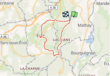
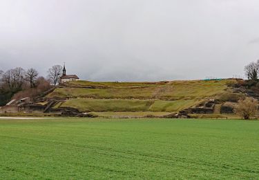
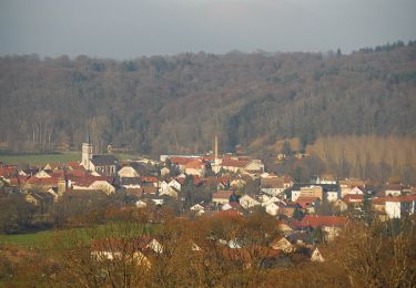
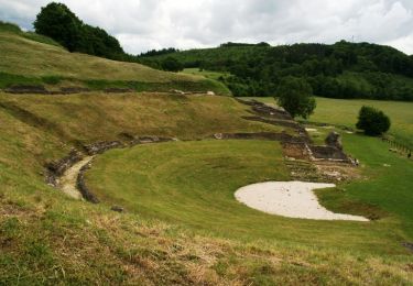
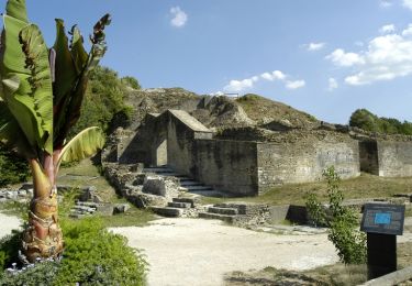
Randonnée Marche de 11,1 km à découvrir à Bourgogne-Franche-Comté, Doubs, Mathay. Cette randonnée est proposée par signorato.
Description
depart la fourche direction la forêt puis chemin de la memoire
puis Ecot puis monument guerre 40 45 puis retour par la route de LUcelans
Localisation
Pays :
France
Région :
Bourgogne-Franche-Comté
Département/Province :
Doubs
Commune :
Mathay
Localité :
Unknown
Départ:(Dec)
Départ:(UTM)
331474 ; 5256282 (32T) N.
Commentaires
Randonnées à proximité
![Marche Marche](https://static1.geolcdn.com/sitytour/trail-icons/101.png)
Mandeure, Les Grands Communaux 9.6 Km
Marche
Difficile
(1)
Mandeure,
Bourgogne-Franche-Comté,
Doubs,
France
![](/images/other/stat-length.png)
9,6 km | 13,2 km-effort
2h 59min
![](https://static1.geolcdn.com/siteimages/upload/files/16400158638029165_repeat_loop_refresh_sync_direction_icon.png)
Oui
![Randonnée Marche Bourguignon - Bourguignon, entre eau et forêt 9.5 Km - Photo](https://media.geolcdn.com/t/375/260/ext.jpg?maxdim=2&url=https%3A%2F%2Fstatic1.geolcdn.com%2Fsiteimages%2Fupload%2Ffiles%2F1553511878bg_sport_marche.png)
![Marche Marche](https://static1.geolcdn.com/sitytour/trail-icons/101.png)
Bourguignon, entre eau et forêt 9.5 Km
Marche
Moyen
(1)
Bourguignon,
Bourgogne-Franche-Comté,
Doubs,
France
![](/images/other/stat-length.png)
9,5 km | 11,9 km-effort
2h 2min
![](https://static1.geolcdn.com/siteimages/upload/files/16400158638029165_repeat_loop_refresh_sync_direction_icon.png)
Oui
![Randonnée Autre activité Voujeaucourt - de voujeaucourt à Dambelin, puis pont de roide - Photo](https://media.geolcdn.com/t/375/260/ext.jpg?maxdim=2&url=https%3A%2F%2Fservices.sitytrail.com%2FGeolivesWS%2FDownloadMedia.ashx%3FTrailID%3D737146%26Media%3Dfix__20170421173351.jpg)
![Autre activité Autre activité](https://static1.geolcdn.com/sitytour/trail-icons/900.png)
de voujeaucourt à Dambelin, puis pont de roide
Autre activité
Très facile
Voujeaucourt,
Bourgogne-Franche-Comté,
Doubs,
France
![](/images/other/stat-length.png)
57 km | 77 km-effort
4h 46min
![](https://static1.geolcdn.com/siteimages/upload/files/16400158638029165_repeat_loop_refresh_sync_direction_icon.png)
Oui
![Randonnée Marche Mandeure - source Charles - Photo](https://media.geolcdn.com/t/375/260/648031c0-b4de-472e-85c6-7607594dcf29.jpg&format=jpg&maxdim=2)
![Marche Marche](https://static1.geolcdn.com/sitytour/trail-icons/101.png)
source Charles
Marche
Facile
Mandeure,
Bourgogne-Franche-Comté,
Doubs,
France
![](/images/other/stat-length.png)
5 km | 6,4 km-effort
1h 35min
![](https://static1.geolcdn.com/siteimages/upload/files/16400158638029165_repeat_loop_refresh_sync_direction_icon.png)
Non
![Randonnée Marche Mandeure - Théâtre Gallo-Romain de Mandeure 9 Km - Photo](https://media.geolcdn.com/t/375/260/074bd74f-4d1e-4ebb-b363-d85a06bb441a.jpg&format=jpg&maxdim=2)
![Marche Marche](https://static1.geolcdn.com/sitytour/trail-icons/101.png)
Théâtre Gallo-Romain de Mandeure 9 Km
Marche
Moyen
Mandeure,
Bourgogne-Franche-Comté,
Doubs,
France
![](/images/other/stat-length.png)
9 km | 11,9 km-effort
2h 42min
![](https://static1.geolcdn.com/siteimages/upload/files/16400158638029165_repeat_loop_refresh_sync_direction_icon.png)
Oui
![Randonnée Marche Mandeure - Etape 1 GTJ : Mandeure à Pont de Roide - Photo](https://media.geolcdn.com/t/375/260/b9c884aa-6364-4edd-9de9-19d71f8c4dd8.jpg&format=jpg&maxdim=2)
![Marche Marche](https://static1.geolcdn.com/sitytour/trail-icons/101.png)
Etape 1 GTJ : Mandeure à Pont de Roide
Marche
Facile
Mandeure,
Bourgogne-Franche-Comté,
Doubs,
France
![](/images/other/stat-length.png)
14 km | 18,1 km-effort
4h 40min
![](https://static1.geolcdn.com/siteimages/upload/files/16400158638029165_repeat_loop_refresh_sync_direction_icon.png)
Non
![Randonnée V.T.T. Mandeure - Randonnée autour de Mandeure - Photo](https://media.geolcdn.com/t/375/260/ext.jpg?maxdim=2&url=https%3A%2F%2Fservices.sitytrail.com%2FGeolivesWS%2FDownloadMedia.ashx%3FTrailID%3D136880%26Media%3D13549_1.jpg)
![V.T.T. V.T.T.](https://static1.geolcdn.com/sitytour/trail-icons/202.png)
Randonnée autour de Mandeure
V.T.T.
Moyen
Mandeure,
Bourgogne-Franche-Comté,
Doubs,
France
![](/images/other/stat-length.png)
25 km | 32 km-effort
2h 0min
![](https://static1.geolcdn.com/siteimages/upload/files/16400158638029165_repeat_loop_refresh_sync_direction_icon.png)
Non
![Randonnée Vélo Mandeure - Le Lomont - Doubs - Photo](https://media.geolcdn.com/t/375/260/ext.jpg?maxdim=2&url=https%3A%2F%2Fservices.sitytrail.com%2FGeolivesWS%2FDownloadMedia.ashx%3FTrailID%3D109430%26Media%3D3778_1.jpg)
![Vélo Vélo](https://static1.geolcdn.com/sitytour/trail-icons/200.png)
Le Lomont - Doubs
Vélo
Difficile
Mandeure,
Bourgogne-Franche-Comté,
Doubs,
France
![](/images/other/stat-length.png)
72 km | 89 km-effort
3h 0min
![](https://static1.geolcdn.com/siteimages/upload/files/16400158638029165_repeat_loop_refresh_sync_direction_icon.png)
Oui
![Randonnée Marche Mandeure - Mandeure - Doubs - Photo](https://media.geolcdn.com/t/375/260/ext.jpg?maxdim=2&url=https%3A%2F%2Fservices.sitytrail.com%2FGeolivesWS%2FDownloadMedia.ashx%3FTrailID%3D108927%26Media%3D2618_1.jpg)
![Marche Marche](https://static1.geolcdn.com/sitytour/trail-icons/101.png)
Mandeure - Doubs
Marche
Moyen
(2)
Mandeure,
Bourgogne-Franche-Comté,
Doubs,
France
![](/images/other/stat-length.png)
9 km | 11,9 km-effort
3h 0min
![](https://static1.geolcdn.com/siteimages/upload/files/16400158638029165_repeat_loop_refresh_sync_direction_icon.png)
Oui