![](/images/other/stat-length.png)
![Randonnée Marche Champcueil - Les grands Avaux - Photo](https://media.geolcdn.com/t/1900/400/ext.pjpeg?maxdim=2&url=https%3A%2F%2Fstatic1.geolcdn.com%2Fsiteimages%2Fupload%2Ffiles%2F1553511878bg_sport_marche.png)
Les grands Avaux
dmatignon
Utilisateur
![Longueur](/images/other/stat-length.png)
Longueur
10,6 km
![Altitude max](https://static1.geolcdn.com/siteimages/upload/files/1508320355ic_sort_altitude_max_24dp.png)
Altitude max
153 m
![Dénivelé positif](https://static1.geolcdn.com/siteimages/upload/files/1508320355ic_sort_den_pos_24dp.png)
Dénivelé positif
171 m
![Km-Effort](/images/other/stat-length.png)
Km-Effort
12,9 km
![Altitude min](https://static1.geolcdn.com/siteimages/upload/files/1508320355ic_sort_altitude_min_24dp.png)
Altitude min
86 m
![Dénivelé négatif](https://static1.geolcdn.com/siteimages/upload/files/1508320355ic_sort_den_neg_24dp.png)
Dénivelé négatif
176 m
![Boucle](https://static1.geolcdn.com/siteimages/upload/files/16400158638029165_repeat_loop_refresh_sync_direction_icon.png)
Boucle
Oui
Date de création :
2019-10-18 16:01:00.034
Dernière modification :
2021-11-17 16:55:37.417
![Marche](https://static1.geolcdn.com/sitytour/trail-icons/101.png)
3h00
Difficulté : Moyen
![Scannez ce code QR pour ouvrir la randonnée dans l'application SityTrail](https://capi.geolives.com/qq0zvz2zws4bq2lad0pu/sitytour/trails/2234577/qr.png?size=200)
Application GPS de randonnée GRATUITE
À propos
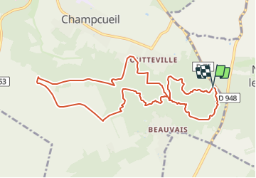
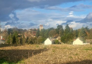
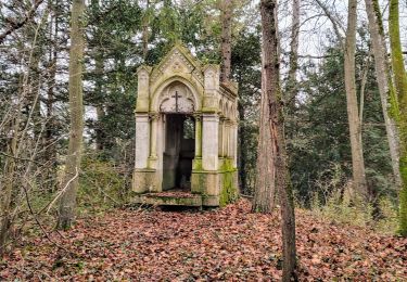
Randonnée Marche de 10,6 km à découvrir à Île-de-France, Essonne, Champcueil. Cette randonnée est proposée par dmatignon.
Description
Randonnée en boucle.
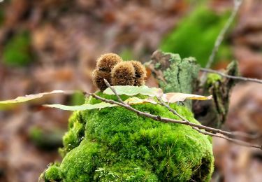
Montée jusqu'au télégraphe au travers des chaos rocheux, puis montée sur le plateau de la Beauce en passant par le château d'eau du buisson et la ferme du bonheur.
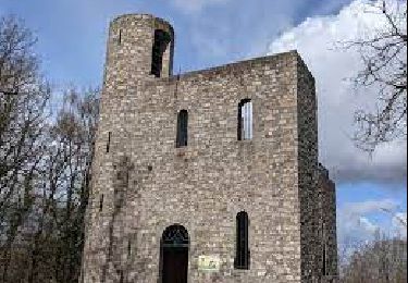
Retour par la tour du Buisson, et les rochers du Duc.
Localisation
Pays :
France
Région :
Île-de-France
Département/Province :
Essonne
Commune :
Champcueil
Localité :
Unknown
Départ:(Dec)
Départ:(UTM)
461565 ; 5372438 (31U) N.
Commentaires
Randonnées à proximité
![Randonnée A pied Saint-Germain-sur-École - Boucle Soisy Sur Ecole - Photo](https://media.geolcdn.com/t/375/260/191519f5-31af-4b92-abf3-6dc57900b32f.jpg&format=jpg&maxdim=2)
![A pied A pied](https://static1.geolcdn.com/sitytour/trail-icons/100.png)
Boucle Soisy Sur Ecole
A pied
Moyen
(1)
Saint-Germain-sur-École,
Île-de-France,
Seine-et-Marne,
France
![](/images/other/stat-length.png)
21 km | 25 km-effort
5h 39min
![](https://static1.geolcdn.com/siteimages/upload/files/16400158638029165_repeat_loop_refresh_sync_direction_icon.png)
Oui
![Randonnée Marche Champcueil - JC 51 - 18,4 km - 320m - Champcueil, Les Grands Avaux - 23 km Effort - Photo](https://media.geolcdn.com/t/375/260/489ffccc-38be-45b9-b302-6ec46034b0a7.jpg&format=jpg&maxdim=2)
![Marche Marche](https://static1.geolcdn.com/sitytour/trail-icons/101.png)
JC 51 - 18,4 km - 320m - Champcueil, Les Grands Avaux - 23 km Effort
Marche
Difficile
(2)
Champcueil,
Île-de-France,
Essonne,
France
![](/images/other/stat-length.png)
17,7 km | 22 km-effort
4h 58min
![](https://static1.geolcdn.com/siteimages/upload/files/16400158638029165_repeat_loop_refresh_sync_direction_icon.png)
Oui
![Randonnée Marche Saint-Fargeau-Ponthierry - Boucle 20 km Saint Fargeau - Photo](https://media.geolcdn.com/t/375/260/1121cafc-c79f-4e4a-a841-485665e96120.jpg&format=jpg&maxdim=2)
![Marche Marche](https://static1.geolcdn.com/sitytour/trail-icons/101.png)
Boucle 20 km Saint Fargeau
Marche
Facile
Saint-Fargeau-Ponthierry,
Île-de-France,
Seine-et-Marne,
France
![](/images/other/stat-length.png)
21 km | 23 km-effort
4h 34min
![](https://static1.geolcdn.com/siteimages/upload/files/16400158638029165_repeat_loop_refresh_sync_direction_icon.png)
Oui
![Randonnée Marche Saint-Germain-sur-École - Boucle soisy version definitif - Photo](https://media.geolcdn.com/t/375/260/393daa89-85e9-457d-aec1-026a61438d59.jpg&format=jpg&maxdim=2)
![Marche Marche](https://static1.geolcdn.com/sitytour/trail-icons/101.png)
Boucle soisy version definitif
Marche
Facile
Saint-Germain-sur-École,
Île-de-France,
Seine-et-Marne,
France
![](/images/other/stat-length.png)
22 km | 26 km-effort
4h 53min
![](https://static1.geolcdn.com/siteimages/upload/files/16400158638029165_repeat_loop_refresh_sync_direction_icon.png)
Oui
![Randonnée A pied Champcueil - Boucle Beauvais 28 km - Photo](https://media.geolcdn.com/t/375/260/e36d05bc-8349-4259-9130-b9f8c6d20d01.jpg&format=jpg&maxdim=2)
![A pied A pied](https://static1.geolcdn.com/sitytour/trail-icons/100.png)
Boucle Beauvais 28 km
A pied
Moyen
Champcueil,
Île-de-France,
Essonne,
France
![](/images/other/stat-length.png)
28 km | 34 km-effort
7h 41min
![](https://static1.geolcdn.com/siteimages/upload/files/16400158638029165_repeat_loop_refresh_sync_direction_icon.png)
Oui
![Randonnée Marche Champcueil - Boucle Champcueil - Photo](https://media.geolcdn.com/t/375/260/7fb1af8d-34a9-45ce-aaee-3ffb4d1f1fed.jpg&format=jpg&maxdim=2)
![Marche Marche](https://static1.geolcdn.com/sitytour/trail-icons/101.png)
Boucle Champcueil
Marche
Moyen
Champcueil,
Île-de-France,
Essonne,
France
![](/images/other/stat-length.png)
25 km | 30 km-effort
5h 38min
![](https://static1.geolcdn.com/siteimages/upload/files/16400158638029165_repeat_loop_refresh_sync_direction_icon.png)
Oui
![Randonnée Marche Saint-Germain-sur-École - Autour de Soisy sur Ecole - Boucle 30 km - Photo](https://media.geolcdn.com/t/375/260/42a45b0a-7dbc-4142-a18c-2c21a7c16f7f.jpg&format=jpg&maxdim=2)
![Marche Marche](https://static1.geolcdn.com/sitytour/trail-icons/101.png)
Autour de Soisy sur Ecole - Boucle 30 km
Marche
Moyen
Saint-Germain-sur-École,
Île-de-France,
Seine-et-Marne,
France
![](/images/other/stat-length.png)
30 km | 36 km-effort
6h 3min
![](https://static1.geolcdn.com/siteimages/upload/files/16400158638029165_repeat_loop_refresh_sync_direction_icon.png)
Oui
![Randonnée A pied Champcueil - Balade entre Brie de Gâtinais - Photo](https://media.geolcdn.com/t/375/260/b0136ac0-b10f-482a-a588-87ed1c582c80.jpeg&format=jpg&maxdim=2)
![A pied A pied](https://static1.geolcdn.com/sitytour/trail-icons/100.png)
Balade entre Brie de Gâtinais
A pied
Facile
Champcueil,
Île-de-France,
Essonne,
France
![](/images/other/stat-length.png)
13,1 km | 15,7 km-effort
3h 33min
![](https://static1.geolcdn.com/siteimages/upload/files/16400158638029165_repeat_loop_refresh_sync_direction_icon.png)
Non
![Randonnée Marche Saint-Sauveur-sur-École - Autour de St Sauveur l'Ecole - Photo](https://media.geolcdn.com/t/375/260/60d05cfc-695b-4981-a344-8a4aca4564fc.jpg&format=jpg&maxdim=2)
![Marche Marche](https://static1.geolcdn.com/sitytour/trail-icons/101.png)
Autour de St Sauveur l'Ecole
Marche
Très facile
Saint-Sauveur-sur-École,
Île-de-France,
Seine-et-Marne,
France
![](/images/other/stat-length.png)
23 km | 26 km-effort
5h 13min
![](https://static1.geolcdn.com/siteimages/upload/files/16400158638029165_repeat_loop_refresh_sync_direction_icon.png)
Oui