![](/images/other/stat-length.png)
![Randonnée V.T.T. Curnier - itinineraire col d'Ambonne - Photo](https://media.geolcdn.com/t/1900/400/ext.pjpeg?maxdim=2&url=https%3A%2F%2Fstatic1.geolcdn.com%2Fsiteimages%2Fupload%2Ffiles%2F1524743154velo.jpg)
itinineraire col d'Ambonne
marcol
Utilisateur
![Longueur](/images/other/stat-length.png)
Longueur
31 km
![Altitude max](https://static1.geolcdn.com/siteimages/upload/files/1508320355ic_sort_altitude_max_24dp.png)
Altitude max
1278 m
![Dénivelé positif](https://static1.geolcdn.com/siteimages/upload/files/1508320355ic_sort_den_pos_24dp.png)
Dénivelé positif
1089 m
![Km-Effort](/images/other/stat-length.png)
Km-Effort
46 km
![Altitude min](https://static1.geolcdn.com/siteimages/upload/files/1508320355ic_sort_altitude_min_24dp.png)
Altitude min
325 m
![Dénivelé négatif](https://static1.geolcdn.com/siteimages/upload/files/1508320355ic_sort_den_neg_24dp.png)
Dénivelé négatif
1102 m
![Boucle](https://static1.geolcdn.com/siteimages/upload/files/16400158638029165_repeat_loop_refresh_sync_direction_icon.png)
Boucle
Non
Date de création :
2019-09-30 14:10:23.723
Dernière modification :
2019-09-30 14:36:49.279
![V.T.T.](https://static1.geolcdn.com/sitytour/trail-icons/202.png)
2h55
Difficulté : Très difficile
![Scannez ce code QR pour ouvrir la randonnée dans l'application SityTrail](https://capi.geolives.com/qq0zvz2zws4bq2lad0pu/sitytour/trails/2218091/qr.png?size=200)
Application GPS de randonnée GRATUITE
À propos
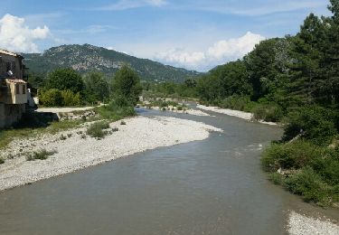
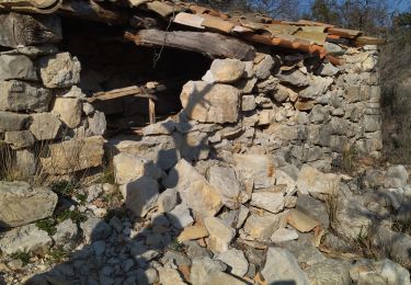
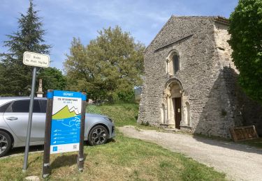
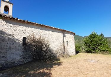
Randonnée V.T.T. de 31 km à découvrir à Auvergne-Rhône-Alpes, Drôme, Curnier. Cette randonnée est proposée par marcol.
Description
descente assez violente et engagé du col d'Ambonne jusqu'au Poet et second single largement plus abordable qui fini à St Jalles
Localisation
Pays :
France
Région :
Auvergne-Rhône-Alpes
Département/Province :
Drôme
Commune :
Curnier
Localité :
Unknown
Départ:(Dec)
Départ:(UTM)
678675 ; 4916931 (31T) N.
Commentaires
Randonnées à proximité
![Randonnée Marche Les Pilles - NYONS (Monts d'Autuche) - Photo](https://media.geolcdn.com/t/375/260/ext.jpg?maxdim=2&url=https%3A%2F%2Fservices.sitytrail.com%2FGeolivesWS%2FDownloadMedia.ashx%3FTrailID%3D973161%26Media%3Dfix__20180524163427.jpg)
![Marche Marche](https://static1.geolcdn.com/sitytour/trail-icons/101.png)
NYONS (Monts d'Autuche)
Marche
Moyen
(1)
Les Pilles,
Auvergne-Rhône-Alpes,
Drôme,
France
![](/images/other/stat-length.png)
9,1 km | 17,9 km-effort
3h 35min
![](https://static1.geolcdn.com/siteimages/upload/files/16400158638029165_repeat_loop_refresh_sync_direction_icon.png)
Oui
![Randonnée Marche Sahune - Le Rocher du Bramard - Sahune - Photo](https://media.geolcdn.com/t/375/260/ext.jpg?maxdim=2&url=https%3A%2F%2Fservices.sitytrail.com%2FGeolivesWS%2FDownloadMedia.ashx%3FTrailID%3D172373%26Media%3D13716_3.jpg)
![Marche Marche](https://static1.geolcdn.com/sitytour/trail-icons/101.png)
Le Rocher du Bramard - Sahune
Marche
Moyen
(2)
Sahune,
Auvergne-Rhône-Alpes,
Drôme,
France
![](/images/other/stat-length.png)
11,2 km | 19,6 km-effort
5h 0min
![](https://static1.geolcdn.com/siteimages/upload/files/16400158638029165_repeat_loop_refresh_sync_direction_icon.png)
Oui
![Randonnée Marche Sahune - 26 sahune - Photo](https://media.geolcdn.com/t/375/260/a180cf7c-fb96-48c2-9d7c-76f8ea234985.jpg&format=jpg&maxdim=2)
![Marche Marche](https://static1.geolcdn.com/sitytour/trail-icons/101.png)
26 sahune
Marche
Moyen
Sahune,
Auvergne-Rhône-Alpes,
Drôme,
France
![](/images/other/stat-length.png)
19,5 km | 33 km-effort
7h 20min
![](https://static1.geolcdn.com/siteimages/upload/files/16400158638029165_repeat_loop_refresh_sync_direction_icon.png)
Non
![Randonnée Marche Sahune - rocher de Bramard - Photo](https://media.geolcdn.com/t/375/260/b6e96133-4660-4d7a-bbea-eb48a170bb19.jpg&format=jpg&maxdim=2)
![Marche Marche](https://static1.geolcdn.com/sitytour/trail-icons/101.png)
rocher de Bramard
Marche
Moyen
Sahune,
Auvergne-Rhône-Alpes,
Drôme,
France
![](/images/other/stat-length.png)
12,4 km | 21 km-effort
4h 35min
![](https://static1.geolcdn.com/siteimages/upload/files/16400158638029165_repeat_loop_refresh_sync_direction_icon.png)
Oui
![Randonnée Marche Eyroles - Eyroles - Photo](https://media.geolcdn.com/t/375/260/ext.jpg?maxdim=2&url=https%3A%2F%2Fstatic1.geolcdn.com%2Fsiteimages%2Fupload%2Ffiles%2F1553511878bg_sport_marche.png)
![Marche Marche](https://static1.geolcdn.com/sitytour/trail-icons/101.png)
Eyroles
Marche
Moyen
(2)
Eyroles,
Auvergne-Rhône-Alpes,
Drôme,
France
![](/images/other/stat-length.png)
11 km | 17,7 km-effort
3h 42min
![](https://static1.geolcdn.com/siteimages/upload/files/16400158638029165_repeat_loop_refresh_sync_direction_icon.png)
Oui
![Randonnée Marche Sahune - Sahune - Photo](https://media.geolcdn.com/t/375/260/ext.jpg?maxdim=2&url=https%3A%2F%2Fstatic1.geolcdn.com%2Fsiteimages%2Fupload%2Ffiles%2F1553511878bg_sport_marche.png)
![Marche Marche](https://static1.geolcdn.com/sitytour/trail-icons/101.png)
Sahune
Marche
Moyen
(2)
Sahune,
Auvergne-Rhône-Alpes,
Drôme,
France
![](/images/other/stat-length.png)
7,1 km | 12,5 km-effort
2h 30min
![](https://static1.geolcdn.com/siteimages/upload/files/16400158638029165_repeat_loop_refresh_sync_direction_icon.png)
Oui
![Randonnée Vélo de route Sainte-Jalle - Col d’Ey depuis Sainte Jalle via Rochebrune - Photo](https://media.geolcdn.com/t/375/260/2d32934e-f0a5-4ec9-8fdb-ba37b4d45c7a.jpg&format=jpg&maxdim=2)
![Vélo de route Vélo de route](https://static1.geolcdn.com/sitytour/trail-icons/201.png)
Col d’Ey depuis Sainte Jalle via Rochebrune
Vélo de route
Moyen
Sainte-Jalle,
Auvergne-Rhône-Alpes,
Drôme,
France
![](/images/other/stat-length.png)
18,8 km | 24 km-effort
1h 55min
![](https://static1.geolcdn.com/siteimages/upload/files/16400158638029165_repeat_loop_refresh_sync_direction_icon.png)
Oui
![Randonnée Marche Condorcet - Condorcet petite boucle par le château - Photo](https://media.geolcdn.com/t/375/260/f801d9fa-daa8-4171-81fe-198e16eeb6c4.jpg&format=jpg&maxdim=2)
![Marche Marche](https://static1.geolcdn.com/sitytour/trail-icons/101.png)
Condorcet petite boucle par le château
Marche
Facile
Condorcet,
Auvergne-Rhône-Alpes,
Drôme,
France
![](/images/other/stat-length.png)
7,6 km | 10,6 km-effort
3h 17min
![](https://static1.geolcdn.com/siteimages/upload/files/16400158638029165_repeat_loop_refresh_sync_direction_icon.png)
Oui
![Randonnée Marche Arpavon - BruBer-Arpavon : ND Consolation - Photo](https://media.geolcdn.com/t/375/260/ac6ca5aa-60a5-46e8-a1a6-5885958bb4b9.jpg&format=jpg&maxdim=2)
![Marche Marche](https://static1.geolcdn.com/sitytour/trail-icons/101.png)
BruBer-Arpavon : ND Consolation
Marche
Moyen
Arpavon,
Auvergne-Rhône-Alpes,
Drôme,
France
![](/images/other/stat-length.png)
5,5 km | 8,2 km-effort
1h 30min
![](https://static1.geolcdn.com/siteimages/upload/files/16400158638029165_repeat_loop_refresh_sync_direction_icon.png)
Oui