Randonnée Marche Les Cammazes - rando les cammazes  - Photo

rando les cammazes

 becken
becken

Utilisateur

© OpenStreetMap contributors
Longueur
Longueur
12,9 km
Altitude max
Altitude max
640 m
Dénivelé positif
Dénivelé positif
207 m
Km-Effort
Km-Effort  
15,7 km
Altitude min
Altitude min
575 m
Dénivelé négatif
Dénivelé négatif
207 m
Boucle
Boucle
Oui
Date de création :
2019-09-29 12:34:21.169
Dernière modification :
2019-09-29 18:26:26.513

(1 Avis)

Marche
Marche
3h19
Difficulté : Moyen

Scannez ce code QR pour ouvrir la randonnée dans l'application SityTrail

Application GPS de randonnée GRATUITE

Logo SityTrail SityTrail

IGN / Instituts géographiques

Télécharger SityTrail sur l'App Store Télécharger SityTrail sur Google Play

Logo SityTrail SityTrail World

Le monde est à vous

Télécharger SityTrail sur l'App Store Télécharger SityTrail sur Google Play Télécharger SityTrail sur Huawei AppGallery

À propos

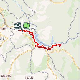
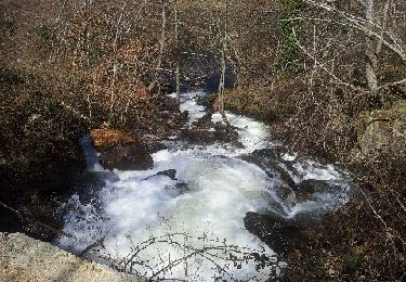
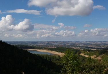
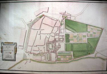
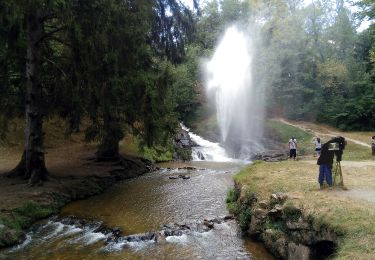
Randonnée Marche de 12,9 km à découvrir à Occitanie, Tarn, Les Cammazes. Cette randonnée est proposée par becken.

Profil altimétrique

Photos

Localisation

Pays :
France
Région :
Occitanie
Département/Province :
Tarn
Commune :
Les Cammazes
Localité :
Unknown
Départ:(UTM)
425587 ; 4806540 (31T) N.

Commentaires

Veuillez vous connecter pour laisser un commentaire ou une note


Randonnées à proximité

Randonnée A pied Les Cammazes - Randonnee pedestre aux cammazes - Photo
A pied
Maxime Dallaston

A pied

Facile
(1)
Les Cammazes, Occitanie, Tarn, France
7,3 km | 11 km-effort
2h 29min
Oui
Randonnée V.T.T. Sorèze - Sorèze - Montagne Noire - Photo
V.T.T.
tracegps

V.T.T.

Très difficile
(1)
Sorèze, Occitanie, Tarn, France
36 km | 53 km-effort
3h 30min
Oui
Randonnée A pied Sorèze - Soreze  Oppidum de Berniquaut en boucle. - Photo
A pied
caccini

A pied

Moyen
(1)
Sorèze, Occitanie, Tarn, France
16,4 km | 24 km-effort
5h 26min
Non
Randonnée Course à pied Revel - Desperado Trail 31km - Photo
Course à pied
ycuiller

Course à pied

Moyen
(1)
Revel, Occitanie, Haute-Garonne, France
31 km | 46 km-effort
3h 0min
Non
Randonnée Marche Verdun-en-Lauragais - BDM Du camping au salon puis retour - Photo
Marche
dtrinquelle

Marche

Moyen
(1)
Verdun-en-Lauragais, Occitanie, Aude, France
13,9 km | 17,7 km-effort
1h 30min
Oui
Randonnée V.T.T. Sorèze - 2012-04-01cammazes - Photo
V.T.T.
Arpones

V.T.T.

Difficile
(1)
Sorèze, Occitanie, Tarn, France
49 km | 63 km-effort
3h 17min
Oui
Randonnée Marche Les Brunels - Boucle entre le Lac de Saint Ferréol et la Lac des Cammazes - Photo
Marche
tercla

Marche

Difficile
Les Brunels, Occitanie, Aude, France
19,8 km | 28 km-effort
4h 58min
Oui
Randonnée A pied Sorèze - La boucle du Bois Grand - Photo
A pied
GUIDE+

A pied

Facile
Sorèze, Occitanie, Tarn, France
7 km | 10,7 km-effort
2h 26min
Oui
Randonnée A pied Revel - Tour du Lac - Photo
A pied
GUIDE+

A pied

Facile
Revel, Occitanie, Haute-Garonne, France
4,3 km | 4,8 km-effort
1h 5min
Oui


Fermer
Mes abonnements