![](/images/other/stat-length.png)
![Randonnée Marche Viscomtat - La Virée des Rocs Nº2/Rocher de Pierre Beille - Photo](https://media.geolcdn.com/t/1900/400/bf0a1021-65c7-48d0-bcc1-daa8d158a6cc.jpg&format=pjpeg&maxdim=2)
La Virée des Rocs Nº2/Rocher de Pierre Beille
boulinevelyne
Utilisateur
![Longueur](/images/other/stat-length.png)
Longueur
16,1 km
![Altitude max](https://static1.geolcdn.com/siteimages/upload/files/1508320355ic_sort_altitude_max_24dp.png)
Altitude max
1021 m
![Dénivelé positif](https://static1.geolcdn.com/siteimages/upload/files/1508320355ic_sort_den_pos_24dp.png)
Dénivelé positif
540 m
![Km-Effort](/images/other/stat-length.png)
Km-Effort
23 km
![Altitude min](https://static1.geolcdn.com/siteimages/upload/files/1508320355ic_sort_altitude_min_24dp.png)
Altitude min
662 m
![Dénivelé négatif](https://static1.geolcdn.com/siteimages/upload/files/1508320355ic_sort_den_neg_24dp.png)
Dénivelé négatif
542 m
![Boucle](https://static1.geolcdn.com/siteimages/upload/files/16400158638029165_repeat_loop_refresh_sync_direction_icon.png)
Boucle
Oui
Date de création :
2019-09-29 07:00:16.0
Dernière modification :
2019-09-29 12:44:33.895
![Marche](https://static1.geolcdn.com/sitytour/trail-icons/101.png)
4h45
Difficulté : Difficile
![Scannez ce code QR pour ouvrir la randonnée dans l'application SityTrail](https://capi.geolives.com/qq0zvz2zws4bq2lad0pu/sitytour/trails/2217095/qr.png?size=200)
Application GPS de randonnée GRATUITE
À propos
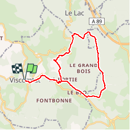
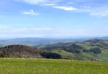
Randonnée Marche de 16,1 km à découvrir à Auvergne-Rhône-Alpes, Puy-de-Dôme, Viscomtat. Cette randonnée est proposée par boulinevelyne.
Description
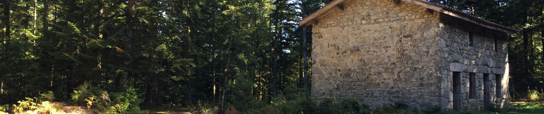
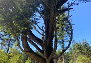
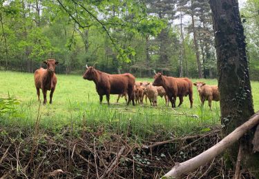
Randonnée de forêts.
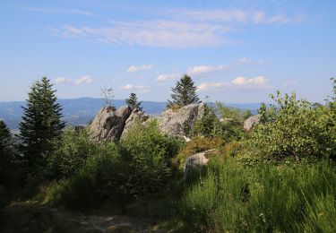
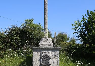
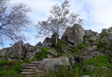
Seule difficulté, la montée sur La Croix du crash de la Caravelle en 10/1972 (pierreuse et abrupte)
Localisation
Pays :
France
Région :
Auvergne-Rhône-Alpes
Département/Province :
Puy-de-Dôme
Commune :
Viscomtat
Localité :
Unknown
Départ:(Dec)
Départ:(UTM)
552513 ; 5075112 (31T) N.
Commentaires
Randonnées à proximité
![Randonnée A pied Celles-sur-Durolle - Le Puy d'Oscot - Photo](https://media.geolcdn.com/t/375/260/72c9d667-7b0d-4bd4-bdcc-04dd7bd66561.jpeg&format=jpg&maxdim=2)
![A pied A pied](https://static1.geolcdn.com/sitytour/trail-icons/100.png)
Le Puy d'Oscot
A pied
Moyen
Celles-sur-Durolle,
Auvergne-Rhône-Alpes,
Puy-de-Dôme,
France
![](/images/other/stat-length.png)
15,2 km | 22 km-effort
4h 59min
![](https://static1.geolcdn.com/siteimages/upload/files/16400158638029165_repeat_loop_refresh_sync_direction_icon.png)
Oui
![Randonnée A pied Vollore-Montagne - Pierre Pamole - Photo](https://media.geolcdn.com/t/375/260/9aafc2fe-4126-48bc-9178-9ec4b9f65852.jpeg&format=jpg&maxdim=2)
![A pied A pied](https://static1.geolcdn.com/sitytour/trail-icons/100.png)
Pierre Pamole
A pied
Moyen
Vollore-Montagne,
Auvergne-Rhône-Alpes,
Puy-de-Dôme,
France
![](/images/other/stat-length.png)
15,5 km | 22 km-effort
4h 57min
![](https://static1.geolcdn.com/siteimages/upload/files/16400158638029165_repeat_loop_refresh_sync_direction_icon.png)
Oui
![Randonnée Marche Vollore-Montagne - Pierre pamole - Photo](https://media.geolcdn.com/t/375/260/6ff9709e-f627-424b-aa61-bab39a073f9f.jpg&format=jpg&maxdim=2)
![Marche Marche](https://static1.geolcdn.com/sitytour/trail-icons/101.png)
Pierre pamole
Marche
Moyen
Vollore-Montagne,
Auvergne-Rhône-Alpes,
Puy-de-Dôme,
France
![](/images/other/stat-length.png)
17 km | 24 km-effort
5h 42min
![](https://static1.geolcdn.com/siteimages/upload/files/16400158638029165_repeat_loop_refresh_sync_direction_icon.png)
Oui
![Randonnée A pied Vollore-Ville - Le Grun de Chignore - Photo](https://media.geolcdn.com/t/375/260/d670d619-94c1-4ebf-b98b-e05e4075dc52.jpeg&format=jpg&maxdim=2)
![A pied A pied](https://static1.geolcdn.com/sitytour/trail-icons/100.png)
Le Grun de Chignore
A pied
Moyen
Vollore-Ville,
Auvergne-Rhône-Alpes,
Puy-de-Dôme,
France
![](/images/other/stat-length.png)
15,1 km | 24 km-effort
5h 27min
![](https://static1.geolcdn.com/siteimages/upload/files/16400158638029165_repeat_loop_refresh_sync_direction_icon.png)
Non
![Randonnée Marche Sainte-Agathe - Ste_Agathe_Peage - Photo](https://media.geolcdn.com/t/375/260/ae73d591-dc6d-481d-b0b0-e0d1ded3bb7c.jpg&format=jpg&maxdim=2)
![Marche Marche](https://static1.geolcdn.com/sitytour/trail-icons/101.png)
Ste_Agathe_Peage
Marche
Moyen
Sainte-Agathe,
Auvergne-Rhône-Alpes,
Puy-de-Dôme,
France
![](/images/other/stat-length.png)
11,1 km | 16,4 km-effort
3h 15min
![](https://static1.geolcdn.com/siteimages/upload/files/16400158638029165_repeat_loop_refresh_sync_direction_icon.png)
Oui
![Randonnée Marche Vollore-Montagne - Vollore_Pierre_Pamole - Photo](https://media.geolcdn.com/t/375/260/6b691788-f28f-4215-bbc2-e488c61bc7e3.jpg&format=jpg&maxdim=2)
![Marche Marche](https://static1.geolcdn.com/sitytour/trail-icons/101.png)
Vollore_Pierre_Pamole
Marche
Moyen
Vollore-Montagne,
Auvergne-Rhône-Alpes,
Puy-de-Dôme,
France
![](/images/other/stat-length.png)
16,5 km | 23 km-effort
5h 0min
![](https://static1.geolcdn.com/siteimages/upload/files/16400158638029165_repeat_loop_refresh_sync_direction_icon.png)
Oui
![Randonnée Marche Sainte-Agathe - Saint agate 3ieme jour - Photo](https://media.geolcdn.com/t/375/260/339ddc93-a3ab-4bd3-b422-9ab8f5ca89f2.jpg&format=jpg&maxdim=2)
![Marche Marche](https://static1.geolcdn.com/sitytour/trail-icons/101.png)
Saint agate 3ieme jour
Marche
Difficile
Sainte-Agathe,
Auvergne-Rhône-Alpes,
Puy-de-Dôme,
France
![](/images/other/stat-length.png)
11,6 km | 16,1 km-effort
4h 45min
![](https://static1.geolcdn.com/siteimages/upload/files/16400158638029165_repeat_loop_refresh_sync_direction_icon.png)
Oui
![Randonnée Marche Celles-sur-Durolle - Celles_Puy_Oscot - Photo](https://media.geolcdn.com/t/375/260/0425f135-eff4-4901-95dd-17aa42b5fbc2.jpg&format=jpg&maxdim=2)
![Marche Marche](https://static1.geolcdn.com/sitytour/trail-icons/101.png)
Celles_Puy_Oscot
Marche
Moyen
Celles-sur-Durolle,
Auvergne-Rhône-Alpes,
Puy-de-Dôme,
France
![](/images/other/stat-length.png)
15,5 km | 22 km-effort
4h 40min
![](https://static1.geolcdn.com/siteimages/upload/files/16400158638029165_repeat_loop_refresh_sync_direction_icon.png)
Oui
![Randonnée Marche Sainte-Agathe - Le_Suchel_Rochemulet - Photo](https://media.geolcdn.com/t/375/260/1d26a0a4-1bd7-4301-9e42-620f890cb068.jpg&format=jpg&maxdim=2)
![Marche Marche](https://static1.geolcdn.com/sitytour/trail-icons/101.png)
Le_Suchel_Rochemulet
Marche
Facile
Sainte-Agathe,
Auvergne-Rhône-Alpes,
Puy-de-Dôme,
France
![](/images/other/stat-length.png)
6,7 km | 10,3 km-effort
2h 0min
![](https://static1.geolcdn.com/siteimages/upload/files/16400158638029165_repeat_loop_refresh_sync_direction_icon.png)
Oui