![](/images/other/stat-length.png)
![Randonnée Marche Begur - Begur randonnée rouge gr22 - Photo](https://media.geolcdn.com/t/1900/400/7d69d149-be67-4832-b8a1-4d7e29e720fb.jpg&format=pjpeg&maxdim=2)
Begur randonnée rouge gr22
jciclc
Utilisateur
![Longueur](/images/other/stat-length.png)
Longueur
18,2 km
![Altitude max](https://static1.geolcdn.com/siteimages/upload/files/1508320355ic_sort_altitude_max_24dp.png)
Altitude max
244 m
![Dénivelé positif](https://static1.geolcdn.com/siteimages/upload/files/1508320355ic_sort_den_pos_24dp.png)
Dénivelé positif
705 m
![Km-Effort](/images/other/stat-length.png)
Km-Effort
28 km
![Altitude min](https://static1.geolcdn.com/siteimages/upload/files/1508320355ic_sort_altitude_min_24dp.png)
Altitude min
5 m
![Dénivelé négatif](https://static1.geolcdn.com/siteimages/upload/files/1508320355ic_sort_den_neg_24dp.png)
Dénivelé négatif
715 m
![Boucle](https://static1.geolcdn.com/siteimages/upload/files/16400158638029165_repeat_loop_refresh_sync_direction_icon.png)
Boucle
Oui
Date de création :
2019-09-20 07:49:20.0
Dernière modification :
2019-09-20 16:03:43.948
![Marche](https://static1.geolcdn.com/sitytour/trail-icons/101.png)
4h52
Difficulté : Très difficile
![Scannez ce code QR pour ouvrir la randonnée dans l'application SityTrail](https://capi.geolives.com/qq0zvz2zws4bq2lad0pu/sitytour/trails/2209701/qr.png?size=200)
Application GPS de randonnée GRATUITE
À propos
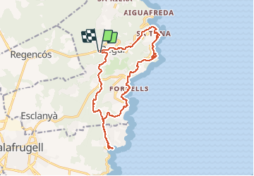
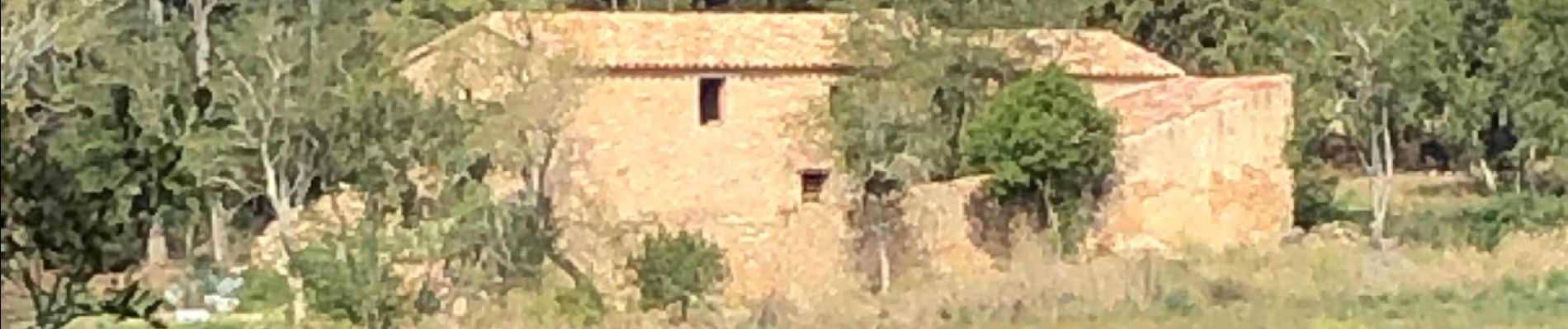
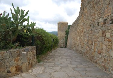
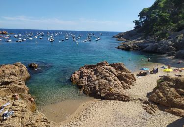
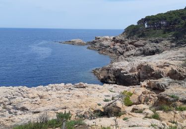
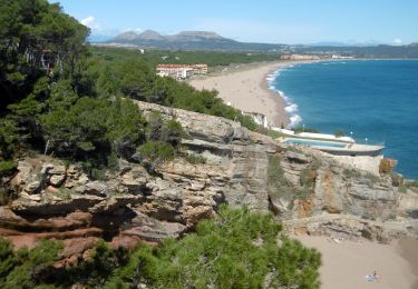
Randonnée Marche de 18,2 km à découvrir à Catalogne, Gérone, Begur. Cette randonnée est proposée par jciclc.
Description
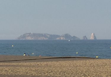
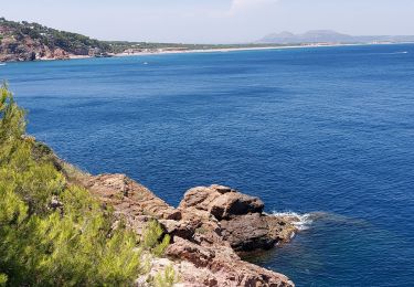
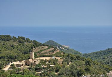
Très belle randonnée de Begur jusqu’à Tamariu puis Aiguablava, Fornells, Sa Tuna et retour à Begur. A travers pinèdes, plages, rochers ... de splendides vues sur la mer. Pour les courageux.
Localisation
Pays :
Espagne
Région :
Catalogne
Département/Province :
Gérone
Commune :
Begur
Localité :
Unknown
Départ:(Dec)
Départ:(UTM)
516794 ; 4644562 (31T) N.
Commentaires
Randonnées à proximité
![Randonnée A pied Pals - Pals-Palau-sator - Photo](https://media.geolcdn.com/t/375/260/fb13bdbe-802a-4d8f-9dd4-9db427da680b.jpeg&format=jpg&maxdim=2)
![A pied A pied](https://static1.geolcdn.com/sitytour/trail-icons/100.png)
Pals-Palau-sator
A pied
Facile
Pals,
Catalogne,
Gérone,
Espagne
![](/images/other/stat-length.png)
9,1 km | 10,5 km-effort
2h 22min
![](https://static1.geolcdn.com/siteimages/upload/files/16400158638029165_repeat_loop_refresh_sync_direction_icon.png)
Non
![Randonnée Marche Palafrugell - Tamaris / Cap de Bisbe - Photo](https://media.geolcdn.com/t/375/260/dbdc3b83-98eb-41cb-a18d-38e37ed5201c.jpg&format=jpg&maxdim=2)
![Marche Marche](https://static1.geolcdn.com/sitytour/trail-icons/101.png)
Tamaris / Cap de Bisbe
Marche
Moyen
Palafrugell,
Catalogne,
Gérone,
Espagne
![](/images/other/stat-length.png)
6,4 km | 10,4 km-effort
2h 40min
![](https://static1.geolcdn.com/siteimages/upload/files/16400158638029165_repeat_loop_refresh_sync_direction_icon.png)
Oui
![Randonnée Marche Begur - platja de Pals - Cap Begur - Photo](https://media.geolcdn.com/t/375/260/23e6d693-57e0-45a1-b8d4-faf71b452e70.jpg&format=jpg&maxdim=2)
![Marche Marche](https://static1.geolcdn.com/sitytour/trail-icons/101.png)
platja de Pals - Cap Begur
Marche
Moyen
Begur,
Catalogne,
Gérone,
Espagne
![](/images/other/stat-length.png)
17,6 km | 26 km-effort
5h 10min
![](https://static1.geolcdn.com/siteimages/upload/files/16400158638029165_repeat_loop_refresh_sync_direction_icon.png)
Oui
![Randonnée Marche Begur - Sa Riera 220722 - Photo](https://media.geolcdn.com/t/375/260/31931d9a-6c96-4724-99c1-7d96f03900c4.jpg&format=jpg&maxdim=2)
![Marche Marche](https://static1.geolcdn.com/sitytour/trail-icons/101.png)
Sa Riera 220722
Marche
Difficile
Begur,
Catalogne,
Gérone,
Espagne
![](/images/other/stat-length.png)
11,4 km | 16,4 km-effort
4h 52min
![](https://static1.geolcdn.com/siteimages/upload/files/16400158638029165_repeat_loop_refresh_sync_direction_icon.png)
Non
![Randonnée A pied Palafrugell - SL-C 25 poblat ibèric de St. Sebastià de la Guàrdia - Photo](https://media.geolcdn.com/t/375/260/706df360-bf02-431d-8602-4a94a3dd8094.jpeg&format=jpg&maxdim=2)
![A pied A pied](https://static1.geolcdn.com/sitytour/trail-icons/100.png)
SL-C 25 poblat ibèric de St. Sebastià de la Guàrdia
A pied
Facile
Palafrugell,
Catalogne,
Gérone,
Espagne
![](/images/other/stat-length.png)
4 km | 5,3 km-effort
1h 12min
![](https://static1.geolcdn.com/siteimages/upload/files/16400158638029165_repeat_loop_refresh_sync_direction_icon.png)
Non
![Randonnée A pied Begur - SL-C 23 reserva marina de Ses Negres - Photo](https://media.geolcdn.com/t/375/260/3fb2b13c-ba9a-4f49-9c7d-7611bd3f1fa0.jpeg&format=jpg&maxdim=2)
![A pied A pied](https://static1.geolcdn.com/sitytour/trail-icons/100.png)
SL-C 23 reserva marina de Ses Negres
A pied
Facile
Begur,
Catalogne,
Gérone,
Espagne
![](/images/other/stat-length.png)
9,9 km | 14,2 km-effort
3h 13min
![](https://static1.geolcdn.com/siteimages/upload/files/16400158638029165_repeat_loop_refresh_sync_direction_icon.png)
Oui
![Randonnée Marche Palafrugell - de Tamariu àcala Pedrosa. - Photo](https://media.geolcdn.com/t/375/260/84442707-0b0f-40c9-8278-29a09e98deb7.jpg&format=jpg&maxdim=2)
![Marche Marche](https://static1.geolcdn.com/sitytour/trail-icons/101.png)
de Tamariu àcala Pedrosa.
Marche
Moyen
Palafrugell,
Catalogne,
Gérone,
Espagne
![](/images/other/stat-length.png)
3,7 km | 5 km-effort
1h 15min
![](https://static1.geolcdn.com/siteimages/upload/files/16400158638029165_repeat_loop_refresh_sync_direction_icon.png)
Oui
![Marche Marche](https://static1.geolcdn.com/sitytour/trail-icons/101.png)
![Randonnée V.T.T. Palafrugell - mont cargol - Photo](https://media.geolcdn.com/t/375/260/26db6a66-a0dc-49af-8532-e3bd2d831509.jpg&format=jpg&maxdim=2)
![V.T.T. V.T.T.](https://static1.geolcdn.com/sitytour/trail-icons/202.png)
mont cargol
V.T.T.
Très difficile
Palafrugell,
Catalogne,
Gérone,
Espagne
![](/images/other/stat-length.png)
36 km | 47 km-effort
3h 46min
![](https://static1.geolcdn.com/siteimages/upload/files/16400158638029165_repeat_loop_refresh_sync_direction_icon.png)
Oui