Randonnée Course à pied Gannat - jour 10 CAP Jeanot - Photo
 jeannat
jeannat

Utilisateur

© OpenStreetMap contributors
Longueur
Longueur
31 km
Altitude max
Altitude max
718 m
Dénivelé positif
Dénivelé positif
741 m
Km-Effort
Km-Effort  
40 km
Altitude min
Altitude min
346 m
Dénivelé négatif
Dénivelé négatif
399 m
Boucle
Boucle
Non
Date de création :
2019-09-18 11:59:02.349
Dernière modification :
2019-09-24 09:21:04.196

(0 Avis)

Course à pied
Course à pied
3h59
Difficulté : Très facile

Scannez ce code QR pour ouvrir la randonnée dans l'application SityTrail

Application GPS de randonnée GRATUITE

Logo SityTrail SityTrail

IGN / Instituts géographiques

Télécharger SityTrail sur l'App Store Télécharger SityTrail sur Google Play

Logo SityTrail SityTrail World

Le monde est à vous

Télécharger SityTrail sur l'App Store Télécharger SityTrail sur Google Play Télécharger SityTrail sur Huawei AppGallery

À propos

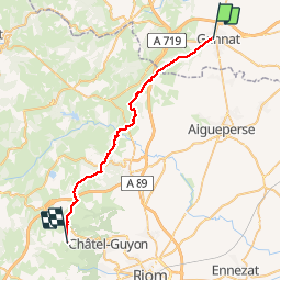
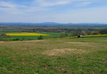
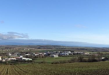
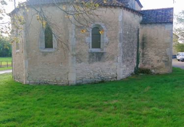
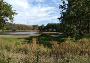
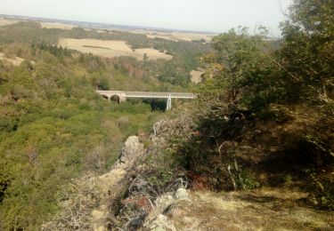
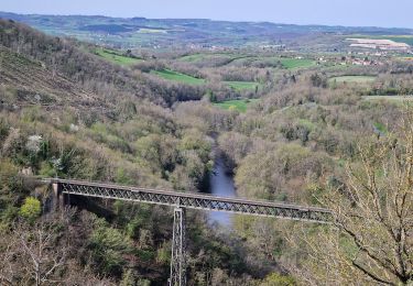
Randonnée Course à pied de 31 km à découvrir à Auvergne-Rhône-Alpes, Allier, Gannat. Cette randonnée est proposée par jeannat.

Description

de Gannat à Loubeyrat.

Profil altimétrique

Photos

Localisation

Pays :
France
Région :
Auvergne-Rhône-Alpes
Département/Province :
Allier
Commune :
Gannat
Localité :
Unknown
Départ:(UTM)
514918 ; 5105128 (31T) N.

Randonnées à proximité

Randonnée A pied Vensat - De manoirs en chateaux - Photo
A pied
GUIDE+

A pied

Facile
Vensat, Auvergne-Rhône-Alpes, Puy-de-Dôme, France
9,5 km | 12,3 km-effort
2h 47min
Oui
Randonnée Marche Saint-Genès-du-Retz - St_Genes_Retz_Pierre_Sanglante - Photo
Marche
GUIDE
jagarnier

Marche

Facile
Saint-Genès-du-Retz, Auvergne-Rhône-Alpes, Puy-de-Dôme, France
9,6 km | 10,7 km-effort
2h 45min
Oui
Randonnée Marche Mazerier - Les collines de Mazerier  - Photo
Marche
Gegetop

Marche

Moyen
(1)
Mazerier, Auvergne-Rhône-Alpes, Allier, France
14,1 km | 17 km-effort
3h 23min
Oui
Randonnée Marche Gannat - Gannat - Photo
Marche
guy63

Marche

Moyen
Gannat, Auvergne-Rhône-Alpes, Allier, France
7,5 km | 9,1 km-effort
2h 40min
Oui
Randonnée Marche nordique Saint-Priest-d'Andelot - St Priest d'Andelot  - Photo
Marche nordique
Gegetop

Marche nordique

Facile
(1)
Saint-Priest-d'Andelot, Auvergne-Rhône-Alpes, Allier, France
14,3 km | 17,5 km-effort
3h 31min
Oui
Randonnée V.T.C. Gannat - jour 10 - Photo
V.T.C.
nathbab

V.T.C.

Très facile
Gannat, Auvergne-Rhône-Alpes, Allier, France
31 km | 38 km-effort
2h 40min
Non
Randonnée Marche Mazerier - Maziere 03 - Photo
Marche
raypat

Marche

Très facile
Mazerier, Auvergne-Rhône-Alpes, Allier, France
14,4 km | 17,4 km-effort
3h 20min
Oui
Randonnée Marche Saint-Bonnet-de-Rochefort - les tressots - Photo
Marche
patrickboisard

Marche

Moyen
Saint-Bonnet-de-Rochefort, Auvergne-Rhône-Alpes, Allier, France
6,6 km | 8,6 km-effort
1h 37min
Oui
Randonnée Marche Charmes - Charmes 03 - Photo
Marche
raypat

Marche

Très facile
Charmes, Auvergne-Rhône-Alpes, Allier, France
19,4 km | 22 km-effort
5h 17min
Oui


Fermer
Mes abonnements