![](/images/other/stat-length.png)
![Randonnée Marche Granges-Narboz - Les Granges Dessus - belvédère sur le château de Joux - Photo](https://media.geolcdn.com/t/1900/400/f445c959-0e50-4069-aa61-d7c3dac45fd2.jpg&format=pjpeg&maxdim=2)
Les Granges Dessus - belvédère sur le château de Joux
nicolibris
Utilisateur
![Longueur](/images/other/stat-length.png)
Longueur
10,9 km
![Altitude max](https://static1.geolcdn.com/siteimages/upload/files/1508320355ic_sort_altitude_max_24dp.png)
Altitude max
1035 m
![Dénivelé positif](https://static1.geolcdn.com/siteimages/upload/files/1508320355ic_sort_den_pos_24dp.png)
Dénivelé positif
269 m
![Km-Effort](/images/other/stat-length.png)
Km-Effort
14,4 km
![Altitude min](https://static1.geolcdn.com/siteimages/upload/files/1508320355ic_sort_altitude_min_24dp.png)
Altitude min
910 m
![Dénivelé négatif](https://static1.geolcdn.com/siteimages/upload/files/1508320355ic_sort_den_neg_24dp.png)
Dénivelé négatif
269 m
![Boucle](https://static1.geolcdn.com/siteimages/upload/files/16400158638029165_repeat_loop_refresh_sync_direction_icon.png)
Boucle
Oui
Date de création :
2019-09-18 10:17:14.71
Dernière modification :
2019-09-20 16:50:49.446
![Marche](https://static1.geolcdn.com/sitytour/trail-icons/101.png)
3h08
Difficulté : Moyen
![Scannez ce code QR pour ouvrir la randonnée dans l'application SityTrail](https://capi.geolives.com/qq0zvz2zws4bq2lad0pu/sitytour/trails/2207762/qr.png?size=200)
Application GPS de randonnée GRATUITE
À propos
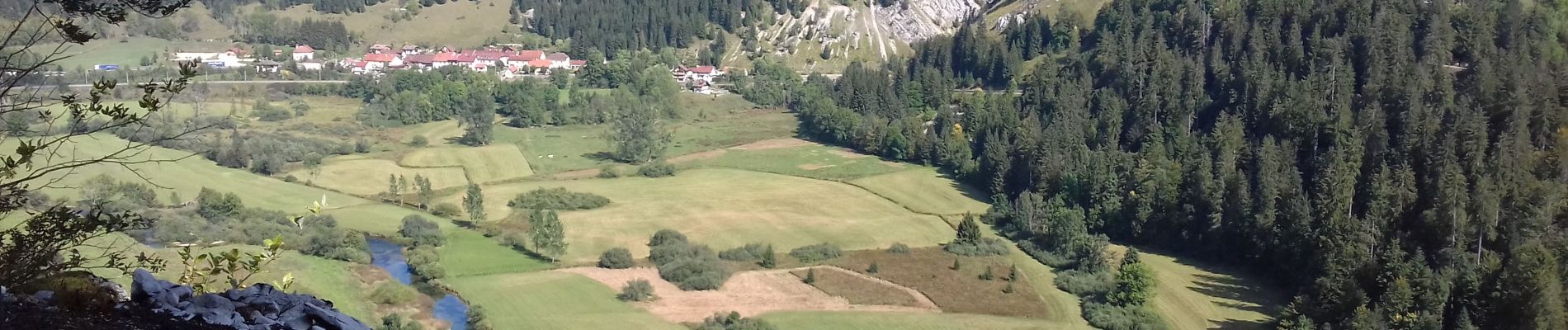
Randonnée Marche de 10,9 km à découvrir à Bourgogne-Franche-Comté, Doubs, Granges-Narboz. Cette randonnée est proposée par nicolibris.
Description
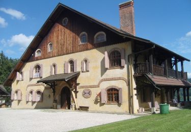
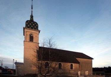
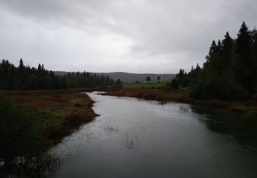
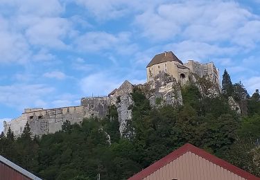
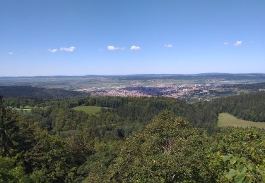
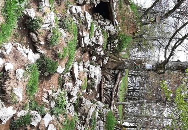
Très belle randonnée en grande partie en sous-bois. Très beau belvédère sur le château de Joux, le fort Mahler, le Doubs.
Localisation
Pays :
France
Région :
Bourgogne-Franche-Comté
Département/Province :
Doubs
Commune :
Granges-Narboz
Localité :
Unknown
Départ:(Dec)
Départ:(UTM)
296018 ; 5194515 (32T) N.
Commentaires
Randonnées à proximité
![Randonnée A pied Les Grangettes - La Pierre qui Tourne - Photo](https://media.geolcdn.com/t/375/260/9bc03250-aa40-4533-aaa8-f54e2fea6187.jpeg&format=jpg&maxdim=2)
![A pied A pied](https://static1.geolcdn.com/sitytour/trail-icons/100.png)
La Pierre qui Tourne
A pied
Facile
Les Grangettes,
Bourgogne-Franche-Comté,
Doubs,
France
![](/images/other/stat-length.png)
8,2 km | 10,7 km-effort
2h 25min
![](https://static1.geolcdn.com/siteimages/upload/files/16400158638029165_repeat_loop_refresh_sync_direction_icon.png)
Oui
![Randonnée A pied Malpas - Le Tour du Lac de Malpas - Photo](https://media.geolcdn.com/t/375/260/0837636c-66a1-4405-831a-9c313453c2cb.jpeg&format=jpg&maxdim=2)
![A pied A pied](https://static1.geolcdn.com/sitytour/trail-icons/100.png)
Le Tour du Lac de Malpas
A pied
Facile
Malpas,
Bourgogne-Franche-Comté,
Doubs,
France
![](/images/other/stat-length.png)
4,9 km | 5,7 km-effort
1h 17min
![](https://static1.geolcdn.com/siteimages/upload/files/16400158638029165_repeat_loop_refresh_sync_direction_icon.png)
Oui
![Randonnée Marche Montperreux - Chaon Saint Point - Lac - Photo](https://media.geolcdn.com/t/375/260/1cb44616-4442-4252-833e-fb8b82bf1bbb.jpg&format=jpg&maxdim=2)
![Marche Marche](https://static1.geolcdn.com/sitytour/trail-icons/101.png)
Chaon Saint Point - Lac
Marche
Facile
(1)
Montperreux,
Bourgogne-Franche-Comté,
Doubs,
France
![](/images/other/stat-length.png)
15,1 km | 19,4 km-effort
3h 5min
![](https://static1.geolcdn.com/siteimages/upload/files/16400158638029165_repeat_loop_refresh_sync_direction_icon.png)
Oui
![Randonnée Marche Montperreux - Sentier de la découverte - Chaon Malbuisson - Photo](https://media.geolcdn.com/t/375/260/9dad01dd-973e-4ef4-b8da-7f7478c28fff.jpg&format=jpg&maxdim=2)
![Marche Marche](https://static1.geolcdn.com/sitytour/trail-icons/101.png)
Sentier de la découverte - Chaon Malbuisson
Marche
Facile
Montperreux,
Bourgogne-Franche-Comté,
Doubs,
France
![](/images/other/stat-length.png)
9,8 km | 12,3 km-effort
2h 12min
![](https://static1.geolcdn.com/siteimages/upload/files/16400158638029165_repeat_loop_refresh_sync_direction_icon.png)
Oui
![Randonnée Marche Montperreux - La Gouille - Photo](https://media.geolcdn.com/t/375/260/85cd76c8-b938-42d3-aec6-148fb2329c9a.jpg&format=jpg&maxdim=2)
![Marche Marche](https://static1.geolcdn.com/sitytour/trail-icons/101.png)
La Gouille
Marche
Facile
Montperreux,
Bourgogne-Franche-Comté,
Doubs,
France
![](/images/other/stat-length.png)
8 km | 10,1 km-effort
1h 53min
![](https://static1.geolcdn.com/siteimages/upload/files/16400158638029165_repeat_loop_refresh_sync_direction_icon.png)
Oui
![Randonnée Marche Montperreux - La source bleue - Photo](https://media.geolcdn.com/t/375/260/8f4113b6-be86-421b-922f-6c8f51836eb0.jpg&format=jpg&maxdim=2)
![Marche Marche](https://static1.geolcdn.com/sitytour/trail-icons/101.png)
La source bleue
Marche
Facile
Montperreux,
Bourgogne-Franche-Comté,
Doubs,
France
![](/images/other/stat-length.png)
9,8 km | 13,4 km-effort
2h 13min
![](https://static1.geolcdn.com/siteimages/upload/files/16400158638029165_repeat_loop_refresh_sync_direction_icon.png)
Oui
![Randonnée Marche La Cluse-et-Mijoux - le grand taureau, la Cluse et Mijoux - Photo](https://media.geolcdn.com/t/375/260/0cb61e11-ae8c-43af-9765-5d7fbec9633a.jpg&format=jpg&maxdim=2)
![Marche Marche](https://static1.geolcdn.com/sitytour/trail-icons/101.png)
le grand taureau, la Cluse et Mijoux
Marche
Moyen
La Cluse-et-Mijoux,
Bourgogne-Franche-Comté,
Doubs,
France
![](/images/other/stat-length.png)
24 km | 34 km-effort
5h 26min
![](https://static1.geolcdn.com/siteimages/upload/files/16400158638029165_repeat_loop_refresh_sync_direction_icon.png)
Oui
![Randonnée Marche Pontarlier - le grand taureau, Pontarlier - Photo](https://media.geolcdn.com/t/375/260/d15871e2-3d8a-47b8-b9b7-cb07d343a2f0.jpg&format=jpg&maxdim=2)
![Marche Marche](https://static1.geolcdn.com/sitytour/trail-icons/101.png)
le grand taureau, Pontarlier
Marche
Difficile
Pontarlier,
Bourgogne-Franche-Comté,
Doubs,
France
![](/images/other/stat-length.png)
20 km | 29 km-effort
3h 36min
![](https://static1.geolcdn.com/siteimages/upload/files/16400158638029165_repeat_loop_refresh_sync_direction_icon.png)
Oui
![Randonnée Marche Pontarlier - Le Grand Taureau 19.3 km D+661 m 20240512 - Photo](https://media.geolcdn.com/t/375/260/cb93b4ef-1227-4efa-ae03-315ee0ca5b8b.jpg&format=jpg&maxdim=2)
![Marche Marche](https://static1.geolcdn.com/sitytour/trail-icons/101.png)
Le Grand Taureau 19.3 km D+661 m 20240512
Marche
Très difficile
Pontarlier,
Bourgogne-Franche-Comté,
Doubs,
France
![](/images/other/stat-length.png)
19,3 km | 28 km-effort
5h 5min
![](https://static1.geolcdn.com/siteimages/upload/files/16400158638029165_repeat_loop_refresh_sync_direction_icon.png)
Oui