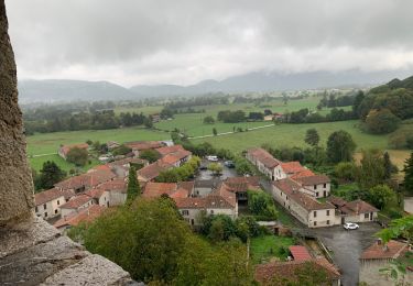
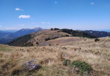
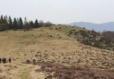
Randonnée Marche Herran -  FR - Pic de Paloumere en boucle par crête de Cournudere - Photo

FR - Pic de Paloumere en boucle par crête de Cournudere

 VACHER31
VACHER31

Utilisateur

© OpenStreetMap contributors
Longueur
Longueur
11,1 km
Altitude max
Altitude max
1595 m
Dénivelé positif
Dénivelé positif
623 m
Km-Effort
Km-Effort  
19,4 km
Altitude min
Altitude min
1207 m
Dénivelé négatif
Dénivelé négatif
626 m
Boucle
Boucle
Oui
Date de création :
2019-09-14 07:59:33.703
Dernière modification :
2019-09-14 15:54:28.897

(0 Avis)

Marche
Marche
4h23
Difficulté : Moyen

Scannez ce code QR pour ouvrir la randonnée dans l'application SityTrail

Application GPS de randonnée GRATUITE

Logo SityTrail SityTrail

IGN / Instituts géographiques

Télécharger SityTrail sur l'App Store Télécharger SityTrail sur Google Play

Logo SityTrail SityTrail World

Le monde est à vous

Télécharger SityTrail sur l'App Store Télécharger SityTrail sur Google Play Télécharger SityTrail sur Huawei AppGallery

À propos

Randonnée Marche de 11,1 km à découvrir à Occitanie, Haute-Garonne, Herran. Cette randonnée est proposée par VACHER31.

Description

Joli panorama sur les vallées et sur les sommets

Profil altimétrique

Localisation

Pays :
France
Région :
Occitanie
Département/Province :
Haute-Garonne
Commune :
Herran
Localité :
Unknown
Départ:(Dec)
Départ:(UTM)
327004 ; 4759032 (31T) N.

Randonnées à proximité

Randonnée Marche Portet-d'Aspet - 2023 09 21 CHEMIN du PIÉMONT PYRÉNÉEN - 14ème étape : Portet-d’Aspet - le Col - Juzet-d’Izaut - St  Pet-d’Ardet - Barbazan - Valcabrère - st Bertrand de Comminges - Photo
Marche
LEGUE

Marche

Très difficile
Portet-d'Aspet, Occitanie, Haute-Garonne, France
46 km | 67 km-effort
8h 46min
Non
Randonnée Marche Herran - 2020-08-20 Arbas -  cabane de roqué pic -  de paloumère - sommet de cornudère. - Photo
Marche
jacq58

Marche

Moyen
Herran, Occitanie, Haute-Garonne, France
13,2 km | 23 km-effort
4h 14min
Oui
Randonnée Marche Arbas - Arbas, chemin du facteur avec extension Penne blanque - Photo
Marche
PhilB24

Marche

Moyen
Arbas, Occitanie, Haute-Garonne, France
13,8 km | 23 km-effort
4h 52min
Oui
Randonnée Marche Portet-d'Aspet - Crête de Cournudère - Photo
Marche
GUIDE
toutankhcarton

Marche

Facile
Portet-d'Aspet, Occitanie, Haute-Garonne, France
12,8 km | 22 km-effort
4h 58min
Oui
Randonnée Marche Herran - Balade Coume Paloumere - Photo
Marche
Timax31

Marche

Très difficile
Herran, Occitanie, Haute-Garonne, France
11,1 km | 19,5 km-effort
5h 6min
Oui
Randonnée Marche Portet-d'Aspet - Le Puech et cabane de Piejeau en boucle - Photo
Marche
chrisgps

Marche

Facile
Portet-d'Aspet, Occitanie, Haute-Garonne, France
12,4 km | 22 km-effort
5h 43min
Oui
Randonnée V.T.T. Arbas - Circuit VTT n°32 Arbas - Photo
V.T.T.
tracegps

V.T.T.

Très difficile
Arbas, Occitanie, Haute-Garonne, France
27 km | 40 km-effort
3h 30min
Oui
Randonnée V.T.T. Arbas - Circuit VTT n°31 à Arbas - Photo
V.T.T.
tracegps

V.T.T.

Difficile
(1)
Arbas, Occitanie, Haute-Garonne, France
22 km | 32 km-effort
2h 30min
Oui
Randonnée V.T.T. Herran - Espace VTT FFC Pyrénées Comminges - n° 33 La croix de Guéret  - Photo
V.T.T.
tracegps

V.T.T.

Très difficile
Herran, Occitanie, Haute-Garonne, France
12,2 km | 21 km-effort
1h 45min
Oui


Fermer
Mes abonnements