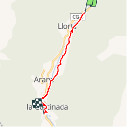
![](/images/other/stat-length.png)
![Randonnée Marche Llorts - Andorre TSM groupe 2 mardi 10 septembre après-midi - Photo](https://media.geolcdn.com/t/1900/400/ext.pjpeg?maxdim=2&url=https%3A%2F%2Fmedia.geolcdn.com%2Ff%2Ffc847cd1-6465-46e2-840b-ad5a182e14dd.jpg)
Andorre TSM groupe 2 mardi 10 septembre après-midi
zanogueb
Utilisateur
![Longueur](/images/other/stat-length.png)
Longueur
4,4 km
![Altitude max](https://static1.geolcdn.com/siteimages/upload/files/1508320355ic_sort_altitude_max_24dp.png)
Altitude max
1445 m
![Dénivelé positif](https://static1.geolcdn.com/siteimages/upload/files/1508320355ic_sort_den_pos_24dp.png)
Dénivelé positif
21 m
![Km-Effort](/images/other/stat-length.png)
Km-Effort
5 km
![Altitude min](https://static1.geolcdn.com/siteimages/upload/files/1508320355ic_sort_altitude_min_24dp.png)
Altitude min
1330 m
![Dénivelé négatif](https://static1.geolcdn.com/siteimages/upload/files/1508320355ic_sort_den_neg_24dp.png)
Dénivelé négatif
118 m
![Boucle](https://static1.geolcdn.com/siteimages/upload/files/16400158638029165_repeat_loop_refresh_sync_direction_icon.png)
Boucle
Non
Date de création :
2019-09-10 11:55:00.947
Dernière modification :
2019-09-16 20:10:08.98
![Marche](https://static1.geolcdn.com/sitytour/trail-icons/101.png)
2h22
Difficulté : Très facile
![Scannez ce code QR pour ouvrir la randonnée dans l'application SityTrail](https://capi.geolives.com/qq0zvz2zws4bq2lad0pu/sitytour/trails/2197508/qr.png?size=200)
Application GPS de randonnée GRATUITE
À propos
Randonnée Marche de 4,4 km à découvrir à Andorre. Cette randonnée est proposée par zanogueb.
Description
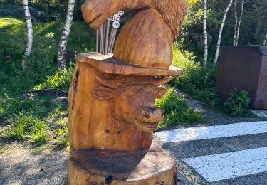
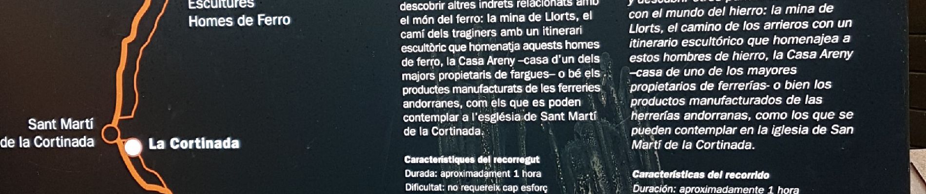
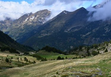
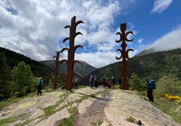
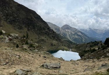
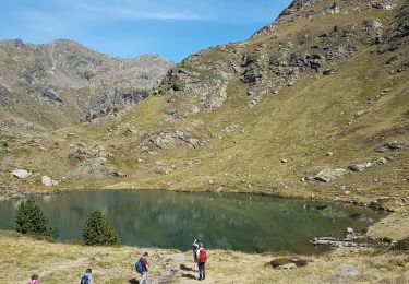
Départ de la mine de fer de Llorts pour une jolie promenade en fond de vallée par le « Cami Ral ».
Ce chemin rural conduira entre montagne, champs et rivière à la Cortinada. Visite du centre d’interprétation de la Nature et de la vallée de Sorteny.
Localisation
Pays :
Andorre
Région :
Ordino
Département/Province :
Ordino
Commune :
Llorts
Localité :
Unknown
Départ:(Dec)
Départ:(UTM)
379602 ; 4717408 (31T) N.
Commentaires
Randonnées à proximité
![Randonnée Marche - llorts_lac_angonella - Photo](https://media.geolcdn.com/t/375/260/ext.jpg?maxdim=2&url=https%3A%2F%2Fservices.sitytrail.com%2FGeolivesWS%2FDownloadMedia.ashx%3FTrailID%3D793517%26Media%3Dfix__20170721150953.jpg)
![Marche Marche](https://static1.geolcdn.com/sitytour/trail-icons/101.png)
![Randonnée Marche - Lac Estany de l'Estanyo - Photo](https://media.geolcdn.com/t/375/260/ext.jpg?maxdim=2&url=https%3A%2F%2Fmedia.geolcdn.com%2Ff%2Ff7c5075f-2281-4dcd-8411-36ac3bb86224.JPG)
![Marche Marche](https://static1.geolcdn.com/sitytour/trail-icons/101.png)
![Randonnée Marche - 3 lacs d'Estany - Photo](https://media.geolcdn.com/t/375/260/ext.jpg?maxdim=2&url=https%3A%2F%2Fmedia.geolcdn.com%2Ff%2F82ced347-6639-4031-81d3-0328c61a8d28.JPG)
![Marche Marche](https://static1.geolcdn.com/sitytour/trail-icons/101.png)
![Randonnée Marche - Andorre TSM groupe 2 vendredi 13 septembre - Photo](https://media.geolcdn.com/t/375/260/ext.jpg?maxdim=2&url=https%3A%2F%2Fmedia.geolcdn.com%2Ff%2F695cc9e4-9bde-4be3-97a9-506aad1c36da.jpg)
![Marche Marche](https://static1.geolcdn.com/sitytour/trail-icons/101.png)
Andorre TSM groupe 2 vendredi 13 septembre
Marche
Moyen
,
,
,
Andorre
![](/images/other/stat-length.png)
5,4 km | 10 km-effort
3h 39min
![](https://static1.geolcdn.com/siteimages/upload/files/16400158638029165_repeat_loop_refresh_sync_direction_icon.png)
Non
![Randonnée A pied - Andorre : Parc de Sorteny - Photo](https://media.geolcdn.com/t/375/260/ext.jpg?maxdim=2&url=https%3A%2F%2Fmedia.geolcdn.com%2Ff%2F078ec51f-0c6b-4dce-9631-936e4d33ee68.jpg)
![A pied A pied](https://static1.geolcdn.com/sitytour/trail-icons/100.png)
![Randonnée sport - Ortiz - Photo](https://media.geolcdn.com/t/375/260/ext.jpg?maxdim=2&url=https%3A%2F%2Fmedia.geolcdn.com%2Ff%2F119fa109-5a2a-456e-9c8b-e18e4b6e9501.jpg)
![Randonnée sport - Arcalis - Photo](https://media.geolcdn.com/t/375/260/ext.jpg?maxdim=2&url=https%3A%2F%2Fmedia.geolcdn.com%2Ff%2F04058f44-9f8f-463f-a1cc-559cb86b42ee.jpg)
![Randonnée Marche - Casamanya S + pic del Miguel + Casamanya S - Photo](https://media.geolcdn.com/t/375/260/ext.jpg?maxdim=2&url=https%3A%2F%2Fstatic1.geolcdn.com%2Fsiteimages%2Fupload%2Ffiles%2F1553511878bg_sport_marche.png)
![Marche Marche](https://static1.geolcdn.com/sitytour/trail-icons/101.png)
Casamanya S + pic del Miguel + Casamanya S
Marche
Difficile
,
,
,
Andorre
![](/images/other/stat-length.png)
7,5 km | 18,4 km-effort
2h 58min
![](https://static1.geolcdn.com/siteimages/upload/files/16400158638029165_repeat_loop_refresh_sync_direction_icon.png)
Oui
![Randonnée Marche - Lacs de Tristagne - Andorre - Photo](https://media.geolcdn.com/t/375/260/ext.jpg?maxdim=2&url=https%3A%2F%2Fstatic1.geolcdn.com%2Fsiteimages%2Fupload%2Ffiles%2F1553511878bg_sport_marche.png)
![Marche Marche](https://static1.geolcdn.com/sitytour/trail-icons/101.png)