Randonnée V.T.T. Cheniménil - chnérante2019 30km - Photo

chnérante2019 30km

 BOSSU88
BOSSU88

Utilisateur

© OpenStreetMap contributors
Longueur
Longueur
34 km
Altitude max
Altitude max
617 m
Dénivelé positif
Dénivelé positif
1003 m
Km-Effort
Km-Effort  
48 km
Altitude min
Altitude min
352 m
Dénivelé négatif
Dénivelé négatif
1006 m
Boucle
Boucle
Oui
Date de création :
2019-09-01 07:52:18.616
Dernière modification :
2019-09-08 06:20:59.964

(0 Avis)

V.T.T.
V.T.T.
3h51
Difficulté : Moyen

Scannez ce code QR pour ouvrir la randonnée dans l'application SityTrail

Application GPS de randonnée GRATUITE

Logo SityTrail SityTrail

IGN / Instituts géographiques

Télécharger SityTrail sur l'App Store Télécharger SityTrail sur Google Play

Logo SityTrail SityTrail World

Le monde est à vous

Télécharger SityTrail sur l'App Store Télécharger SityTrail sur Google Play Télécharger SityTrail sur Huawei AppGallery

À propos

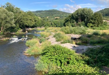
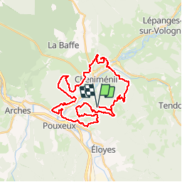
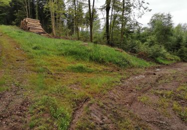
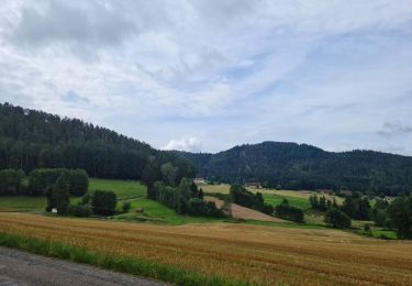
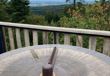
Randonnée V.T.T. de 34 km à découvrir à Grand Est, Vosges, Cheniménil. Cette randonnée est proposée par BOSSU88.

Description

Magnifique variété entre chemins et sentiers.

Profil altimétrique

Localisation

Pays :
France
Région :
Grand Est
Département/Province :
Vosges
Commune :
Cheniménil
Localité :
Unknown
Départ:(UTM)
321819 ; 5332441 (32U) N.

Randonnées à proximité

Randonnée Marche Éloyes - eloyes champ dolant - Photo
Marche
lacote

Marche

Moyen
(2)
Éloyes, Grand Est, Vosges, France
8,2 km | 12,4 km-effort
2h 26min
Oui
Randonnée Marche Saint-Étienne-lès-Remiremont - Les cuveaux à Eloyes - Photo
Marche
regish54

Marche

Facile
Saint-Étienne-lès-Remiremont, Grand Est, Vosges, France
4,5 km | 5,6 km-effort
1h 23min
Non
Randonnée Marche Jarménil - haut jarmenil 2 - Photo
Marche
lacote

Marche

Moyen
(1)
Jarménil, Grand Est, Vosges, France
12,3 km | 16,8 km-effort
2h 39min
Oui
Randonnée Marche Saint-Étienne-lès-Remiremont - Vers la Tête des Cuveaux - Photo
Marche
jeanclaude12

Marche

Facile
(1)
Saint-Étienne-lès-Remiremont, Grand Est, Vosges, France
9 km | 12,4 km-effort
2h 30min
Oui
Randonnée Marche Éloyes - Belvédère et Tête des Cuveaux - Photo
Marche
jpblimond

Marche

Facile
Éloyes, Grand Est, Vosges, France
3,7 km | 5,7 km-effort
1h 24min
Oui
Randonnée Marche Éloyes - Éloyes - Photo
Marche
jpblimond

Marche

Moyen
Éloyes, Grand Est, Vosges, France
12,3 km | 17,2 km-effort
3h 12min
Oui
Randonnée Marche Pouxeux - Pouxeux  - Photo
Marche
STjmd300945

Marche

Difficile
Pouxeux, Grand Est, Vosges, France
11,9 km | 15,7 km-effort
2h 57min
Oui
Randonnée Marche Pouxeux - St Nabord Malaide - Photo
Marche
STjmd300945

Marche

Difficile
Pouxeux, Grand Est, Vosges, France
11,2 km | 15 km-effort
3h 32min
Oui
Randonnée Marche Éloyes - 18-02-22 tête des cuveaux - Photo
Marche
annefrance70

Marche

Facile
(1)
Éloyes, Grand Est, Vosges, France
5,3 km | 8,6 km-effort
1h 26min
Oui


Fermer
Mes abonnements