


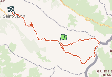

13,1 km | 23 km-effort


Utilisateur


Application GPS de randonnée GRATUITE
 SityTrail
IGN / Instituts géographiques
SityTrail World
Le monde est à vous
Randonnée Marche de 19 km à découvrir à Provence-Alpes-Côte d'Azur, Hautes-Alpes, Saint-Véran. Cette randonnée est proposée par BADEY.
Départ sous la chapelle de Clausis
Refuge de la Blanche
lac inférieur et supérieur du Blanchet
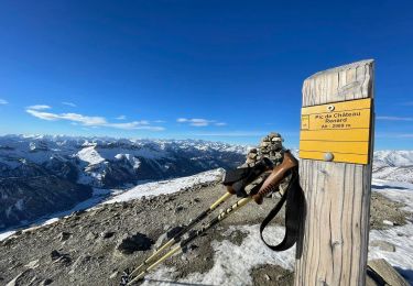
Col de St Véran
Col de Chamoussière
et retour ST Véran par le canal

Marche

Marche

Marche

Raquettes à neige
Raquettes à neige

Marche

Marche

Marche

Marche