![](/images/other/stat-length.png)
![Randonnée V.T.T. Sainte-Marie-de-Ré - IDR002-Île de Ré-Pont-Anse Aiguillon - Photo](https://media.geolcdn.com/t/1900/400/ext.pjpeg?maxdim=2&url=https%3A%2F%2Fservices.sitytrail.com%2FGeolivesWS%2FDownloadMedia.ashx%3FTrailID%3D218315%26Media%3Dfix__20130901173120.jpg)
IDR002-Île de Ré-Pont-Anse Aiguillon
Polo-31
Utilisateur
![Longueur](/images/other/stat-length.png)
Longueur
49 km
![Altitude max](https://static1.geolcdn.com/siteimages/upload/files/1508320355ic_sort_altitude_max_24dp.png)
Altitude max
16 m
![Dénivelé positif](https://static1.geolcdn.com/siteimages/upload/files/1508320355ic_sort_den_pos_24dp.png)
Dénivelé positif
191 m
![Km-Effort](/images/other/stat-length.png)
Km-Effort
52 km
![Altitude min](https://static1.geolcdn.com/siteimages/upload/files/1508320355ic_sort_altitude_min_24dp.png)
Altitude min
-3 m
![Dénivelé négatif](https://static1.geolcdn.com/siteimages/upload/files/1508320355ic_sort_den_neg_24dp.png)
Dénivelé négatif
187 m
![Boucle](https://static1.geolcdn.com/siteimages/upload/files/16400158638029165_repeat_loop_refresh_sync_direction_icon.png)
Boucle
Non
Date de création :
2014-12-10 00:00:00.0
Dernière modification :
2014-12-10 00:00:00.0
![V.T.T.](https://static1.geolcdn.com/sitytour/trail-icons/202.png)
3h29
Difficulté : Très facile
![Scannez ce code QR pour ouvrir la randonnée dans l'application SityTrail](https://capi.geolives.com/qq0zvz2zws4bq2lad0pu/sitytour/trails/218315/qr.png?size=200)
Application GPS de randonnée GRATUITE
À propos
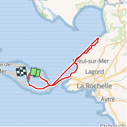
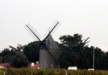
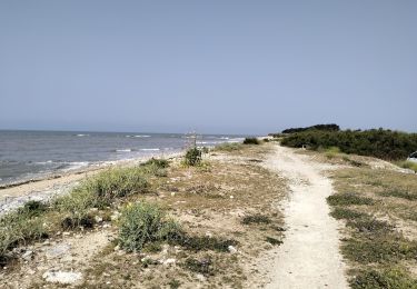
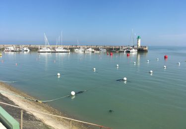
Randonnée V.T.T. de 49 km à découvrir à Nouvelle-Aquitaine, Charente-Maritime, Sainte-Marie-de-Ré. Cette randonnée est proposée par Polo-31.
Description
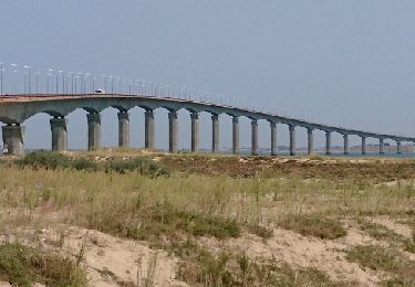
Départ entre La Noue et La Flotte, passer le pont et faire un A/R jusqu'à Esnandes le long des falaises par le chemin cyclable. Perte GPS après le pont mais à partir du Pont le circuit fait un A/R le long de la Côte.
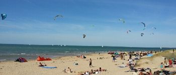
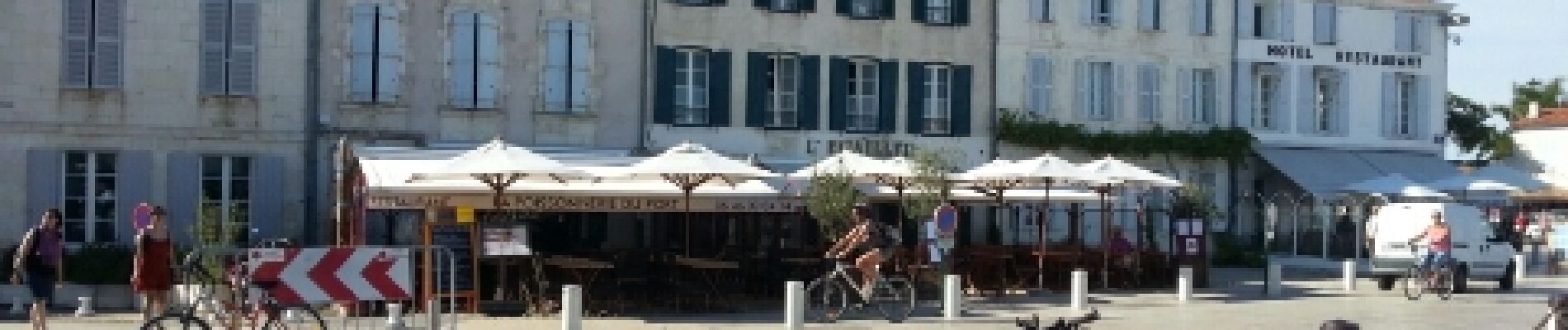
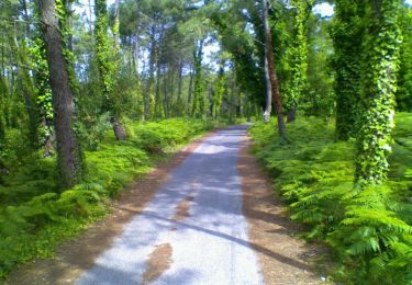
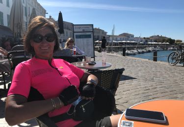
Localisation
Pays :
France
Région :
Nouvelle-Aquitaine
Département/Province :
Charente-Maritime
Commune :
Sainte-Marie-de-Ré
Localité :
Unknown
Départ:(Dec)
Départ:(UTM)
628522 ; 5113557 (30T) N.
Commentaires
Randonnées à proximité
![Randonnée Marche Le Bois-Plage-en-Ré - Promenons-nous dans le bois - Le Bois Plage en Ré - Photo](https://media.geolcdn.com/t/375/260/ext.jpg?maxdim=2&url=https%3A%2F%2Fservices.sitytrail.com%2FGeolivesWS%2FDownloadMedia.ashx%3FTrailID%3D191605%26Media%3D15244_6.jpg)
![Marche Marche](https://static1.geolcdn.com/sitytour/trail-icons/101.png)
Promenons-nous dans le bois - Le Bois Plage en Ré
Marche
Moyen
(3)
Le Bois-Plage-en-Ré,
Nouvelle-Aquitaine,
Charente-Maritime,
France
![](/images/other/stat-length.png)
10,3 km | 11,3 km-effort
2h 40min
![](https://static1.geolcdn.com/siteimages/upload/files/16400158638029165_repeat_loop_refresh_sync_direction_icon.png)
Oui
![Randonnée Marche Saint-Martin-de-Ré - St Martin-de-Ré à La Flotte - Photo](https://media.geolcdn.com/t/375/260/ext.jpg?maxdim=2&url=https%3A%2F%2Fservices.sitytrail.com%2FGeolivesWS%2FDownloadMedia.ashx%3FTrailID%3D173008%26Media%3D14509_6.jpg)
![Marche Marche](https://static1.geolcdn.com/sitytour/trail-icons/101.png)
St Martin-de-Ré à La Flotte
Marche
Difficile
(1)
Saint-Martin-de-Ré,
Nouvelle-Aquitaine,
Charente-Maritime,
France
![](/images/other/stat-length.png)
11,8 km | 12,8 km-effort
3h 30min
![](https://static1.geolcdn.com/siteimages/upload/files/16400158638029165_repeat_loop_refresh_sync_direction_icon.png)
Oui
![Randonnée V.T.T. Sainte-Marie-de-Ré - 17-vtt-ste-marie-rivedoux-la-flotte-st-martin-39km - Photo](https://media.geolcdn.com/t/375/260/69622bb9-f3d5-4af1-b588-98519501a98e.jpg&format=jpg&maxdim=2)
![V.T.T. V.T.T.](https://static1.geolcdn.com/sitytour/trail-icons/202.png)
17-vtt-ste-marie-rivedoux-la-flotte-st-martin-39km
V.T.T.
Moyen
Sainte-Marie-de-Ré,
Nouvelle-Aquitaine,
Charente-Maritime,
France
![](/images/other/stat-length.png)
39 km | 42 km-effort
4h 50min
![](https://static1.geolcdn.com/siteimages/upload/files/16400158638029165_repeat_loop_refresh_sync_direction_icon.png)
Oui
![Randonnée Marche Rivedoux-Plage - Rivedoux plage - Photo](https://media.geolcdn.com/t/375/260/55b24b39-5c26-4df0-b6d4-863e4a24fee7.jpg&format=jpg&maxdim=2)
![Marche Marche](https://static1.geolcdn.com/sitytour/trail-icons/101.png)
Rivedoux plage
Marche
Difficile
Rivedoux-Plage,
Nouvelle-Aquitaine,
Charente-Maritime,
France
![](/images/other/stat-length.png)
11,6 km | 12,3 km-effort
2h 51min
![](https://static1.geolcdn.com/siteimages/upload/files/16400158638029165_repeat_loop_refresh_sync_direction_icon.png)
Oui
![Randonnée V.T.C. Sainte-Marie-de-Ré - 20200908 île de Ré sud - Photo](https://media.geolcdn.com/t/375/260/c54dac49-3d39-44df-b926-1978b5ff3a54.jpg&format=jpg&maxdim=2)
![V.T.C. V.T.C.](https://static1.geolcdn.com/sitytour/trail-icons/203.png)
20200908 île de Ré sud
V.T.C.
Très facile
Sainte-Marie-de-Ré,
Nouvelle-Aquitaine,
Charente-Maritime,
France
![](/images/other/stat-length.png)
42 km | 44 km-effort
7h 20min
![](https://static1.geolcdn.com/siteimages/upload/files/16400158638029165_repeat_loop_refresh_sync_direction_icon.png)
Oui
![Randonnée Vélo électrique Saint-Martin-de-Ré - 6 ème jour île de Ré - Photo](https://media.geolcdn.com/t/375/260/c46c4575-ebc7-453b-a233-c053cf269555.jpg&format=jpg&maxdim=2)
![Vélo électrique Vélo électrique](https://static1.geolcdn.com/sitytour/trail-icons/205.png)
6 ème jour île de Ré
Vélo électrique
Facile
Saint-Martin-de-Ré,
Nouvelle-Aquitaine,
Charente-Maritime,
France
![](/images/other/stat-length.png)
24 km | 26 km-effort
2h 15min
![](https://static1.geolcdn.com/siteimages/upload/files/16400158638029165_repeat_loop_refresh_sync_direction_icon.png)
Oui
![Randonnée Vélo électrique Saint-Martin-de-Ré - 5 ème jour île de Ré - Photo](https://media.geolcdn.com/t/375/260/1e0bad21-beec-4153-9ac6-c19b0f39c94d.jpg&format=jpg&maxdim=2)
![Vélo électrique Vélo électrique](https://static1.geolcdn.com/sitytour/trail-icons/205.png)
5 ème jour île de Ré
Vélo électrique
Facile
Saint-Martin-de-Ré,
Nouvelle-Aquitaine,
Charente-Maritime,
France
![](/images/other/stat-length.png)
32 km | 34 km-effort
2h 33min
![](https://static1.geolcdn.com/siteimages/upload/files/16400158638029165_repeat_loop_refresh_sync_direction_icon.png)
Oui
![Randonnée V.T.T. Le Bois-Plage-en-Ré - Village océanique (Bois plage) - La Flotte - Rivedoux - Le Pont - St Marie en boucle - Photo](https://media.geolcdn.com/t/375/260/ext.jpg?maxdim=2&url=https%3A%2F%2Fservices.sitytrail.com%2FGeolivesWS%2FDownloadMedia.ashx%3FTrailID%3D819680%26Media%3Dfix__20170829141143.jpg)
![V.T.T. V.T.T.](https://static1.geolcdn.com/sitytour/trail-icons/202.png)
Village océanique (Bois plage) - La Flotte - Rivedoux - Le Pont - St Marie en...
V.T.T.
Facile
Le Bois-Plage-en-Ré,
Nouvelle-Aquitaine,
Charente-Maritime,
France
![](/images/other/stat-length.png)
32 km | 34 km-effort
4h 44min
![](https://static1.geolcdn.com/siteimages/upload/files/16400158638029165_repeat_loop_refresh_sync_direction_icon.png)
Oui
![Randonnée V.T.T. Sainte-Marie-de-Ré - Sainte Marie de Ré - Rivedoux Plage - La Flotte - Photo](https://media.geolcdn.com/t/375/260/ext.jpg?maxdim=2&url=https%3A%2F%2Fservices.sitytrail.com%2FGeolivesWS%2FDownloadMedia.ashx%3FTrailID%3D105397%26Media%3D9107_6.jpg)
![V.T.T. V.T.T.](https://static1.geolcdn.com/sitytour/trail-icons/202.png)
Sainte Marie de Ré - Rivedoux Plage - La Flotte
V.T.T.
Moyen
Sainte-Marie-de-Ré,
Nouvelle-Aquitaine,
Charente-Maritime,
France
![](/images/other/stat-length.png)
15,5 km | 16,5 km-effort
1h 15min
![](https://static1.geolcdn.com/siteimages/upload/files/16400158638029165_repeat_loop_refresh_sync_direction_icon.png)
Oui