


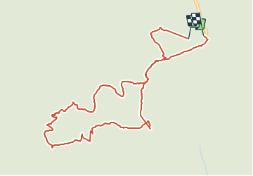

4,5 km | 7 km-effort


Utilisateur GUIDE


Application GPS de randonnée GRATUITE
 SityTrail
IGN / Instituts géographiques
SityTrail World
Le monde est à vous
Randonnée Marche de 5,5 km à découvrir à Québec, La Haute-Gaspésie, Mont-Albert. Cette randonnée est proposée par Alizée.pee.
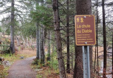
Randonnée familiale avec une magnifique vue sur les monts Albert et Jacques-Cartier. Vous aurez peut être la possibilité de voir des Caribous.

Marche
Marche
Marche
Marche
Marche
Marche
Marche
Marche
Marche