


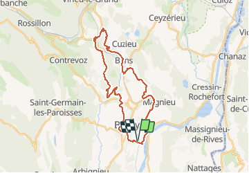

39 km | 54 km-effort


Utilisateur


Application GPS de randonnée GRATUITE
 SityTrail
IGN / Instituts géographiques
SityTrail World
Le monde est à vous
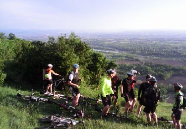
Randonnée V.T.T. de 30 km à découvrir à Auvergne-Rhône-Alpes, Ain, Belley. Cette randonnée est proposée par jeannot01.
Parcours inédit et très varié.
Pas de grosse difficulté.
Le chemin le long du furan entre Chavillieu et Pugieu est quand même assez technique. La descente après Verupt un petit peu.
Beaucoup de végétation par endroit et d'arbres en travers. Dommage
Sinon, super parcours

V.T.T.
V.T.T.

V.T.T.
V.T.T.
V.T.T.
V.T.T.
V.T.T.
V.T.T.