Randonnée Marche L'Isle-de-Noé - gr653 arle - Photo
 xenkod
xenkod

Utilisateur

© OpenStreetMap contributors
Longueur
Longueur
23 km
Altitude max
Altitude max
249 m
Dénivelé positif
Dénivelé positif
420 m
Km-Effort
Km-Effort  
28 km
Altitude min
Altitude min
140 m
Dénivelé négatif
Dénivelé négatif
390 m
Boucle
Boucle
Non
Date de création :
2014-12-10 00:00:00.0
Dernière modification :
2014-12-10 00:00:00.0

(0 Avis)

Marche
Marche
6h03
Difficulté : Moyen

Scannez ce code QR pour ouvrir la randonnée dans l'application SityTrail

Application GPS de randonnée GRATUITE

Logo SityTrail SityTrail

IGN / Instituts géographiques

Télécharger SityTrail sur l'App Store Télécharger SityTrail sur Google Play

Logo SityTrail SityTrail World

Le monde est à vous

Télécharger SityTrail sur l'App Store Télécharger SityTrail sur Google Play Télécharger SityTrail sur Huawei AppGallery

À propos

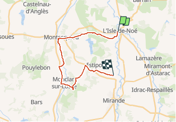
Randonnée Marche de 23 km à découvrir à Occitanie, Gers, L'Isle-de-Noé. Cette randonnée est proposée par xenkod.

Profil altimétrique

Localisation

Pays :
France
Région :
Occitanie
Département/Province :
Gers
Commune :
L'Isle-de-Noé
Localité :
Unknown
Départ:(Dec)
Départ:(UTM)
290895 ; 4828971 (31T) N.

Randonnées à proximité

Randonnée Marche L'Isle-de-Noé - S-J-L''isle de NOE - MARCIAC - Photo
Marche
CANON2

Marche

Difficile
L'Isle-de-Noé, Occitanie, Gers, France
25 km | 32 km-effort
6h 47min
Non
Randonnée Marche Barran - Étape 3 - Photo
Marche
Camsity

Marche

Très facile
Barran, Occitanie, Gers, France
21 km | 0 m-effort
5h 28min
Non
Randonnée Marche Barran - 9 Barran - Artiguelouve - Photo
Marche
Marc83143

Marche

Moyen
Barran, Occitanie, Gers, France
119 km | 146 km-effort
30h 30min
Non
Randonnée Marche L'Isle-de-Noé - gr 635 barran - Photo
Marche
xenkod

Marche

Moyen
L'Isle-de-Noé, Occitanie, Gers, France
19,1 km | 24 km-effort
5h 8min
Non
Randonnée Marche Estipouy - autour d'entarrieux - Photo
Marche
xenkod

Marche

Très facile
Estipouy, Occitanie, Gers, France
10,7 km | 13,5 km-effort
2h 53min
Oui
Randonnée Vélo Estipouy - grande boucle de barran - Photo
Vélo
xenkod

Vélo

Moyen
Estipouy, Occitanie, Gers, France
42 km | 52 km-effort
2h 56min
Oui
Randonnée V.T.T. Miramont-d'Astarac - seissan - Photo
V.T.T.
xenkod

V.T.T.

Moyen
Miramont-d'Astarac, Occitanie, Gers, France
32 km | 40 km-effort
2h 37min
Oui
Randonnée V.T.T. Estipouy - petit velo - Photo
V.T.T.
xenkod

V.T.T.

Facile
Estipouy, Occitanie, Gers, France
8,2 km | 9,9 km-effort
39min
Oui
Randonnée V.T.T. Estipouy - entre 2 lacs - Photo
V.T.T.
xenkod

V.T.T.

Moyen
Estipouy, Occitanie, Gers, France
31 km | 37 km-effort
2h 26min
Non


Fermer
Mes abonnements