![](/images/other/stat-length.png)
![Randonnée Marche Montfort-sur-Risle - Montfort-sur-Risle - Photo](https://media.geolcdn.com/t/1900/400/14202da2-b278-459f-b37f-9fa97561a5eb.jpg&format=pjpeg&maxdim=2)
Montfort-sur-Risle
MichelRando7656
Utilisateur
![Longueur](/images/other/stat-length.png)
Longueur
21 km
![Altitude max](https://static1.geolcdn.com/siteimages/upload/files/1508320355ic_sort_altitude_max_24dp.png)
Altitude max
148 m
![Dénivelé positif](https://static1.geolcdn.com/siteimages/upload/files/1508320355ic_sort_den_pos_24dp.png)
Dénivelé positif
388 m
![Km-Effort](/images/other/stat-length.png)
Km-Effort
26 km
![Altitude min](https://static1.geolcdn.com/siteimages/upload/files/1508320355ic_sort_altitude_min_24dp.png)
Altitude min
28 m
![Dénivelé négatif](https://static1.geolcdn.com/siteimages/upload/files/1508320355ic_sort_den_neg_24dp.png)
Dénivelé négatif
387 m
![Boucle](https://static1.geolcdn.com/siteimages/upload/files/16400158638029165_repeat_loop_refresh_sync_direction_icon.png)
Boucle
Oui
Date de création :
2019-08-15 08:03:25.563
Dernière modification :
2019-08-15 16:13:55.031
![Marche](https://static1.geolcdn.com/sitytour/trail-icons/101.png)
7h21
Difficulté : Difficile
![Scannez ce code QR pour ouvrir la randonnée dans l'application SityTrail](https://capi.geolives.com/qq0zvz2zws4bq2lad0pu/sitytour/trails/2171949/qr.png?size=200)
Application GPS de randonnée GRATUITE
À propos
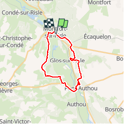
Randonnée Marche de 21 km à découvrir à Normandie, Eure, Montfort-sur-Risle. Cette randonnée est proposée par MichelRando7656.
Description
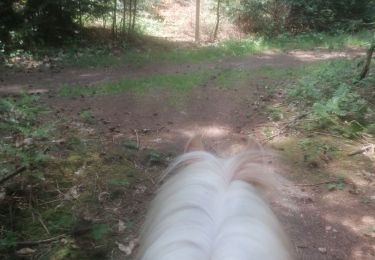
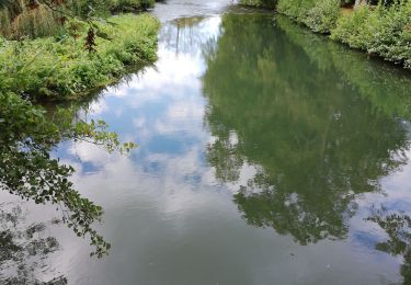
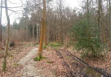
Beau parcours de 20 km. Nombreux sentiers forestiers et campagnards. Très peu de route. Bel endroit au bord de la Risle pour le pique-nique du midi.
Parking près la poste.
Localisation
Pays :
France
Région :
Normandie
Département/Province :
Eure
Commune :
Montfort-sur-Risle
Localité :
Unknown
Départ:(Dec)
Départ:(UTM)
330245 ; 5462734 (31U) N.
Commentaires
Randonnées à proximité
![Randonnée Marche Thierville - Thierville - La petite vallee - Photo](https://media.geolcdn.com/t/375/260/453ee1c9-9d31-4a8b-923c-572ef5a8ce46.jpg&format=jpg&maxdim=2)
![Marche Marche](https://static1.geolcdn.com/sitytour/trail-icons/101.png)
Thierville - La petite vallee
Marche
Moyen
Thierville,
Normandie,
Eure,
France
![](/images/other/stat-length.png)
9,9 km | 11,7 km-effort
4h 3min
![](https://static1.geolcdn.com/siteimages/upload/files/16400158638029165_repeat_loop_refresh_sync_direction_icon.png)
Oui
![Randonnée Marche Illeville-sur-Montfort - Illeville sur Montfort - Le circuit des Jacinthes - La Ferme de Fourges - Photo](https://media.geolcdn.com/t/375/260/3f49af04-1319-456c-9456-ec8bbc5a3b82.jpg&format=jpg&maxdim=2)
![Marche Marche](https://static1.geolcdn.com/sitytour/trail-icons/101.png)
Illeville sur Montfort - Le circuit des Jacinthes - La Ferme de Fourges
Marche
Difficile
(1)
Illeville-sur-Montfort,
Normandie,
Eure,
France
![](/images/other/stat-length.png)
12,3 km | 14,4 km-effort
3h 13min
![](https://static1.geolcdn.com/siteimages/upload/files/16400158638029165_repeat_loop_refresh_sync_direction_icon.png)
Oui
![Randonnée Marche Illeville-sur-Montfort - Illeville-sur-Monfort - Le circuit des Jacinthes - Photo](https://media.geolcdn.com/t/375/260/4ad22c83-41bc-47e4-95e1-447b2054afca.jpg&format=jpg&maxdim=2)
![Marche Marche](https://static1.geolcdn.com/sitytour/trail-icons/101.png)
Illeville-sur-Monfort - Le circuit des Jacinthes
Marche
Difficile
(2)
Illeville-sur-Montfort,
Normandie,
Eure,
France
![](/images/other/stat-length.png)
12,3 km | 14,5 km-effort
3h 8min
![](https://static1.geolcdn.com/siteimages/upload/files/16400158638029165_repeat_loop_refresh_sync_direction_icon.png)
Oui
![Randonnée Randonnée équestre Pont-Authou - ruine château montfort - Photo](https://media.geolcdn.com/t/375/260/f64efe13-e2af-4601-a37f-d0fd2ea020f8.jpg&format=jpg&maxdim=2)
![Randonnée équestre Randonnée équestre](https://static1.geolcdn.com/sitytour/trail-icons/301.png)
ruine château montfort
Randonnée équestre
Moyen
Pont-Authou,
Normandie,
Eure,
France
![](/images/other/stat-length.png)
23 km | 29 km-effort
3h 46min
![](https://static1.geolcdn.com/siteimages/upload/files/16400158638029165_repeat_loop_refresh_sync_direction_icon.png)
Non
![Randonnée Randonnée équestre Pont-Authou - bec hellouin - Photo](https://media.geolcdn.com/t/375/260/e961421f-a6cd-4453-96b0-e093eae8254f.jpg&format=jpg&maxdim=2)
![Randonnée équestre Randonnée équestre](https://static1.geolcdn.com/sitytour/trail-icons/301.png)
bec hellouin
Randonnée équestre
Moyen
Pont-Authou,
Normandie,
Eure,
France
![](/images/other/stat-length.png)
21 km | 26 km-effort
4h 3min
![](https://static1.geolcdn.com/siteimages/upload/files/16400158638029165_repeat_loop_refresh_sync_direction_icon.png)
Oui
![Randonnée Marche Condé-sur-Risle - Circuit des faneuses -Condé sur Risle-St Christophe sur Condé - Photo](https://media.geolcdn.com/t/375/260/3b4a5190-fc9d-4ba2-a272-b6d4b94cd6f5.jpg&format=jpg&maxdim=2)
![Marche Marche](https://static1.geolcdn.com/sitytour/trail-icons/101.png)
Circuit des faneuses -Condé sur Risle-St Christophe sur Condé
Marche
Difficile
Condé-sur-Risle,
Normandie,
Eure,
France
![](/images/other/stat-length.png)
14 km | 16,4 km-effort
4h 8min
![](https://static1.geolcdn.com/siteimages/upload/files/16400158638029165_repeat_loop_refresh_sync_direction_icon.png)
Oui
![Randonnée Marche Appeville-Annebault - Appeville Annebault - Photo](https://media.geolcdn.com/t/375/260/1129d546-4635-4e2a-ba5f-33c44de23099.jpg&format=jpg&maxdim=2)
![Marche Marche](https://static1.geolcdn.com/sitytour/trail-icons/101.png)
Appeville Annebault
Marche
Moyen
(1)
Appeville-Annebault,
Normandie,
Eure,
France
![](/images/other/stat-length.png)
26 km | 33 km-effort
4h 42min
![](https://static1.geolcdn.com/siteimages/upload/files/16400158638029165_repeat_loop_refresh_sync_direction_icon.png)
Oui
![Randonnée Marche Appeville-Annebault - appeville - Photo](https://media.geolcdn.com/t/375/260/ext.jpg?maxdim=2&url=https%3A%2F%2Fservices.sitytrail.com%2FGeolivesWS%2FDownloadMedia.ashx%3FTrailID%3D1021886%26Media%3Dfix__20180812105811.jpg)
![Marche Marche](https://static1.geolcdn.com/sitytour/trail-icons/101.png)
appeville
Marche
Moyen
Appeville-Annebault,
Normandie,
Eure,
France
![](/images/other/stat-length.png)
23 km | 29 km-effort
5h 6min
![](https://static1.geolcdn.com/siteimages/upload/files/16400158638029165_repeat_loop_refresh_sync_direction_icon.png)
Oui
![Randonnée Marche Illeville-sur-Montfort - chemin des Séquoias - Photo](https://media.geolcdn.com/t/375/260/ext.jpg?maxdim=2&url=https%3A%2F%2Fservices.sitytrail.com%2FGeolivesWS%2FDownloadMedia.ashx%3FTrailID%3D536058%26Media%3Dfix__20160310171813.jpg)
![Marche Marche](https://static1.geolcdn.com/sitytour/trail-icons/101.png)
chemin des Séquoias
Marche
Moyen
Illeville-sur-Montfort,
Normandie,
Eure,
France
![](/images/other/stat-length.png)
7,8 km | 9,7 km-effort
2h 56min
![](https://static1.geolcdn.com/siteimages/upload/files/16400158638029165_repeat_loop_refresh_sync_direction_icon.png)
Oui