![](/images/other/stat-length.png)
![Randonnée Marche Pont-Noyelles - Le passage aux loups - Pont-Noyelles - Photo](https://media.geolcdn.com/t/1900/400/ext.pjpeg?maxdim=2&url=https%3A%2F%2Fservices.sitytrail.com%2FGeolivesWS%2FDownloadMedia.ashx%3FTrailID%3D215210%26Media%3D15824_5.jpg)
Le passage aux loups - Pont-Noyelles
tracegps
Utilisateur
![Longueur](/images/other/stat-length.png)
Longueur
13,8 km
![Altitude max](https://static1.geolcdn.com/siteimages/upload/files/1508320355ic_sort_altitude_max_24dp.png)
Altitude max
96 m
![Dénivelé positif](https://static1.geolcdn.com/siteimages/upload/files/1508320355ic_sort_den_pos_24dp.png)
Dénivelé positif
143 m
![Km-Effort](/images/other/stat-length.png)
Km-Effort
15,7 km
![Altitude min](https://static1.geolcdn.com/siteimages/upload/files/1508320355ic_sort_altitude_min_24dp.png)
Altitude min
25 m
![Dénivelé négatif](https://static1.geolcdn.com/siteimages/upload/files/1508320355ic_sort_den_neg_24dp.png)
Dénivelé négatif
143 m
![Boucle](https://static1.geolcdn.com/siteimages/upload/files/16400158638029165_repeat_loop_refresh_sync_direction_icon.png)
Boucle
Oui
Date de création :
2014-12-10 00:00:00.0
Dernière modification :
2014-12-10 00:00:00.0
![Marche](https://static1.geolcdn.com/sitytour/trail-icons/101.png)
4h40
Difficulté : Difficile
![Scannez ce code QR pour ouvrir la randonnée dans l'application SityTrail](https://capi.geolives.com/qq0zvz2zws4bq2lad0pu/sitytour/trails/215210/qr.png?size=200)
Application GPS de randonnée GRATUITE
À propos
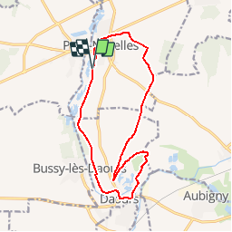
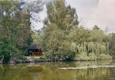
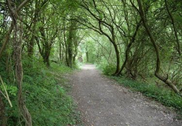
Randonnée Marche de 13,8 km à découvrir à Hauts-de-France, Somme, Pont-Noyelles. Cette randonnée est proposée par tracegps.
Description
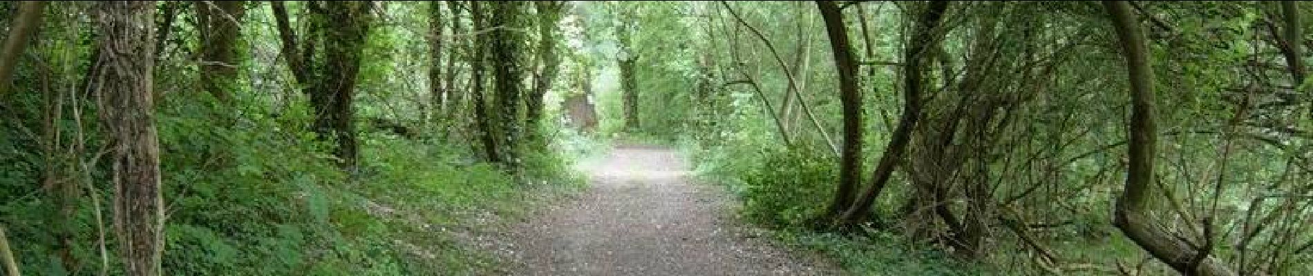
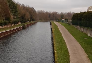
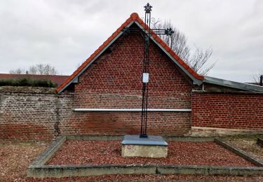
Entre points de vue d’exception, monuments historiques et sites naturels tous vos sens seront mis en éveil lors de cette balade. Départ de la route du camping de Pont-Noyelles. Téléchargez la fiche du circuit.
Localisation
Pays :
France
Région :
Hauts-de-France
Département/Province :
Somme
Commune :
Pont-Noyelles
Localité :
Unknown
Départ:(Dec)
Départ:(UTM)
459660 ; 5531451 (31U) N.
Commentaires
Randonnées à proximité
![Randonnée Marche Corbie - Les rives de Somme de Corbie à Amiens - Photo](https://media.geolcdn.com/t/375/260/b950c723-196c-4705-b4c8-c7caaabdf39d.jpg&format=jpg&maxdim=2)
![Marche Marche](https://static1.geolcdn.com/sitytour/trail-icons/101.png)
Les rives de Somme de Corbie à Amiens
Marche
Moyen
Corbie,
Hauts-de-France,
Somme,
France
![](/images/other/stat-length.png)
21 km | 22 km-effort
4h 31min
![](https://static1.geolcdn.com/siteimages/upload/files/16400158638029165_repeat_loop_refresh_sync_direction_icon.png)
Non
![Randonnée A pied Daours - Le Passage aux Loups - Photo](https://media.geolcdn.com/t/375/260/c0a6c8f5-02d2-4dbd-8744-0550644a54a7.jpeg&format=jpg&maxdim=2)
![A pied A pied](https://static1.geolcdn.com/sitytour/trail-icons/100.png)
Le Passage aux Loups
A pied
Facile
Daours,
Hauts-de-France,
Somme,
France
![](/images/other/stat-length.png)
13,9 km | 15,9 km-effort
3h 36min
![](https://static1.geolcdn.com/siteimages/upload/files/16400158638029165_repeat_loop_refresh_sync_direction_icon.png)
Oui
![Randonnée Quad Fouilloy - quad falloise - Photo](https://media.geolcdn.com/t/375/260/2fe84f10-c8aa-4a4e-9c7d-13d62879c110.jpg&format=jpg&maxdim=2)
![Quad Quad](https://static1.geolcdn.com/sitytour/trail-icons/404.png)
quad falloise
Quad
Moyen
(1)
Fouilloy,
Hauts-de-France,
Somme,
France
![](/images/other/stat-length.png)
103 km | 122 km-effort
Inconnu
![](https://static1.geolcdn.com/siteimages/upload/files/16400158638029165_repeat_loop_refresh_sync_direction_icon.png)
Non
![Randonnée V.T.T. Pont-Noyelles - Le passage aux loups - Pont-Noyelles - Photo](https://media.geolcdn.com/t/375/260/ext.jpg?maxdim=2&url=https%3A%2F%2Fservices.sitytrail.com%2FGeolivesWS%2FDownloadMedia.ashx%3FTrailID%3D215211%26Media%3D15824_5.jpg)
![V.T.T. V.T.T.](https://static1.geolcdn.com/sitytour/trail-icons/202.png)
Le passage aux loups - Pont-Noyelles
V.T.T.
Moyen
Pont-Noyelles,
Hauts-de-France,
Somme,
France
![](/images/other/stat-length.png)
13,8 km | 15,7 km-effort
1h 15min
![](https://static1.geolcdn.com/siteimages/upload/files/16400158638029165_repeat_loop_refresh_sync_direction_icon.png)
Oui
![Randonnée Quad Fouilloy - rando-fouilloy - Photo](https://media.geolcdn.com/t/375/260/ext.jpg?maxdim=2&url=https%3A%2F%2Fstatic1.geolcdn.com%2Fsiteimages%2Fupload%2Ffiles%2F15247431544x4.jpg)
![Quad Quad](https://static1.geolcdn.com/sitytour/trail-icons/404.png)
rando-fouilloy
Quad
Facile
Fouilloy,
Hauts-de-France,
Somme,
France
![](/images/other/stat-length.png)
73 km | 84 km-effort
Inconnu
![](https://static1.geolcdn.com/siteimages/upload/files/16400158638029165_repeat_loop_refresh_sync_direction_icon.png)
Non
![Randonnée V.T.T. Pont-Noyelles - Le passage aux loups - Pont-Noyelles - Photo](https://media.geolcdn.com/t/375/260/ext.jpg?maxdim=2&url=https%3A%2F%2Fstatic1.geolcdn.com%2Fsiteimages%2Fupload%2Ffiles%2F1524743154velo.jpg)
![V.T.T. V.T.T.](https://static1.geolcdn.com/sitytour/trail-icons/202.png)
Le passage aux loups - Pont-Noyelles
V.T.T.
Moyen
Pont-Noyelles,
Hauts-de-France,
Somme,
France
![](/images/other/stat-length.png)
13,8 km | 15,8 km-effort
1h 15min
![](https://static1.geolcdn.com/siteimages/upload/files/16400158638029165_repeat_loop_refresh_sync_direction_icon.png)
Oui
![Randonnée Marche Béhencourt - Le circuit des monts - Photo](https://media.geolcdn.com/t/375/260/ext.jpg?maxdim=2&url=https%3A%2F%2Fstatic1.geolcdn.com%2Fsiteimages%2Fupload%2Ffiles%2F1553511878bg_sport_marche.png)
![Marche Marche](https://static1.geolcdn.com/sitytour/trail-icons/101.png)
Le circuit des monts
Marche
Moyen
Béhencourt,
Hauts-de-France,
Somme,
France
![](/images/other/stat-length.png)
16,4 km | 18,6 km-effort
Inconnu
![](https://static1.geolcdn.com/siteimages/upload/files/16400158638029165_repeat_loop_refresh_sync_direction_icon.png)
Oui
![Randonnée Marche Fréchencourt - frechencourt - Photo](https://media.geolcdn.com/t/375/260/ext.jpg?maxdim=2&url=https%3A%2F%2Fstatic1.geolcdn.com%2Fsiteimages%2Fupload%2Ffiles%2F1553511878bg_sport_marche.png)
![Marche Marche](https://static1.geolcdn.com/sitytour/trail-icons/101.png)
frechencourt
Marche
Moyen
Fréchencourt,
Hauts-de-France,
Somme,
France
![](/images/other/stat-length.png)
20 km | 24 km-effort
4h 5min
![](https://static1.geolcdn.com/siteimages/upload/files/16400158638029165_repeat_loop_refresh_sync_direction_icon.png)
Oui
![Randonnée Randonnée équestre Pont-Noyelles - Jour 1 equirando - Photo](https://media.geolcdn.com/t/375/260/ext.jpg?maxdim=2&url=https%3A%2F%2Fstatic1.geolcdn.com%2Fsiteimages%2Fupload%2Ffiles%2F1524743154cheval.jpg)
![Randonnée équestre Randonnée équestre](https://static1.geolcdn.com/sitytour/trail-icons/301.png)
Jour 1 equirando
Randonnée équestre
Moyen
Pont-Noyelles,
Hauts-de-France,
Somme,
France
![](/images/other/stat-length.png)
26 km | 29 km-effort
5h 29min
![](https://static1.geolcdn.com/siteimages/upload/files/16400158638029165_repeat_loop_refresh_sync_direction_icon.png)
Non