![](/images/other/stat-length.png)
![Randonnée Marche Chastre - P5904067 Promenade de Villeroux - Photo](https://media.geolcdn.com/t/1900/400/ext.pjpeg?maxdim=2&url=https%3A%2F%2Fstatic1.geolcdn.com%2Fsiteimages%2Fupload%2Ffiles%2F1553511878bg_sport_marche.png)
P5904067 Promenade de Villeroux
vindju
Utilisateur
![Longueur](/images/other/stat-length.png)
Longueur
6,7 km
![Altitude max](https://static1.geolcdn.com/siteimages/upload/files/1508320355ic_sort_altitude_max_24dp.png)
Altitude max
152 m
![Dénivelé positif](https://static1.geolcdn.com/siteimages/upload/files/1508320355ic_sort_den_pos_24dp.png)
Dénivelé positif
63 m
![Km-Effort](/images/other/stat-length.png)
Km-Effort
7,5 km
![Altitude min](https://static1.geolcdn.com/siteimages/upload/files/1508320355ic_sort_altitude_min_24dp.png)
Altitude min
115 m
![Dénivelé négatif](https://static1.geolcdn.com/siteimages/upload/files/1508320355ic_sort_den_neg_24dp.png)
Dénivelé négatif
65 m
![Boucle](https://static1.geolcdn.com/siteimages/upload/files/16400158638029165_repeat_loop_refresh_sync_direction_icon.png)
Boucle
Oui
Date de création :
2019-07-28 06:21:33.141
Dernière modification :
2020-07-03 07:02:59.703
![Marche](https://static1.geolcdn.com/sitytour/trail-icons/101.png)
1h53
Difficulté : Moyen
![Scannez ce code QR pour ouvrir la randonnée dans l'application SityTrail](https://capi.geolives.com/qq0zvz2zws4bq2lad0pu/sitytour/trails/2151795/qr.png?size=200)
Application GPS de randonnée GRATUITE
À propos
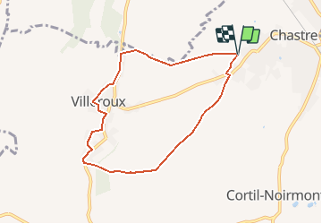
Randonnée Marche de 6,7 km à découvrir à Wallonie, Brabant wallon, Chastre. Cette randonnée est proposée par vindju.
Description
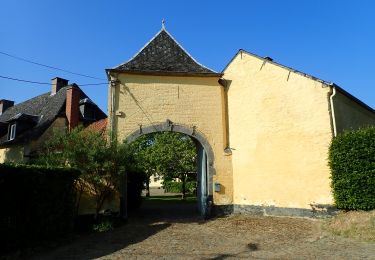
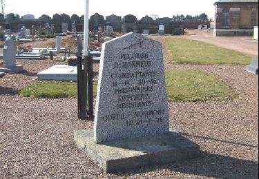
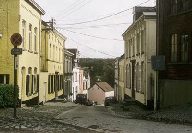
Cette promenade entre vallée et plateau démarre à l'église de Chastre, se dirige vers Villeroux à travers les champs puis parcourt la vallée de la Houssière.
Points d'intérêt
Localisation
Pays :
Belgique
Région :
Wallonie
Département/Province :
Brabant wallon
Commune :
Chastre
Localité :
Chastre-Villeroux-Blanmont
Départ:(Dec)
Départ:(UTM)
615581 ; 5607496 (31U) N.
Commentaires
Randonnées à proximité
![Randonnée Marche Mont-Saint-Guibert - Balade à Mont-Saint-Guibert - Photo](https://media.geolcdn.com/t/375/260/ext.jpg?maxdim=2&url=https%3A%2F%2Fservices.sitytrail.com%2FGeolivesWS%2FDownloadMedia.ashx%3FTrailID%3D942864%26Media%3D4a857fe0-cf43-4eb8-b563-62b2b90d4fc2.jpg)
![Marche Marche](https://static1.geolcdn.com/sitytour/trail-icons/101.png)
Balade à Mont-Saint-Guibert
Marche
Très facile
(1)
Mont-Saint-Guibert,
Wallonie,
Brabant wallon,
Belgique
![](/images/other/stat-length.png)
8,4 km | 10,1 km-effort
2h 12min
![](https://static1.geolcdn.com/siteimages/upload/files/16400158638029165_repeat_loop_refresh_sync_direction_icon.png)
Oui
![Randonnée Marche Court-Saint-Étienne - RB-Bw-08_Court-Saint-Etienne_via-var - Photo](https://media.geolcdn.com/t/375/260/ext.jpg?maxdim=2&url=https%3A%2F%2Fservices.sitytrail.com%2FGeolivesWS%2FDownloadMedia.ashx%3FTrailID%3D220267%26Media%3D6c86831f-6220-45af-ac63-82e6ea37f2ed.jpg)
![Marche Marche](https://static1.geolcdn.com/sitytour/trail-icons/101.png)
RB-Bw-08_Court-Saint-Etienne_via-var
Marche
Très difficile
(2)
Court-Saint-Étienne,
Wallonie,
Brabant wallon,
Belgique
![](/images/other/stat-length.png)
26 km | 32 km-effort
7h 18min
![](https://static1.geolcdn.com/siteimages/upload/files/16400158638029165_repeat_loop_refresh_sync_direction_icon.png)
Oui
![Randonnée Marche Chastre - #240223a - Blanmont, Orne, Alvaux, Nil Pierreux*** - Photo](https://media.geolcdn.com/t/375/260/ext.jpg?maxdim=2&url=https%3A%2F%2Fmedia.geolcdn.com%2Ff%2F93f4f268-f0dd-4755-9fda-3b9155347db7.JPG)
![Marche Marche](https://static1.geolcdn.com/sitytour/trail-icons/101.png)
#240223a - Blanmont, Orne, Alvaux, Nil Pierreux***
Marche
Moyen
(1)
Chastre,
Wallonie,
Brabant wallon,
Belgique
![](/images/other/stat-length.png)
6,6 km | 7,8 km-effort
1h 47min
![](https://static1.geolcdn.com/siteimages/upload/files/16400158638029165_repeat_loop_refresh_sync_direction_icon.png)
Oui
![Randonnée Marche Court-Saint-Étienne - #230730 - Court-St-Etienne - Avenue des Rossignols - Photo](https://media.geolcdn.com/t/375/260/ext.jpg?maxdim=2&url=https%3A%2F%2Fmedia.geolcdn.com%2Ff%2F0934785a-3707-4824-af89-7c509e828e07.JPG)
![Marche Marche](https://static1.geolcdn.com/sitytour/trail-icons/101.png)
#230730 - Court-St-Etienne - Avenue des Rossignols
Marche
Moyen
(1)
Court-Saint-Étienne,
Wallonie,
Brabant wallon,
Belgique
![](/images/other/stat-length.png)
5,8 km | 6,8 km-effort
1h 33min
![](https://static1.geolcdn.com/siteimages/upload/files/16400158638029165_repeat_loop_refresh_sync_direction_icon.png)
Non
![Randonnée Marche Chastre - #230728 - Gentinnes Mémorial Kongolo - Photo](https://media.geolcdn.com/t/375/260/ext.jpg?maxdim=2&url=https%3A%2F%2Fmedia.geolcdn.com%2Ff%2Fb8e0ed62-13ad-4df2-8ddb-c88775d5e582.JPG)
![Marche Marche](https://static1.geolcdn.com/sitytour/trail-icons/101.png)
#230728 - Gentinnes Mémorial Kongolo
Marche
Facile
(1)
Chastre,
Wallonie,
Brabant wallon,
Belgique
![](/images/other/stat-length.png)
5 km | 5,6 km-effort
1h 16min
![](https://static1.geolcdn.com/siteimages/upload/files/16400158638029165_repeat_loop_refresh_sync_direction_icon.png)
Oui
![Randonnée A pied Walhain - #170829 - Nil Pierreux, carrières de quartzite, Moulin d'Al Poudre et Tour des Sarrasins*** - Photo](https://media.geolcdn.com/t/375/260/ext.jpg?maxdim=2&url=https%3A%2F%2Fmedia.geolcdn.com%2Ff%2F3f6d304f-08de-4d1a-b4cf-2557e45951c8.JPG)
![A pied A pied](https://static1.geolcdn.com/sitytour/trail-icons/100.png)
#170829 - Nil Pierreux, carrières de quartzite, Moulin d'Al Poudre et Tour de...
A pied
Très facile
(2)
Walhain,
Wallonie,
Brabant wallon,
Belgique
![](/images/other/stat-length.png)
8,1 km | 9,9 km-effort
2h 0min
![](https://static1.geolcdn.com/siteimages/upload/files/16400158638029165_repeat_loop_refresh_sync_direction_icon.png)
Oui
![Randonnée Marche Chastre - Promenade de Villeroux - Photo](https://media.geolcdn.com/t/375/260/ext.jpg?maxdim=2&url=https%3A%2F%2Fservices.sitytrail.com%2FGeolivesWS%2FDownloadMedia.ashx%3FTrailID%3D233658%26Media%3D6ce217ee-b2e1-442a-b4a3-34a4ee262c13.JPG)
![Marche Marche](https://static1.geolcdn.com/sitytour/trail-icons/101.png)
Promenade de Villeroux
Marche
Moyen
(1)
Chastre,
Wallonie,
Brabant wallon,
Belgique
![](/images/other/stat-length.png)
7,6 km | 8,5 km-effort
1h 53min
![](https://static1.geolcdn.com/siteimages/upload/files/16400158638029165_repeat_loop_refresh_sync_direction_icon.png)
Oui
![Randonnée Marche Chastre - Balade récréative de Cortil - Photo](https://media.geolcdn.com/t/375/260/ext.jpg?maxdim=2&url=https%3A%2F%2Fservices.sitytrail.com%2FGeolivesWS%2FDownloadMedia.ashx%3FTrailID%3D232278%26Media%3D010369e0-b48e-4ca2-9215-837380cbac27.jpg)
![Marche Marche](https://static1.geolcdn.com/sitytour/trail-icons/101.png)
Balade récréative de Cortil
Marche
Facile
(4)
Chastre,
Wallonie,
Brabant wallon,
Belgique
![](/images/other/stat-length.png)
5,9 km | 6,5 km-effort
1h 26min
![](https://static1.geolcdn.com/siteimages/upload/files/16400158638029165_repeat_loop_refresh_sync_direction_icon.png)
Oui
![Randonnée Marche Court-Saint-Étienne - Promenade 11 Suzeril et la vallée de la Thyle - Photo](https://media.geolcdn.com/t/375/260/ext.jpg?maxdim=2&url=https%3A%2F%2Fservices.sitytrail.com%2FGeolivesWS%2FDownloadMedia.ashx%3FTrailID%3D220354%26Media%3Dd68426e0-c29b-4ce9-a921-f69a4ba57f92.jpg)
![Marche Marche](https://static1.geolcdn.com/sitytour/trail-icons/101.png)
Promenade 11 Suzeril et la vallée de la Thyle
Marche
Facile
(1)
Court-Saint-Étienne,
Wallonie,
Brabant wallon,
Belgique
![](/images/other/stat-length.png)
3,7 km | 4,5 km-effort
59min
![](https://static1.geolcdn.com/siteimages/upload/files/16400158638029165_repeat_loop_refresh_sync_direction_icon.png)
Oui