![](/images/other/stat-length.png)
![Randonnée Marche Taintrux - Anozel 24-07-19 - 19KM - Photo](https://media.geolcdn.com/t/1900/400/0c03f3c4-9391-4a01-b940-c8c7705bb7e8.jpg&format=pjpeg&maxdim=2)
Anozel 24-07-19 - 19KM
1957
Utilisateur
![Longueur](/images/other/stat-length.png)
Longueur
17,8 km
![Boucle](https://static1.geolcdn.com/siteimages/upload/files/16400158638029165_repeat_loop_refresh_sync_direction_icon.png)
Boucle
Oui
Date de création :
2019-07-24 06:38:56.0
Dernière modification :
2019-07-24 12:12:57.669
![Marche](https://static1.geolcdn.com/sitytour/trail-icons/101.png)
5h19
Difficulté : Difficile
![Scannez ce code QR pour ouvrir la randonnée dans l'application SityTrail](https://capi.geolives.com/qq0zvz2zws4bq2lad0pu/sitytour/trails/2149261/qr.png?size=200)
Application GPS de randonnée GRATUITE
À propos
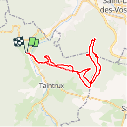
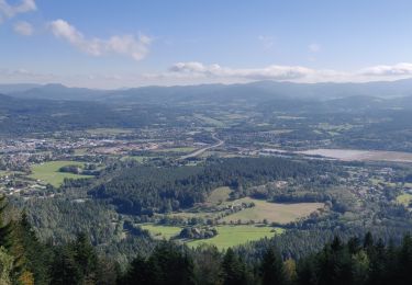
Randonnée Marche de 17,8 km à découvrir à Grand Est, Vosges, Taintrux. Cette randonnée est proposée par 1957.
Description
Rougiville - Climont - Pierre de Laitre - Anozel -Kiosque - Enclume -Anozel -Retour
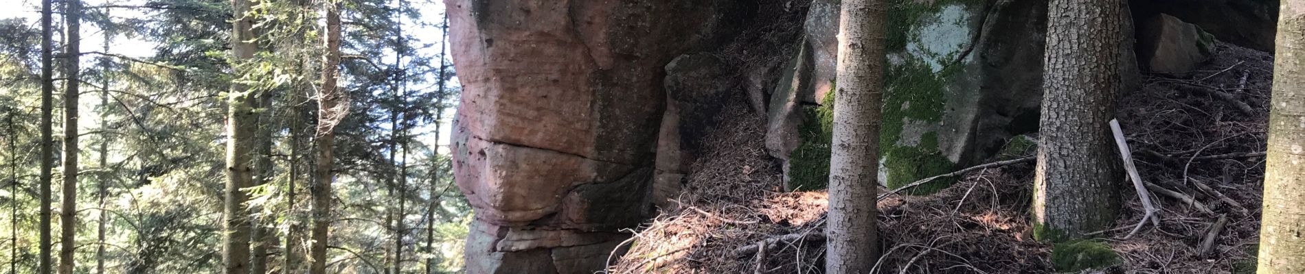
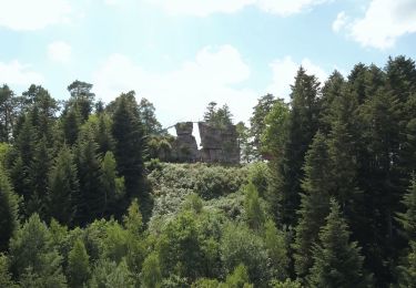
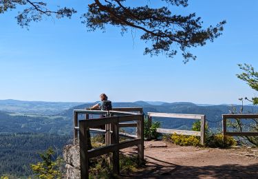
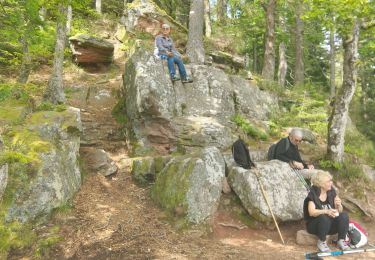
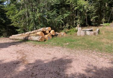
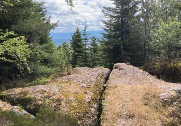
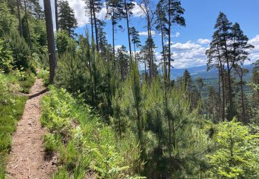
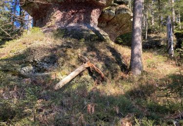
Localisation
Pays :
France
Région :
Grand Est
Département/Province :
Vosges
Commune :
Taintrux
Localité :
Unknown
Départ:(Dec)
Départ:(UTM)
342945 ; 5347912 (32U) N.
Commentaires
Randonnées à proximité
![Randonnée Marche Saint-Michel-sur-Meurthe - massif de la madeleine - Photo](https://media.geolcdn.com/t/375/260/ext.jpg?maxdim=2&url=https%3A%2F%2Fservices.sitytrail.com%2FGeolivesWS%2FDownloadMedia.ashx%3FTrailID%3D1148232%26Media%3D20190421153638.jpg)
![Marche Marche](https://static1.geolcdn.com/sitytour/trail-icons/101.png)
massif de la madeleine
Marche
Moyen
(1)
Saint-Michel-sur-Meurthe,
Grand Est,
Vosges,
France
![](/images/other/stat-length.png)
14,7 km | 22 km-effort
4h 10min
![](https://static1.geolcdn.com/siteimages/upload/files/16400158638029165_repeat_loop_refresh_sync_direction_icon.png)
Oui
![Randonnée A pied Taintrux - GR de Pays de Déodatie - Photo](https://media.geolcdn.com/t/375/260/8c9d86c2-6a8a-421f-b627-7552051e9313.jpeg&format=jpg&maxdim=2)
![A pied A pied](https://static1.geolcdn.com/sitytour/trail-icons/100.png)
GR de Pays de Déodatie
A pied
Facile
Taintrux,
Grand Est,
Vosges,
France
![](/images/other/stat-length.png)
7,9 km | 12,5 km-effort
2h 49min
![](https://static1.geolcdn.com/siteimages/upload/files/16400158638029165_repeat_loop_refresh_sync_direction_icon.png)
Non
![Randonnée Marche Taintrux - 2024-05-10 Marche Taintrux - Photo](https://media.geolcdn.com/t/375/260/9fe93acc-f8ea-40c3-b435-6f108f3a2d6d.jpg&format=jpg&maxdim=2)
![Marche Marche](https://static1.geolcdn.com/sitytour/trail-icons/101.png)
2024-05-10 Marche Taintrux
Marche
Moyen
Taintrux,
Grand Est,
Vosges,
France
![](/images/other/stat-length.png)
18,8 km | 32 km-effort
7h 14min
![](https://static1.geolcdn.com/siteimages/upload/files/16400158638029165_repeat_loop_refresh_sync_direction_icon.png)
Non
![Randonnée Marche Saulcy-sur-Meurthe - Massif du KEMBERG - Photo](https://media.geolcdn.com/t/375/260/a0e83b61-8364-418a-96af-6be211e18cd3.jpg&format=jpg&maxdim=2)
![Marche Marche](https://static1.geolcdn.com/sitytour/trail-icons/101.png)
Massif du KEMBERG
Marche
Très difficile
Saulcy-sur-Meurthe,
Grand Est,
Vosges,
France
![](/images/other/stat-length.png)
12,6 km | 20 km-effort
4h 45min
![](https://static1.geolcdn.com/siteimages/upload/files/16400158638029165_repeat_loop_refresh_sync_direction_icon.png)
Oui
![Randonnée Marche Taintrux - Marche 09-07-22 18Km - Photo](https://media.geolcdn.com/t/375/260/dffd94f9-cf6a-45ad-8857-0cc31d7aeb13.jpg&format=jpg&maxdim=2)
![Marche Marche](https://static1.geolcdn.com/sitytour/trail-icons/101.png)
Marche 09-07-22 18Km
Marche
Difficile
Taintrux,
Grand Est,
Vosges,
France
![](/images/other/stat-length.png)
15,4 km | 24 km-effort
4h 13min
![](https://static1.geolcdn.com/siteimages/upload/files/16400158638029165_repeat_loop_refresh_sync_direction_icon.png)
Oui
![Randonnée Marche Taintrux - Marche 06-06-22 24km - Photo](https://media.geolcdn.com/t/375/260/0cc2cfac-96ee-423b-8767-12701e4ef6de.jpg&format=jpg&maxdim=2)
![Marche Marche](https://static1.geolcdn.com/sitytour/trail-icons/101.png)
Marche 06-06-22 24km
Marche
Difficile
Taintrux,
Grand Est,
Vosges,
France
![](/images/other/stat-length.png)
23 km | 32 km-effort
5h 48min
![](https://static1.geolcdn.com/siteimages/upload/files/16400158638029165_repeat_loop_refresh_sync_direction_icon.png)
Oui
![Randonnée Marche Taintrux - Marche 25-05-22 18Km Climont - Photo](https://media.geolcdn.com/t/375/260/3f6a4b19-ce20-42f2-b08d-3fcf1fa7acba.jpg&format=jpg&maxdim=2)
![Marche Marche](https://static1.geolcdn.com/sitytour/trail-icons/101.png)
Marche 25-05-22 18Km Climont
Marche
Difficile
Taintrux,
Grand Est,
Vosges,
France
![](/images/other/stat-length.png)
16 km | 27 km-effort
4h 50min
![](https://static1.geolcdn.com/siteimages/upload/files/16400158638029165_repeat_loop_refresh_sync_direction_icon.png)
Oui
![Randonnée Marche Taintrux - Marche 04-03-22 Gachotte - Photo](https://media.geolcdn.com/t/375/260/90e78970-4db7-45b3-8d38-2e859eac2862.jpg&format=jpg&maxdim=2)
![Marche Marche](https://static1.geolcdn.com/sitytour/trail-icons/101.png)
Marche 04-03-22 Gachotte
Marche
Difficile
Taintrux,
Grand Est,
Vosges,
France
![](/images/other/stat-length.png)
16,2 km | 25 km-effort
4h 44min
![](https://static1.geolcdn.com/siteimages/upload/files/16400158638029165_repeat_loop_refresh_sync_direction_icon.png)
Oui
![Randonnée Marche Saint-Dié-des-Vosges - 2021-10-08 Marche St Die Metzeral Jour 1 - Photo](https://media.geolcdn.com/t/375/260/e22b097e-6393-4be9-8a81-a85993f41b61.jpg&format=jpg&maxdim=2)
![Marche Marche](https://static1.geolcdn.com/sitytour/trail-icons/101.png)
2021-10-08 Marche St Die Metzeral Jour 1
Marche
Très difficile
Saint-Dié-des-Vosges,
Grand Est,
Vosges,
France
![](/images/other/stat-length.png)
26 km | 39 km-effort
7h 40min
![](https://static1.geolcdn.com/siteimages/upload/files/16400158638029165_repeat_loop_refresh_sync_direction_icon.png)
Non