![](/images/other/stat-length.png)
![Randonnée Marche Πρόδρομος - Prodromos - Lefkes A-R par la « Route Byzantine « - Photo](https://media.geolcdn.com/t/1900/400/5d6008ae-af9f-4f61-8501-277c9966697e.jpg&format=pjpeg&maxdim=2)
Prodromos - Lefkes A-R par la « Route Byzantine «
brudecliss
Utilisateur
![Longueur](/images/other/stat-length.png)
Longueur
7,8 km
![Altitude max](https://static1.geolcdn.com/siteimages/upload/files/1508320355ic_sort_altitude_max_24dp.png)
Altitude max
207 m
![Dénivelé positif](https://static1.geolcdn.com/siteimages/upload/files/1508320355ic_sort_den_pos_24dp.png)
Dénivelé positif
276 m
![Km-Effort](/images/other/stat-length.png)
Km-Effort
11,5 km
![Altitude min](https://static1.geolcdn.com/siteimages/upload/files/1508320355ic_sort_altitude_min_24dp.png)
Altitude min
32 m
![Dénivelé négatif](https://static1.geolcdn.com/siteimages/upload/files/1508320355ic_sort_den_neg_24dp.png)
Dénivelé négatif
268 m
![Boucle](https://static1.geolcdn.com/siteimages/upload/files/16400158638029165_repeat_loop_refresh_sync_direction_icon.png)
Boucle
Non
Date de création :
2019-07-23 06:17:36.0
Dernière modification :
2019-07-23 09:06:25.532
![Marche](https://static1.geolcdn.com/sitytour/trail-icons/101.png)
2h24
Difficulté : Moyen
![Scannez ce code QR pour ouvrir la randonnée dans l'application SityTrail](https://capi.geolives.com/qq0zvz2zws4bq2lad0pu/sitytour/trails/2148139/qr.png?size=200)
Application GPS de randonnée GRATUITE
À propos
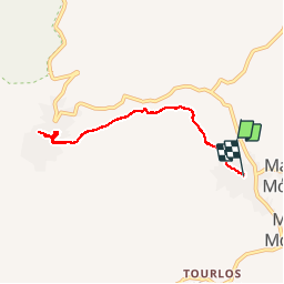
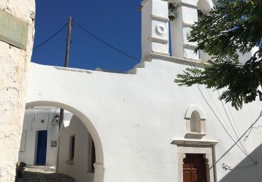
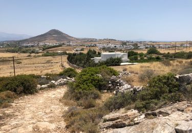
Randonnée Marche de 7,8 km à découvrir à Égée, Περιφερειακή Ενότητα Πάρου. Cette randonnée est proposée par brudecliss.
Description
L’ancienne route Byzantine entre Prodromos et Lefkes se révèle très praticable pour tout public.
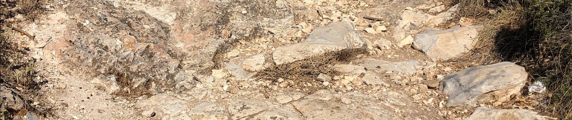
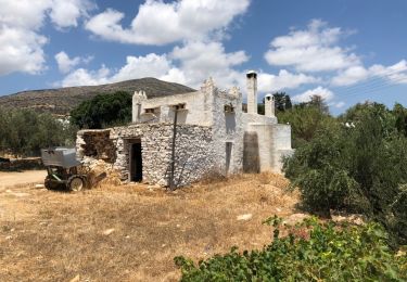
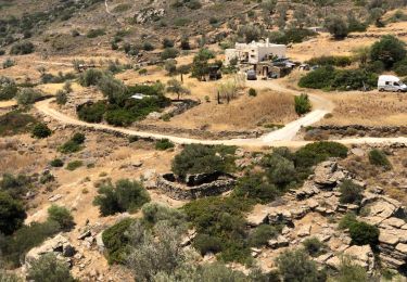
Localisation
Pays :
Grèce
Région :
Égée
Département/Province :
Περιφερειακή Ενότητα Πάρου
Commune :
Πρόδρομος
Localité :
Unknown
Départ:(Dec)
Départ:(UTM)
343239 ; 4102257 (35S) N.
Commentaires
Randonnées à proximité
![Randonnée Marche - Piso Livadi Dryos sentier côtier - Photo](https://media.geolcdn.com/t/375/260/ext.jpg?maxdim=2&url=https%3A%2F%2Fservices.sitytrail.com%2FGeolivesWS%2FDownloadMedia.ashx%3FTrailID%3D1005451%26Media%3D20180710125012.jpg)
![Marche Marche](https://static1.geolcdn.com/sitytour/trail-icons/101.png)
Piso Livadi Dryos sentier côtier
Marche
Facile
,
Égée,
Περιφερειακή Ενότητα Πάρου,
Grèce
![](/images/other/stat-length.png)
8,6 km | 9,5 km-effort
2h 5min
![](https://static1.geolcdn.com/siteimages/upload/files/16400158638029165_repeat_loop_refresh_sync_direction_icon.png)
Non
![Randonnée Marche - Lefkes Aspro Chorio par la kavouropotamos - Photo](https://media.geolcdn.com/t/375/260/ext.jpg?maxdim=2&url=https%3A%2F%2Fservices.sitytrail.com%2FGeolivesWS%2FDownloadMedia.ashx%3FTrailID%3D1005450%26Media%3D20180708122353.jpg)
![Marche Marche](https://static1.geolcdn.com/sitytour/trail-icons/101.png)
Lefkes Aspro Chorio par la kavouropotamos
Marche
Facile
,
Égée,
Περιφερειακή Ενότητα Πάρου,
Grèce
![](/images/other/stat-length.png)
9,2 km | 14,1 km-effort
3h 29min
![](https://static1.geolcdn.com/siteimages/upload/files/16400158638029165_repeat_loop_refresh_sync_direction_icon.png)
Non
![Randonnée Marche - Marpissa Marmara Lefkes - Photo](https://media.geolcdn.com/t/375/260/05bcdd77-9505-43a2-8cd4-015e357a9478.jpg&format=jpg&maxdim=2)
![Marche Marche](https://static1.geolcdn.com/sitytour/trail-icons/101.png)
Marpissa Marmara Lefkes
Marche
,
Égée,
Περιφερειακή Ενότητα Πάρου,
Grèce
![](/images/other/stat-length.png)
7,8 km | 11,1 km-effort
3h 26min
![](https://static1.geolcdn.com/siteimages/upload/files/16400158638029165_repeat_loop_refresh_sync_direction_icon.png)
Non
![Randonnée Marche - prodromos lefkes retour byzantin - Photo](https://media.geolcdn.com/t/375/260/ext.jpg?maxdim=2&url=https%3A%2F%2Fservices.sitytrail.com%2FGeolivesWS%2FDownloadMedia.ashx%3FTrailID%3D1005456%26Media%3D20180706125948.jpg)
![Marche Marche](https://static1.geolcdn.com/sitytour/trail-icons/101.png)
prodromos lefkes retour byzantin
Marche
Moyen
,
Égée,
Περιφερειακή Ενότητα Πάρου,
Grèce
![](/images/other/stat-length.png)
11,7 km | 16,6 km-effort
3h 29min
![](https://static1.geolcdn.com/siteimages/upload/files/16400158638029165_repeat_loop_refresh_sync_direction_icon.png)
Oui
![Randonnée Marche - Prodomos - Lefkès (chemin Byzantin) - Photo](https://media.geolcdn.com/t/375/260/ext.jpg?maxdim=2&url=https%3A%2F%2Fstatic1.geolcdn.com%2Fsiteimages%2Fupload%2Ffiles%2F1553511878bg_sport_marche.png)
![Marche Marche](https://static1.geolcdn.com/sitytour/trail-icons/101.png)
Prodomos - Lefkès (chemin Byzantin)
Marche
Facile
,
Égée,
Περιφερειακή Ενότητα Πάρου,
Grèce
![](/images/other/stat-length.png)
6,4 km | 9,4 km-effort
1h 16min
![](https://static1.geolcdn.com/siteimages/upload/files/16400158638029165_repeat_loop_refresh_sync_direction_icon.png)
Non