![](/images/other/stat-length.png)
![Randonnée Cyclotourisme Bettes - Bettes - St-Pé-de-Bigorre - Photo](https://media.geolcdn.com/t/1900/400/7afa07fd-6f68-4682-97a6-85b570c489ef.jpg&format=pjpeg&maxdim=2)
Bettes - St-Pé-de-Bigorre
karawatsj
Utilisateur
![Longueur](/images/other/stat-length.png)
![Boucle](https://static1.geolcdn.com/siteimages/upload/files/16400158638029165_repeat_loop_refresh_sync_direction_icon.png)
![Cyclotourisme](https://static1.geolcdn.com/sitytour/trail-icons/204.png)
2h57
Difficulté : Difficile
![Scannez ce code QR pour ouvrir la randonnée dans l'application SityTrail](https://capi.geolives.com/qq0zvz2zws4bq2lad0pu/sitytour/trails/2129588/qr.png?size=200)
Application GPS de randonnée GRATUITE
À propos
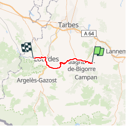
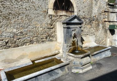
Randonnée Cyclotourisme de 42 km à découvrir à Occitanie, Hautes-Pyrénées, Bettes. Cette randonnée est proposée par karawatsj.
Description
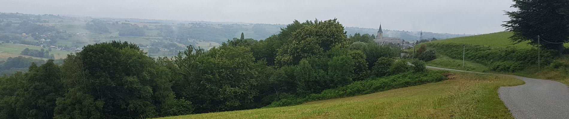
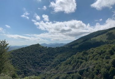
We volgen de D26 tot in Lourdes. We dalen eerst 200m om het stroompje de Luz over te steken en stijgen dan om vervolgen weer af te dalen naar de Petit Luz. Daarna stijgt het weer naar Haut de Côte om af te dalen naar de Adour. We steken de Adour over ten noorden van de grote stad Bagnère-de-Bigorre.
We laten nu de haast verlaten regio Baronnie (2 inw/km2) achter ons en zetten koers naar Lourdes.
Hiervoor moeten we wel eerst 300m klimmen tot Neuilh om dan een zeer lange afdaling naar Lourdes in te zetten. We rijden door Lourdes tot aan de Kathedraal en de quitcherige souvenierswinkeltjes.
We verlaten Lourdes langs de westzijde door het Forêt de St-Pé-de-Bigorre en volgen de Gave de Pau stroomopwaarts tot het gelijknamige en heel rustige stadje.
Localisation
Commentaires
Randonnées à proximité
![Randonnée Marche Asque - Asque G3 2023 soum det Raygade - Photo](https://media.geolcdn.com/t/375/260/c51a294e-3986-44fb-b83d-5eec65b57f41.jpg&format=jpg&maxdim=2)
![Marche Marche](https://static1.geolcdn.com/sitytour/trail-icons/101.png)
Marche
![](/images/other/stat-length.png)
![](https://static1.geolcdn.com/siteimages/upload/files/16400158638029165_repeat_loop_refresh_sync_direction_icon.png)
![Randonnée sport Asque - CA Asque en Baronnies par le soum det Raygade 605... - Photo](https://media.geolcdn.com/t/375/260/ext.jpg?maxdim=2&url=https%3A%2F%2Fsecurestorage.geolives.com%2Fsitytour%2Ftrail-bg%2Fdefault.jpg)
sport
![](/images/other/stat-length.png)
![](https://static1.geolcdn.com/siteimages/upload/files/16400158638029165_repeat_loop_refresh_sync_direction_icon.png)
![Randonnée Marche Castillon - FEU 2015 - Etape 4 - Photo](https://media.geolcdn.com/t/375/260/ext.jpg?maxdim=2&url=https%3A%2F%2Fstatic1.geolcdn.com%2Fsiteimages%2Fupload%2Ffiles%2F1553511878bg_sport_marche.png)
![Marche Marche](https://static1.geolcdn.com/sitytour/trail-icons/101.png)
Marche
![](/images/other/stat-length.png)
![](https://static1.geolcdn.com/siteimages/upload/files/16400158638029165_repeat_loop_refresh_sync_direction_icon.png)
![Randonnée Marche Gerde - Casque du Lheris - Photo](https://media.geolcdn.com/t/375/260/127d6360-7ed6-475e-a89b-3eca1405854b.jpg&format=jpg&maxdim=2)
![Marche Marche](https://static1.geolcdn.com/sitytour/trail-icons/101.png)
Marche
![](/images/other/stat-length.png)
![](https://static1.geolcdn.com/siteimages/upload/files/16400158638029165_repeat_loop_refresh_sync_direction_icon.png)
![Randonnée V.T.T. Bagnères-de-Bigorre - Randonnée 1 mai haut de Bagneres - Photo](https://media.geolcdn.com/t/375/260/4a87d4a3-5d4a-42ce-b248-b29ff1010a7f.jpg&format=jpg&maxdim=2)
![V.T.T. V.T.T.](https://static1.geolcdn.com/sitytour/trail-icons/202.png)
V.T.T.
![](/images/other/stat-length.png)
![](https://static1.geolcdn.com/siteimages/upload/files/16400158638029165_repeat_loop_refresh_sync_direction_icon.png)
![Randonnée Marche Asque - Loubetas - Photo](https://media.geolcdn.com/t/375/260/ext.jpg?maxdim=2&url=https%3A%2F%2Fservices.sitytrail.com%2FGeolivesWS%2FDownloadMedia.ashx%3FTrailID%3D562222%26Media%3D20160426141141.jpg)
![Marche Marche](https://static1.geolcdn.com/sitytour/trail-icons/101.png)
Marche
![](/images/other/stat-length.png)
![](https://static1.geolcdn.com/siteimages/upload/files/16400158638029165_repeat_loop_refresh_sync_direction_icon.png)
![Randonnée Marche Gerde - Casque du Lhéris - Gerde - Photo](https://media.geolcdn.com/t/375/260/ext.jpg?maxdim=2&url=https%3A%2F%2Fservices.sitytrail.com%2FGeolivesWS%2FDownloadMedia.ashx%3FTrailID%3D172521%26Media%3D13880_4.jpg)
![Marche Marche](https://static1.geolcdn.com/sitytour/trail-icons/101.png)
Marche
![](/images/other/stat-length.png)
![](https://static1.geolcdn.com/siteimages/upload/files/16400158638029165_repeat_loop_refresh_sync_direction_icon.png)
![Randonnée V.T.T. Asté - Bagnères de Bigorre bis VTT - Photo](https://media.geolcdn.com/t/375/260/ext.jpg?maxdim=2&url=https%3A%2F%2Fservices.sitytrail.com%2FGeolivesWS%2FDownloadMedia.ashx%3FTrailID%3D100959%26Media%3D458_3.jpg)
![V.T.T. V.T.T.](https://static1.geolcdn.com/sitytour/trail-icons/202.png)
V.T.T.
![](/images/other/stat-length.png)
![](https://static1.geolcdn.com/siteimages/upload/files/16400158638029165_repeat_loop_refresh_sync_direction_icon.png)
![Randonnée Marche Gerde - Col des Palomieres et Pic de Castets - Photo](https://media.geolcdn.com/t/375/260/c30cafa7-b386-48a5-b0f6-6bcdba0d19c1.jpg&format=jpg&maxdim=2)
![Marche Marche](https://static1.geolcdn.com/sitytour/trail-icons/101.png)
Marche
![](/images/other/stat-length.png)
![](https://static1.geolcdn.com/siteimages/upload/files/16400158638029165_repeat_loop_refresh_sync_direction_icon.png)